
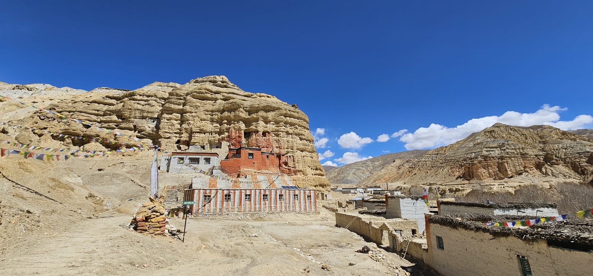
Upper Mustang Trek (14-17 Days) 17 Days Guide
Trail notes for Upper Mustang Trek (14-17 Days). Daily walking hours, pass elevations, teahouse stops, and permit logistics.
Upper Mustang Trek
Upper Mustang Trek (14-17 Days) spans 17 days through a high-altitude arid desert, featuring ancient walled cities, steep canyon trails, and strong winds. The physical challenge requires sustained walking against afternoon gusts and navigating dusty, gravel-strewn paths above 3,500m.
Key Trail Realities
What to expect along the route
Jomsom Gateway and Kali Gandaki Valley
Entering the arid rain-shadow region via early morning flights or rugged jeep tracks through the deep Kali Gandaki river gorge.
Controlled Restricted Area Entry
Passing through checkpoint gates at Kagbeni where special permits and registered guides are strictly verified before entering the walled kingdom.
Walled City of Lo Manthang
Exploring ancient medieval alleyways, multi-story mud-brick royal palaces, and centuries-old Tibetan Buddhist monasteries enclosed by high earthen defensive walls.
High Desert Plateau Terrain
Trekking across windswept arid canyons, eroded sandstone cliffs, and barren ridges marked by striking geological formations.
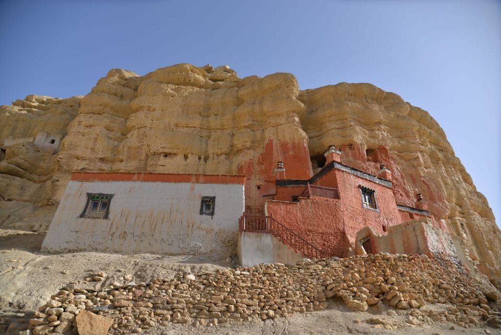
Ancient Cave Dwellings
Viewing mysterious cliffside cave networks hand-carved into sheer rock faces centuries ago across the Mustang gorges.
High Altitude Pass Crossings
Navigating windy mountain passes exceeding 3,800 to 4,000 meters offering expansive vistas toward the Tibetan plateau.
Traditional Thakali and Loba Villages
Visiting remote agricultural settlements where flat-roofed stone houses store winter firewood and local communities maintain preserved Tibetan cultural traditions.
Champa Lakhang and Thubchen Monasteries
Inspecting restored clay statues, intricate wall murals, and ancient Buddhist scriptures inside historical prayer halls.
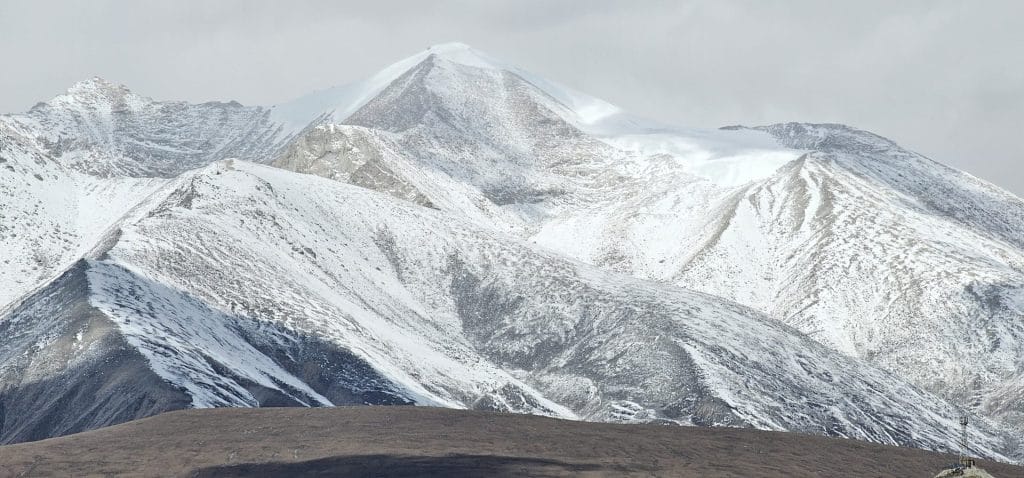
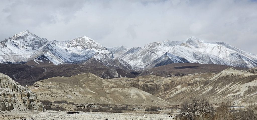
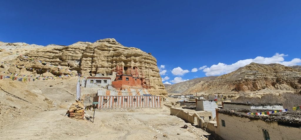
Trail Photos & Videos
High-definition captures and video clips from Himalayan passes, glacial lakes, Sherpa villages, and mountain summits.


Upper Mustang Trek (14-17 Days) Trail Map
Interactive OpenStreetMap topographic trail map tracing the route.
Key High-Altitude Stops
Compatible with Garmin, Apple Watch, Strava & Gaia GPS
Upper Mustang Trek (14-17 Days) Weather Center
Real-time mountain weather and 5-day altitude forecasts across key Upper Mustang Trek (14-17 Days) waypoints.
Loading weather for ...
Choose waypoint
Altitude Chart & Acclimatization Nodes
Strict adherence to "Hike High, Sleep Low" ensures safe high-altitude adaptation.
Complete Itinerary Route
Explore the detailed day-by-day routing, acclimatization schedule, and trek milestones.
Kathmandu to Pokhara (820m)
Depart Kathmandu early by tourist bus or short flight along the Prithvi Highway, following the Trishuli and Marsyangdi river gorges. Arrive in Pokhara by afternoon to view the Annapurna range reflected across Phewa Lake and finalize restricted area permits.
Pokhara to Jomsom (2,720m) & Trek to Kagbeni (2,810m)
HighlightCatch an early morning mountain flight through the Kali Gandaki gorge to Jomsom airstrip. Wind speeds pick up by midday, so start walking immediately northward along the riverbed toward Kagbeni, the gateway village featuring a medieval fortress monastery.
Kagbeni to Chele (3,050m)
HighlightEnter the restricted Upper Mustang zone at the police checkpoint just outside Kagbeni. Follow the eastern bank of the Kali Gandaki river, passing Tangbe village with its narrow whitewashed alleys and buckwheat fields before climbing into Chele.
Chele to Syanbochen (3,800m) via Taklam La
HighlightClimb steeply out of Chele past the Samar canyon and cross the Taklam La pass at 3,624 meters. The trail contours through windswept arid plateaus before dropping briefly into the charming farming settlement of Syanbochen for the night.
Syanbochen to Ghami (3,520m) via Nyi La
HighlightAscend gradually toward the Chhongmi La and Nyi La passes, standing above 4,000 meters as expansive views of the Mustang desert unfold. Descend past long stretches of intricately carved mani walls to reach Ghami, nestled beneath giant red cliffs.
Ghami to Tsarang (3,560m)
HighlightCross the steel suspension bridge over the Ghami Khola and walk alongside the longest mani wall in Upper Mustang. Reach Tsarang by early afternoon to explore its massive five-story dzong and red monastery overlooking the canyon.
Tsarang to Lo Manthang (3,840m)
HighlightTrek north across the windy plateau known as the Wind Valley, catching your first distant glimpse of the walled capital of Lo Manthang. Pass prayer walls and ancient chortens before entering the historic city gate.
Acclimatization & Exploration in Lo Manthang (3,840m)
AcclimatizationDedicate the day to exploring the inner alleys, royal palace, and ancient monasteries of Thubchen, Jampa, and Chode. Visit nearby Chooser village and its multi-story cave dwellings carved directly into cliff faces.
Lo Manthang to Yara (3,650m)
Leave the main trail behind and traverse high desert tracks toward Dhi village. Descend steeply to cross the Dhi Khola river bed before making a hot, exposed afternoon climb up to Yara village perched on a rocky shelf.
Yara to Luri Gompa & Return to Yara (3,820m)
HighlightClimb from Yara along cliffside paths to reach Luri Gompa, a 15th-century cave monastery built into a sandstone pillar containing priceless Buddhist murals and chortens. Return to Yara for a second night.
Yara to Tangge (3,240m)
Trek across a vast, waterless plateau under intense sun before dropping into a deep canyon gorge. Cross the Yara Khola and climb up to Tangge, a striking isolated village surrounded by giant mud-brick chortens and terraced barley fields.
Tangge to Tetang (3,040m) via Pa La
HighlightDepart early for a strenuous day crossing the Pa La pass amid barren red hills and sweeping desert vistas. Descend along the ridge down to Tetang, an ancient fortified village nestled between two towering hills.
Tetang to Muktinath (3,760m) via Gyu La Pass
HighlightAscend steadily toward the Gyu La pass at 4,077 meters, where views open up across the Thorong La massif and the Annapurna range. Descend into the sacred pilgrimage site of Muktinath to visit the eternal flame and 108 water spouts.
Muktinath to Marpha (2,670m)
Descend through Jomsom along the windy Kali Gandaki valley floor or opt for the quieter upper trail through Eklebhatti. Arrive in Marpha, famous for its paved stone alleys, whitewashed houses, and local apple orchards and brandy.
Marpha to Tatopani (1,190m)
HighlightDescend further through pine forests and subtropical gorges, passing waterfalls at Rupse Chhahara. Reach Tatopani by afternoon and soak your muscles in the natural hot springs located right by the Kali Gandaki riverbank.
Tatopani to Pokhara (820m)
Board a local jeep or bus from Tatopani, driving along unpaved mountain roads past Beni through the Kali Gandaki valley floor. Arrive back in Pokhara by afternoon to celebrate the conclusion of your desert expedition.
Pokhara to Kathmandu (1,350m)
Return to Kathmandu via tourist coach or domestic flight along the highway corridor. Spend the evening organizing gear and reflecting on the remote walled kingdom before your international departure.
What's Covered & What's Not
A clear breakdown so you know exactly what to budget for and what's already taken care of.
Restricted Area Permit
- Special Upper Mustang Restricted Area permit costing $500 USD for the first 10 days, plus $50 USD for each additional day.
Annapurna Conservation Area Permit
- ACAP entry permit required for entering the Annapurna conservation jurisdiction.
Ground Transportation
- Shared or private four-wheel-drive jeep transport along the Kali Gandaki corridor between Pokhara, Jomsom, and Lo Manthang.
Teahouse Lodging
- Basic double-occupancy stone lodge rooms throughout the villages of Kagbeni, Chele, Gelling, Tsarang, and Lo Manthang.
International Flights
- Airfare from your home country into Kathmandu.
Nepal Tourist Visa
- On-arrival visa fees payable at Tribhuvan International Airport.
Emergency Evacuation Insurance
- Mandatory medical and helicopter rescue insurance policy covering high-altitude elevations up to 4,500 meters.
On-Trail Personal Expenses
- Hot showers, battery charging fees, Wi-Fi access cards, bottled water, and hot drinks.
Trail Meals & Hydration Rules
What to eat for stamina and altitude safety
Dhal Bhat Power
Rice, lentil soup, spiced potato, and seasonal greens. Always comes with free refills to refuel after long walking hours on the trail.
Garlic Soup
Thin clear garlic broth served in mountain lodges. Local guides rely on this daily in high settlements to assist with cold conditions and circulation.
Boiled & Fried Potatoes
High-carbohydrate local staple often served with dried cheese or chili paste in settlements along the valley.
Tibetan Bread & Honey
Deep-fried golden flatbread providing quick energy for cold morning departures.
Thukpa Noodle Soup
Hot broth with handmade wheat noodles, garlic, and root vegetables to combat dry wind.
Fried or Boiled Eggs
Reliable morning protein source available at nearly every teahouse kitchen.
Boiled Lodge Water
Purchase boiled water by the liter at evening stops and place the metal bottle inside your sleeping bag for night warmth.
Ginger Lemon Honey Tea
Hot beverage that soothes a dry throat caused by cold, dusty wind.
Electrolyte Tablets
Dissolve one tablet in a liter of purified water daily to replace salts lost through heavy sweating and dry air.
Chlorine Dioxide Tablets
Chemical treatment for stream or tap water; wait the full 30 minutes before drinking.
Vegetarian Preference
Vegetarian dhal bhat and noodle dishes use fresh local vegetables and turn over quickly in lodge kitchens.
Rice & Potato Staples
Naturally gluten-free meals of boiled rice and potatoes are widely available at all elevations.
Black Tea Option
Order 'kalo chiya' (black tea) if you prefer to avoid powdered yak milk used in standard milk tea.
Early Kitchen Orders
Place dinner orders by 5:00 PM so kitchen staff can prepare meals before the evening rush.
No Meat Above 3,500m
Meat carried up by porter or mule lacks refrigeration. Stick to vegetarian meals in high villages.
No Alcohol at Altitude
Alcohol accelerates dehydration and suppresses breathing rate during sleep.
Never Drink Tap Water
Avoid untreated water from village spouts or streams to prevent severe gastrointestinal illness.
Skip Raw Greens
Avoid uncooked vegetable salads washed in unpurified water.
Trip Preparation & Rules
Paperwork, restricted area authorizations, and cash guidelines for Mustang
Passport & Tourist Visa
Passport valid for at least 6 months beyond travel dates. Obtain a 30-day tourist visa ($50 USD cash) on arrival at Tribhuvan International Airport.
Rescue Insurance Verification
Policy must explicitly cover high-altitude helicopter evacuation up to 4,500m. Keep digital and printed copies of policy numbers handy.
Passport-Sized Photos
Carry 4 printed passport photos. They are required for restricted area permit processing and local checkpoint registration.
Upper Mustang Restricted Area Permit
Special restricted area permit costs $500 USD for the first 10 days, plus $50 USD for each additional day. Independent trekkers are not permitted; you must be accompanied by a registered guide.
Annapurna Conservation Area Permit
ACAP entry permit is required as the route passes through the Annapurna conservation boundary. Costs roughly NPR 3,000 for foreign nationals.
Local Municipality Fee
Baragung Muktichhetra Rural Municipality entrance fee applies at checkpoint gates along the trail (approx. NPR 1,000).
Pokhara to Jomsom Flight Luggage
Stricter weight allowances apply on twin-engine flights to Jomsom: 10kg checked duffel and 5kg hand luggage maximum.
Weather-Dependent Jomsom Flights
Morning wind patterns dictate flights out of Pokhara. Build buffer days into your schedule for potential weather delays.
Alternative Road Transit
When flights are grounded by high winds, 4WD jeeps operate rough dirt roads from Pokhara to Jomsom via Beni.
Carrying Nepalese Rupees
ATMs in Jomsom are unreliable, and cash is non-existent further north in walled villages like Lo Manthang. Carry enough physical rupees for all food, lodging, and extras.
Small Denominations
Carry smaller notes (NPR 100, 500) for teahouse purchases. Teahouses struggle to break NPR 1,000 or 5,000 notes.
Digital Payment Limitations
Credit card machines and mobile data banking are practically non-existent on the arid plateau above Kagbeni.
Upper Mustang Cultural & Trail Customs
Practical rules for passing stupas, mule caravans, and sacred monasteries
Clockwise Mani Walls
- •Always keep long mani stone walls and chortens on your right side.
- •Walk clockwise around every stupa and prayer wall.
- •Never sit or place gear on carved prayer stones.
Mule and Yak Right-of-Way
- •Stand on the cliff-wall side when mule caravans or yaks approach.
- •Never stand on the outer drop-off edge where a pack animal could bump you.
- •Wait until the entire caravan passes before moving.
Monastery Photography
- •Ask permission before photographing elderly residents or inside homes.
- •Never use flash photography inside ancient monastery prayer halls.
- •Leave a small offering in the donation box when viewing art.
Waste Management
- •Carry all non-degradable trash and plastic wrappers out to larger towns.
- •Do not burn plastic or batteries in teahouse stoves.
- •Use water purification tablets to avoid buying single-use bottles.
Entering Homes and Kitchens
- •Remove boots before entering carpeted monastery spaces or private homes.
- •Do not touch sacred items, butter lamps, or altar relics.
- •Avoid stepping on the threshold of wooden doorways.
Local Interactions
- •Greet locals with a respectful 'Tashi Delek' in Tibetan-influenced villages.
- •Dress modestly by covering shoulders and knees in settlements.
- •Support local teahouse economies by eating meals where you sleep.
Permits & Emergency Directory
Current permit fee structures and official emergency contacts for the Upper Mustang trek
Required Permits & Mandatory Fees
-
📜Annapurna Conservation Area Permit (ACAP) NPR 3,000
Required for all trekkers entering the Annapurna Conservation Area region, purchased at the Nepal Tourism Board in Kathmandu or Pokhara.
-
📜Upper Mustang Restricted Area Permit $500 USD for 10 Days
Mandatory special permit for the restricted upper Kagbeni-to-Lo Manthang zone. Additional days cost $50 USD per day. Must be processed through a registered Nepal trekking agency with a minimum of two trekkers.
-
☘️TIMS Card / Local Entry Fee NPR 2,000
Local rural municipality entry fee collected at Kagbeni checkpoint to support regional infrastructure development in Mustang.
Nepal Tourism Directory
Official contact channels for permits, park regulations, and emergency rescue assistance.
Power, Connectivity & Showers
Realistic day-to-day guide for charging, phones, and hygiene
Device Charging
Electricity in upper villages relies on local solar micro-grids. Charging devices in lodge dining halls typically costs Rs 300 to 600 per full charge. Carry a high-capacity power bank and store it inside your sleeping bag at night to prevent lithium battery drain from sub-zero temperatures.
Mobile Connectivity & Wi-Fi
Nepal Telecom (NTC) provides intermittent 4G coverage up to Jomsom and lower Kagbeni, while Ncell signal drops out significantly further north into the restricted zone. Paid satellite Wi-Fi cards are available at select teahouses in Tsarang and Lo Manthang, though speeds drop during peak evening hours.
Hot Showers & Water
Gas-heated or solar showers cost Rs 400 to 600 per use in lower lodges. Above 3,800 meters, indoor plumbing frequently freezes overnight, and cold wind exposure makes hot showers risky for hypothermia. Pack biodegradable wet wipes and hand sanitizer for high camps.
Cash and Currency Access
ATMs are available only in Jomsom and are frequently out of service or emptied by travellers. Carry sufficient Nepalese Rupees in cash from Kathmandu or Pokhara for all lodge meals, hot water, battery charging, and permit contingency funds.
Altitude Safety & Health
How to handle altitude symptoms and emergency protocols
Daily Symptom Monitoring
Watch closely for early acute mountain sickness signs: a persistent throbbing headache, loss of appetite, nausea, dizziness, and insomnia.
Effective Hydration Strategy
Count hot lemon, ginger tea, and local garlic soup toward your daily fluid intake. Dehydration in dry mountain air arrives silently and worsens altitude symptoms.
Emergency Evacuation Insurance
Verify your insurance policy explicitly covers emergency helicopter rescue up to 6,000 meters before starting the route.
Immediate Descent Protocol
If severe symptoms like ataxia or a persistent bubbling cough appear, dropping 500 to 1,000 meters reverses sickness fast and saves lives.
The Golden Altitude Rule
If you have a headache, nausea, or dizziness, do NOT ascend. If symptoms worsen after resting, descend 300–500m immediately. Descent is the only guaranteed cure.
Highland Villages & Wildlife
Indigenous communities and wildlife along the trail
Lo Pa Heritage & Architecture
The indigenous Lo Pa people inhabit the arid northern valleys, preserving traditional Tibetan-influenced mud-brick homes with flat roofs designed to store firewood and harvest winter barley.
Ancient Village Fortresses
Walled settlements feature defensive towers and labyrinthine alleys built centuries ago to protect trade routes and farming communities from harsh winds and historical raiders.
Traditional Tibetan Weaving
Local artisans produce intricate woolen carpets, blankets, and traditional garments using hand-spun sheep wool and natural dyes passed down through generations.
Centuries-Old Cave Monasteries
Rock-hewn shrines such as Choedle Gompa and ancient meditation caves carved directly into sandstone cliffs house sacred Buddhist murals and manuscript collections.
Chortens & Long Mani Walls
Plastered chortens and stone walls inscribed with Tibetan Buddhist mantras line the approaches to every historical village, requiring clockwise passage.
Sky Burial Sites & Sacred Ridges
High-altitude ridges hold deep spiritual significance for local residents, reflecting ancient Bon and Tibetan Buddhist funeral customs tied to the mountain landscape.
Blue Sheep & Himalayan Fauna
Steep rocky cliffs and arid valley sides provide habitat for herds of bharal (blue sheep), red foxes, and elusive snow leopards hunting at higher elevations.
High-Altitude Raptors
Lammergeiers, golden eagles, and Himalayan griffons soar on thermal updrafts across the wide desert canyons and wind-scoured plateaus.
Arid Plateau Flora
Resilient high-altitude vegetation includes seabuckthorn bushes, caragana shrubs, and wild medicinal herbs adapted to the rain-shadow desert climate.
Essential Packing Checklist
Prepare 1 duffel bag (handled by porter team) and 1 daypack for personal warm layers & water.
Frequently Asked Questions
Honest answers about the Upper Mustang Trek route