

Everest Base Camp via Gokyo Valley (18-20 Days) 20 Days Guide
Trail notes for Everest Base Camp via Gokyo Valley (18-20 Days). Daily walking hours, pass elevations, teahouse stops, and permit logistics.
Everest Base Camp via Gokyo Valley
20-day high altitude route connecting Gokyo Lakes, Cho La pass, and Everest Base Camp. Daily walking requires sustained climbing on uneven moraine and stone stairs.
Key Route Realities
What defines the Everest Base Camp via Gokyo Valley trail
Cho La Pass Traverse
Crossing the high 5,420-meter mountain pass linking the Gokyo lakes directly to the Khumbu glacier trail over steep moraine and exposed ice.
Gokyo Ri Summit
Steep pre-dawn ascent to 5,357 meters above the emerald lakes, offering a wide view of Everest, Lhotse, Makalu, and Cho Oyu.
Ngozumpa Glacier Crossing
Navigating the unstable rock and ice rubble of Nepal's longest glacier between Dragnag and Gokyo.
Renjo La Viewpoint
Alternative high pass at 5,360 meters overlooking the turquoise Gokyo waters with views toward Tibet across the Nangpa La.
Kala Patthar Ridge
The high rocky viewpoint above Gorak Shep at 5,643 meters delivering the closest unobstructed look at the south face of Everest.
Tengboche Monastery
Historic Sherpa spiritual center situated on a forested ridge beneath Ama Dablam, housing active morning prayer ceremonies.
Namche Bazaar Trading Hub
Amphitheater-shaped mountain town at 3,440 meters serving as the primary acclimatization stop and regional administrative center.
Sagarmatha National Park Terrain
Steep forest trails, deep river gorges, and suspension bridges spanning the Dudh Koshi river drainage.
Trail Photos & Videos
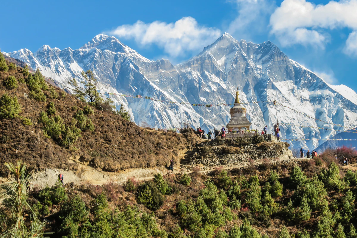
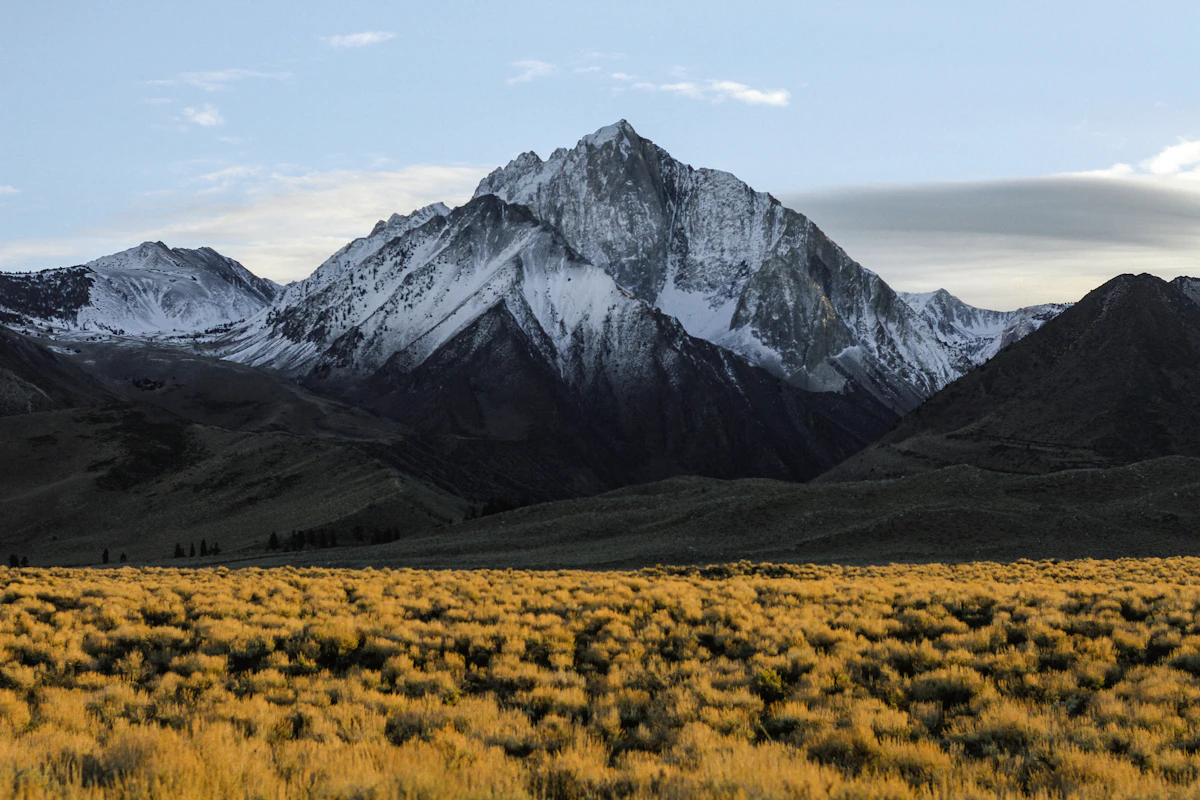
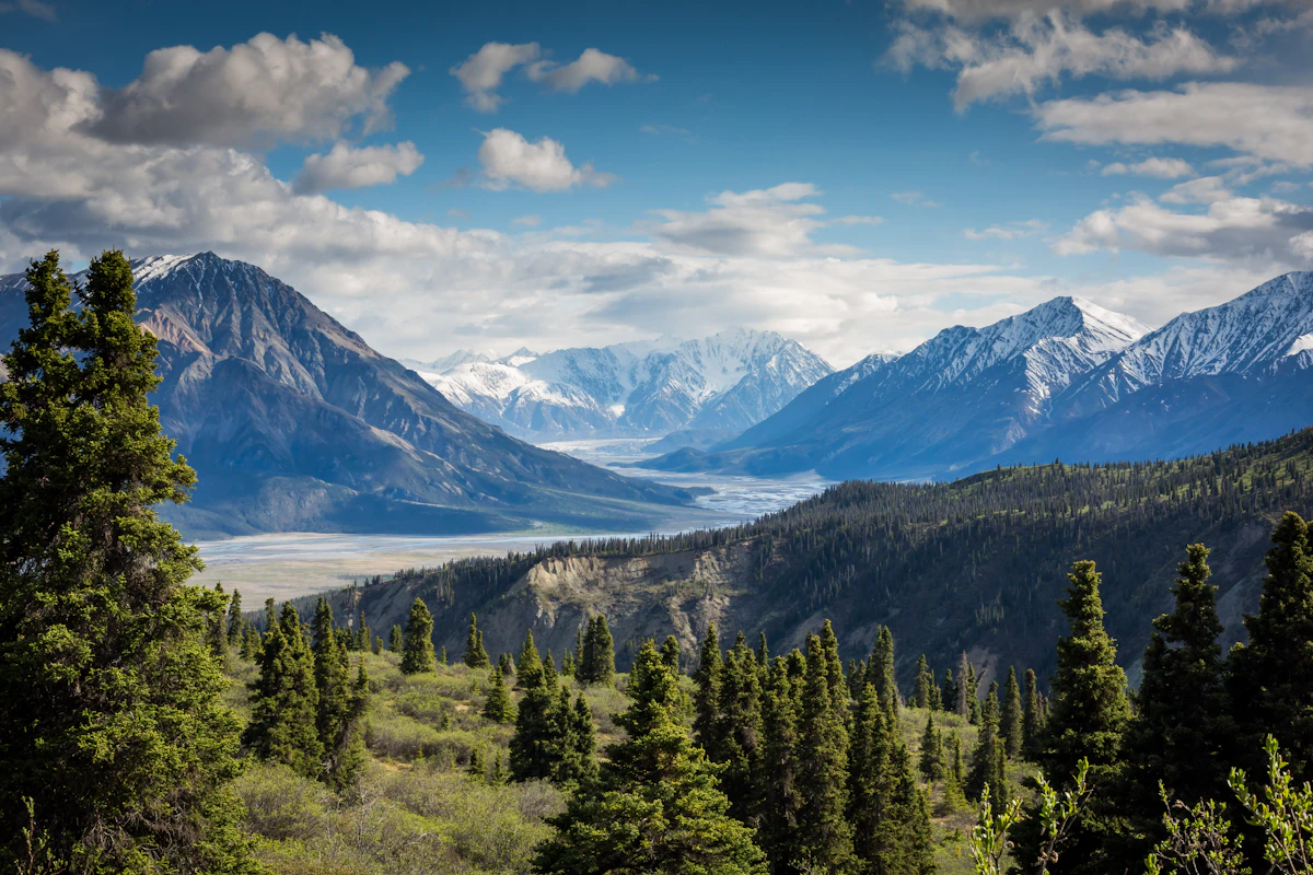
High-definition captures and video clips from Himalayan passes, glacial lakes, Sherpa villages, and mountain summits.


Everest Base Camp via Gokyo Valley (18-20 Days) Trail Map
Interactive OpenStreetMap topographic trail map tracing the route.
Key High-Altitude Stops
Compatible with Garmin, Apple Watch, Strava & Gaia GPS
Everest Base Camp via Gokyo Valley (18-20 Days) Weather Center
Real-time mountain weather and 5-day altitude forecasts across key Everest Base Camp via Gokyo Valley (18-20 Days) waypoints.
Loading weather for ...
Choose waypoint
Altitude Chart & Acclimatization Nodes
Strict adherence to "Hike High, Sleep Low" ensures safe high-altitude adaptation.
Complete Itinerary Route
Explore the detailed day-by-day routing, acclimatization schedule, and trek milestones.
Arrival and Briefing
Arrive at the starting settlement and settle into your lodge. Attend the required permit check and briefing with your logistics coordinator. The trail surface today is a mix of paved lanes and dusty footpaths. Drink plenty of water to offset the travel fatigue and prepare for tomorrow's early departure.
First Valley Trek
HighlightDescend through terraced fields before climbing steadily alongside the main river. The terrain alternates between stone steps and exposed dirt tracks. Watch out for passing mule trains and step to the uphill side. Nights in the teahouse turn cold quickly, so secure an extra blanket early.
River Crossings and Ascents
HighlightCross several suspension bridges draped with prayer flags. The path involves steep, rocky inclines that test your initial fitness level. Dust is common on dry sections, so a buff is useful. Rooms are basic with shared washing facilities and minimal insulation.
Climbing to the Ridge
HighlightLeave the lower riverbanks behind for a continuous uphill haul onto a wide ridge. The air begins to feel noticeably thinner as you gain elevation. Pack layers within easy reach as wind speeds pick up by midday. Dinner consists of hearty dal bhat to refuel.
Entering the Alpine Zone
Traverse high alpine meadows where scrub vegetation replaces tall trees. The footing is uneven over glacial moraine debris and loose gravel. Stay hydrated to reduce mild altitude headaches. Teahouse dining rooms offer warmth from a central stove fueled by yak dung.
Acclimatization and Exploration
AcclimatizationHike high during the morning hours to a nearby vantage point, then descend back to sleep low. The terrain features steep, loose scree that requires careful pole placement. Cold morning temperatures demand thermal base layers. Use the afternoon to rest and dry your laundry.
Path to Gokyo Lakes
HighlightTrek alongside the massive lateral moraine of the Ngozumpa Glacier. The path is rocky, uneven, and demands concentration to avoid twisted ankles. Arrive at the first glacial lakes, where icy winds sweep across the water. Indoor spaces freeze overnight, so keep your water bottle inside your sleeping bag.
Rest and Lake Exploration
AcclimatizationTake an active rest day to explore the upper glacial lakes and examine the glacier edge. The air is dry and thin, causing shortness of breath with minimal exertion. Ensure your electronics and batteries are kept warm to prevent rapid discharge. Water purification tablets or a reliable filter are essential here.
Climbing Gokyo Ri
HighlightStart before dawn for a relentless, steep climb up the sandy, frozen switchbacks of Gokyo Ri. Wind gusts at the summit ridge are fierce and bitterly cold. The descent requires caution on slippery, loose gravel slopes. Spend the afternoon resting indoors as temperatures plummet.
Crossing Cho La Pass Approach
HighlightMove toward the base of the high mountain pass through a stark boulder-strewn valley. The route is isolated with no amenities between settlements. Stream crossings can feature icy stepping stones requiring careful footing. Prepare your gear thoroughly for the high pass crossing tomorrow.
Over Cho La Pass
HighlightAn early pre-dawn departure is mandatory to navigate the icy, steep boulders of Cho La Pass safely. Microspikes may be necessary depending on recent snowfall and ice conditions. The descent on the far side is steep, rocky, and physically demanding. Celebrate surviving the toughest physical day of the trek over a hot meal.
Rejoining the Main Trail
Descend gradually along a wide valley floor to merge with the main highway trail. The path is well-worn, dusty, and busy with yak trains and fellow trekkers. Strong afternoon winds frequently blow down the valley. Teahouses here offer better amenities, including bakery items and hot showers.
Ascent toward Gorak Shep
Trek over the rocky, undulating moraine beneath massive Himalayan rock faces. The altitude makes every uphill step feel labored and slow. Drinking at least four liters of water is critical to manage dehydration. Rooms are basic, unheated, and temperatures remain below freezing all day.
Everest Base Camp Excursion
HighlightTraverse the Khumbu Glacier moraine to reach the rocky expanse of Everest Base Camp. The trail is a maze of shifting ice, loose stones, and steep ridges. Return to the lodge before dark as temperatures drop drastically. Sleep is often restless due to the extreme elevation.
Kalapatthar Sunrise and Descent
HighlightClimb Kalapatthar in the freezing dark morning hours for panoramic peak views. Descend rapidly afterward down the valley to shed altitude and ease breathing. The continuous downhill pounding tests your knees and thigh muscles. Enjoy the warmer air and thicker atmosphere as you drop lower.
Long Descent to Pheriche Area
HighlightWalk down a wide river valley with a gentle downhill slope. The terrain is sandy and exposed to midday sun and wind. Pass through windswept settlements with stone-walled fields. Teahouse rooms feel comparatively luxurious with working indoor dining stoves.
Returning Downward
HighlightDescend through rhododendron and pine forests as the air becomes rich with oxygen. The trail surface features stone staircases and tree roots. Local children and stray dogs greet passing trekkers along the paths. Enjoy a hot shower and a celebratory local meal.
Final Valley Push
Walk along the familiar river gorge trail, retracing your initial steps from weeks ago. The path rolls gently with short, punchy uphills and downhills. Porters and trekkers share the stone-paved trail with heavily laden pack animals. Pack your gear carefully for the final travel arrangements.
Return to Starting Settlement
Complete the final stretch of walking back to the trek terminus. The dirt track transitions back to paved lanes and bustling market stalls. Tip your guides and porters to thank them for their hard work. Spend the evening celebrating the completion of the trek.
Departure and Transfer
HighlightPack your gear and complete your check-out from the hotel. Transfer to the local transport hub for your onward journey home. Reflect on the physical challenge and remote mountain passes traversed. The trek officially concludes upon reaching your departure connection.
What's Covered & What's Not
A clear breakdown so you know exactly what to budget for and what's already taken care of.
Sagarmatha National Park Permit
- Required national park entry fee issued by the Nepal Tourism Board or at Monjo checkpoint.
Khumbu Pasang Lhamu Rural Municipality Fee
- Local government registration fee required for all travelers entering the Khumbu region.
Teahouse Accommodation
- Basic twin-share lodge room along the trail from Phakding through Namche, Gokyo, and Gorak Shep.
Domestic Flight Logistics
- Airfare from Kathmandu or Ramechhap to Lukla airstrip (weather dependent).
International Airfare
- Flights from your home country to Kathmandu.
Nepal Entry Visa
- Tourist visa obtained upon arrival at Tribhuvan International Airport.
Emergency Evacuation Insurance
- Mandatory policy covering high-altitude helicopter rescue up to 6,000 meters.
On-Trail Personal Expenses
- Hot showers, battery charging, Wi-Fi cards, bottled water, and hot drinks.
Trail Meals & Hydration Rules
What to eat for stamina and altitude safety
Dhal Bhat
Steamed rice, lentil soup, and vegetable curry with free refills available at most teahouses. It is the best calorie value on the mountain.
Garlic Soup
Clear broth made with local garlic cloves. Consumed widely by trekkers to assist with throat comfort and acclimatization.
Boiled Potatoes
Simple starchy carbohydrates that digest easily at high elevation when appetite dips.
Tibetan Bread
Dense, fried flatbread served with honey or jam, providing sustained energy for morning climbs.
Purified Tap Water
Fill two wide-mouth bottles from lodge taps and treat with chlorine dioxide tablets or iodine.
Hot Ginger Lemon Tea
Counted toward daily fluid intake while soothing dry airways affected by cold mountain air.
Electrolyte Solutions
Mix electrolyte powders into purified water to replace essential minerals lost through heavy exertion.
Nighttime Nalgene
Fill a sturdy water bottle with boiling water before bed; it warms your sleeping bag and provides safe drinking water by morning.
Vegetarian Preference
Opting for meatless meals above Namche Bazaar significantly reduces the risk of foodborne illness.
Rice-Based Meals
Dal bhat and fried rice dishes naturally accommodate gluten-free dietary needs.
Local Yak Cheese
Available in select villages as a high-calorie snack for mid-day energy.
Early Dinner Orders
Place your evening meal order by 5:00 PM to give lodge kitchen staff adequate preparation time.
Meat Above Namche
Meat carried up on porters' backs lacks proper refrigeration and often causes severe stomach distress.
Alcohol at Altitude
Drinking alcohol accelerates dehydration and impairs the body's natural acclimatization response.
Untreated Stream Water
Never drink directly from rivers or taps without chemical treatment or boiling.
Raw Green Salads
Uncooked vegetables washed in unpurified water frequently carry waterborne parasites.
Trip Preparation & Rules
Paperwork, flight baggage limits, and cash guidelines
Passport & Tourist Visa
Passport valid for 6+ months. Get 30-day visa ($50 USD cash) on arrival at Kathmandu airport.
Helicopter Evacuation Insurance
Policy must explicitly cover high-altitude rescue up to 6,000m+. Keep policy number on your phone.
Passport Photos
Bring 4 printed passport photos for local permit counters and SIM card registration.
Copies of Important Documents
Keep physical and digital copies of your passport, visa, insurance policy, and emergency contacts separate from originals.
Khumbu Pasang Lhamu Permit
Local rural municipality entry permit (NPR 3,000) obtained upon arrival in Lukla or Monjo. Note: TIMS cards are not required or valid in the Khumbu region.
Sagarmatha National Park Permit
Mandatory national park entry permit (NPR 3,000 + 13% VAT = NPR 3,390) obtained in Kathmandu at the Tourism Board or directly at the Monjo park entrance.
Licensed Guide Requirement
Under Nepal Tourism Board regulations, foreign trekkers must trek with a licensed government guide for safety and environmental sustainability.
Strict 15kg Weight Limit
Mountain flights strictly limit weight to 10kg checked duffel + 5kg hand pack. Extra weight costs extra.
Weather-Related Delays
Ramechhap or Kathmandu flights frequently face fog or wind holds. Build 2 to 3 buffer days into your schedule.
Alternative Road Diversions
When flights to mountain airstrips are grounded for consecutive days, overland jeep travel via Jiri or Salleri is a rugged backup.
Bring Cash in Nepalese Rupees
Carry Rs 4,000–5,000 per day in cash. ATMs on high trails are absent or frequently out of service.
Card Processing Limitations
Teahouses above Namche Bazaar operate strictly on paper ledgers and cash; digital payments and credit cards are unavailable.
Small Denominations
Stock up on Rs 100 and Rs 500 notes in Kathmandu. Higher notes like Rs 1,000 are difficult to break in small mountain settlements.
Mountain Customs & Route Rules
Essential guidelines for passing pack animals, sacred sites, and village paths
Pass Mani Stones and Stupas Clockwise
- •Always keep chortens, mani walls, and prayer wheels on your right side as you walk past.
- •Never climb on top of sacred stone walls or sit on inscribed prayer tablets.
Yield the Mountain Side to Yak Caravans
- •Step toward the cliff wall when yaks, mules, or dzo pack trains approach from either direction.
- •Never stand on the outer drop-off side; an animal nudge can cause a fatal fall.
Monastery and Portrait Permissions
- •Ask permission before photographing monks, elders, or working villagers along the trail.
- •Leave a small cash donation in the box if entering active prayer rooms for brief viewing.
Pack Out Plastic and Waste
- •Carry empty energy bar wrappers, wrappers, and wet wipes back down to lower towns with waste management.
- •Avoid buying single-use bottled water above Namche Bazaar where plastic recycling does not exist.
Respect Local Clothing and Customs
- •Remove hats and sunglasses before stepping inside active Sherpa gompas or sacred prayer halls.
- •Dress conservatively in villages by keeping shoulders and knees covered out of respect for local traditions.
Lodge Quiet Hours and Shared Spaces
- •Turn off headlamps and keep voices low in teahouse dormitories after 9:00 PM so resting climbers can sleep.
- •Clear the central stove area for kitchen staff and arriving trekkers during freezing evening hours.
Permits & Emergency Directory
Current permit fee structures and official emergency contacts
Required Permits & Mandatory Fees
-
📜Sagarmatha National Park Entry Permit NPR 3,000
Required for entering the Khumbu region, payable at the Nepal Tourism Board office in Kathmandu or at the Monjo checkpoint.
-
📜Khumbu Pasang Lhamu Rural Municipality Fee NPR 3,000
Mandatory local government fee replacing the old TIMS card in the Khumbu region, collected upon arrival in Lukla or at Monjo.
-
📜Gaurishankar Conservation Area Permit NPR 3,000
Required if approaching the region via the alternative Jiri or Rolwaling connecting routes.
Nepal Tourism Directory
Official contact channels for permits, park regulations, and emergency rescue assistance.
Power, Connectivity & Showers
Realistic day-to-day guide for charging, phones, and hygiene
Device Charging
Charging fees increase with altitude, ranging from Rs 300 to Rs 600 per device or power bank in teahouse dining halls. Batteries drain rapidly in sub-zero overnight temperatures; keep phones and camera batteries inside your sleeping bag.
Mobile Connectivity
Ncell and Nepal Telecom (NTC) networks function reliably up to Namche Bazaar and sporadically in higher valleys like Gokyo. AirLink and local Everest Link Wi-Fi cards provide paid internet access at most lodges along the route.
Hot Showers & Hygiene
Gas-heated or solar showers cost between Rs 400 and Rs 700 where available. Above 4,000 meters, unheated rooms and freezing evening temperatures make wet-wipes a safer, more practical alternative to avoid cold-water shock.
Electricity & Lighting
Most teahouses rely on shared solar systems with limited capacity for room lighting. Headlamps with spare batteries or a personal USB rechargeable light are essential after sunset.
Altitude Safety & Health
How to handle altitude symptoms and emergency protocols
Daily Symptom Monitoring
Watch closely for early AMS signs: persistent headache, loss of appetite, nausea, dizziness, and insomnia.
Helicopter Evacuation
Ensure your insurance policy covers emergency helicopter rescue up to 6,000 meters for fast evacuation to Kathmandu.
Satellite SOS Communication
Carry a Garmin inReach or confirm your trekking agency maintains satellite communication for dead-zone sections.
Hydration and Electrolytes
Drink 3 to 4 liters daily, factoring in hot lemon, black tea, and garlic soup alongside treated water.
The Golden Altitude Rule
If a throbbing headache resists two ibuprofen or you experience stumbling and a bubbling cough, drop 500 to 1,000 meters immediately. Descending is the only reliable cure for severe altitude illness.
Highland Villages & Wildlife
Indigenous communities and wildlife along the trail
Sherpa Settlement Architecture
Stone masonry houses built with thick slate roofs and carved timber window frames designed to withstand harsh Himalayan winters in the upper Khumbu and Dudh Koshi valleys.
Traditional Hearth & Hospitality
Central metal stoves burning dried yak dung or imported wood in teahouse common rooms, serving as the sole gathering space for trekkers and locals after dark.
Highland Agro-Pastoralism
Puna farming plots cultivating hardy mountain potatoes and buckwheat alongside seasonal yak herding across high-altitude pastures.
Buddhist Gompas & Monasteries
Historic monastic institutions like Tengboche holding sacred scriptures, murals, and serving as spiritual centers for valley residents.
Mani Walls & Chortens
Stone monuments and carved slate walls bearing the mantra 'Om Mani Padme Hum', passed always to the left by travelers.
Sacred Peak Sanctuaries
Cho Oyu, Ama Dablam, and Everest viewed not merely as climbing objectives by local communities, but as living deities demanding respect.
Himalayan Tahr & Musk Deer
Wild ungulates grazing steep cliff faces and sub-alpine birch forests along the Dudh Koshi and Imja river corridors.
Rhododendron Forests
Extensive sub-alpine forests exploding into red, pink, and white blooms during spring months below Namche Bazaar.
High-Altitude Raptors
Lammergeiers and golden eagles riding thermal updrafts above glacial moraines and high mountain passes.
Essential Packing Checklist
Prepare 1 duffel bag (handled by porter team) and 1 daypack for personal warm layers & water.
Frequently Asked Questions
Practical answers about the Everest Base Camp via Gokyo Valley route