

Langtang Gosaikund Trek (9-13 Days) 13 Days Guide
Trail notes for Langtang Gosaikund Trek (9-13 Days). Covers road access to Syabrubesi, daily walking hours, Lauribina La pass crossing, teahouse stops, and RAM permit logistics.
Langtang Gosaikund Trek
Langtang Gosaikund Trek (9-13 Days) spans 13 days of rugged valley ascents and high alpine lake crossings. Expect steep stone staircases, daily climbs from 500m to 900m, freezing night temperatures above 3,500m, and basic teahouse lodging.
Key Trail Realities
What to expect along the route
Sacred Alpine Waters at Gosaikund
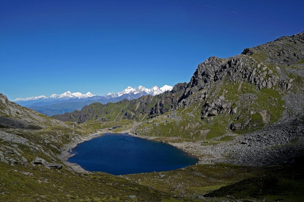
Reach the high-altitude glacial lakes at 4,380m surrounded by rugged rocky ridges and traditional stone shrines.
Lauribina La Pass Crossing
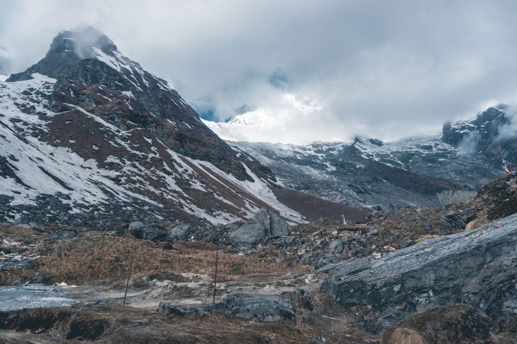
Tackle the high-altitude pass crossing at 4,610m, requiring steady pacing across steep, wind-swept stone trails.
Deep Valley Pine Forests
Climb through dense rhododendron and pine forests along the roaring Langtang River upstream from Syabrubesi.
Tamang Heritage and Culture
Pass through traditional Tamang villages featuring ancient mani walls, flat-roofed stone houses, and local wooden prayer wheels.
Langtang Lirung Views
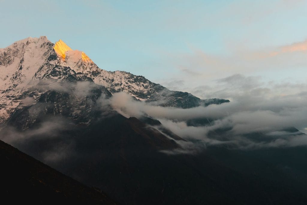
Observe clear morning panoramas of Langtang Lirung and surrounding icefalls directly from the lodge door at Kyanjin Gompa.
High Elevation Acclimatization
Climb up the steep ridge of Kyanjin Ri at 4,773m to support red blood cell adaptation before heading toward Gosaikund.
Road Travel and Trailhead Access
Begin the journey via a bumpy 7 to 8-hour bus or private jeep ride from Kathmandu to Syabrubesi along narrow hillside roads.
Traditional Teahouse Infrastructure
Stay in basic, family-run stone lodges featuring central wood-fired stoves and simple twin-share rooms without en-suite plumbing.
Trail Photos & Videos
High-definition captures and video clips from Himalayan passes, glacial lakes, Sherpa villages, and mountain summits.


Langtang Gosaikund Trek (9-13 Days) Trail Map
Interactive OpenStreetMap topographic trail map tracing the route.
Key High-Altitude Stops
Compatible with Garmin, Apple Watch, Strava & Gaia GPS
Langtang Gosaikund Trek (9-13 Days) Weather Center
Real-time mountain weather and 5-day altitude forecasts across key Langtang Gosaikund Trek (9-13 Days) waypoints.
Loading weather for ...
Choose waypoint
Altitude Chart & Acclimatization Nodes
Strict adherence to "Hike High, Sleep Low" ensures safe high-altitude adaptation.
Complete Itinerary Route
Explore the detailed day-by-day routing, acclimatization schedule, and trek milestones.
Kathmandu to Syabrubesi (1,550m)
HighlightDepart Kathmandu on a winding northern highway passing through Trishuli bazaar and terraced hillside settlements. The road transitions from paved tarmac to unpaved mountain tracks near Dhunche before descending steeply into the narrow river gorge leading to Syabrubesi.
Syabrubesi to Lama Hotel (2,470m)
HighlightCross the Bhote Koshi suspension bridge and climb through dense subtropical forests of oak and rhododendron. The trail follows the rushing Langtang Khola upstream, passing small waterfall crossings and old stone water mills before reaching the cluster of lodges at Lama Hotel.
Lama Hotel to Langtang Village (3,430m)
HighlightAscend steadily through tall pine woods until the valley gradually widens near Ghora Tabela. Pass grazing yak pastures and ancient mani stones carved into massive boulders before entering Langtang Village, rebuilt with modern stone teahouses following the 2015 earthquake.
Langtang Village to Kyanjin Gompa (3,870m)
HighlightTrek through open yak grazing meadows flanked by towering ice walls and hanging glaciers. Pass a traditional yak cheese factory operating since the 1950s before arriving at Kyanjin Gompa, situated beneath the dramatic fluted faces of Langtang Lirung and Dorje Lakpa.
Acclimatization Day at Kyanjin Gompa (3,870m / Tserko Ri 4,984m)
AcclimatizationHike early toward the high viewpoint ridge of Tserko Ri to stimulate red blood cell production above 4,500 meters. The steep climb rewards steady pacing with panoramic views of Langtang Ri, Ganja La, and the sweeping moraines descending from the glacial basin.
Kyanjin Gompa to Lama Hotel (2,470m)
Retrace steps down the valley following the descending Langtang Khola current. The continuous downhill trek offers fresh perspectives on the rocky canyon walls and forested slopes previously ascended during the upward push.
Lama Hotel to Thulo Syabru (2,230m)
HighlightBranch off the main river trail at Bamboo and tackle a steep, sustained uphill climb through damp forests of towering trees. Emerge onto open ridgelines leading into Thulo Syabru, a traditional Tamang village built in stacked tiers along the steep hillside.
Thulo Syabru to Sing Gompa / Chandanbari (3,250m)
HighlightClimb steeply past ancient chortens and scattered potato fields into dense fir and hemlock woods. Arrive at Sing Gompa, home to a well-known local cheese factory and a historic Buddhist monastery nestled just below the high ridge crest.
Sing Gompa to Gosainkund Lake (4,380m)
HighlightTrek along an exposed ridge trail above the tree line with panoramic views stretching across the Langtang and Ganesh Himal ranges. Pass several small alpine tarns before reaching the sacred glacial basin of Gosainkund Lake, surrounded by rugged rock walls.
Gosainkund to Gopte (3,430m) via Laurebina La Pass (4,610m)
HighlightCross the high mountain notch of Laurebina La, the highest elevation point of the route, marked by prayer flags and cairns. Descend carefully across loose scree slopes and rocky gullies through the isolated Helambu region down to the forest shelters at Gopte.
Gopte to Melamchigaon (2,560m)
Descend through dense rhododendrons and cross several small forest streams before climbing back up the opposite valley wall. Arrive at Melamchigaon, a traditional Sherpa and Tamang settlement featuring stone houses and terraced fields overlooking the Melamchi valley.
Melamchigaon to Tarke Gyang (2,590m)
HighlightDescend to cross the Melamchi Khola via a suspension bridge and begin a steady uphill climb through pine forests. Reach Tarke Gyang, the largest village in the Helambu circuit, known for its old wooden monastery and traditional local architecture.
Tarke Gyang to Sermathang (2,610m) and Drive to Kathmandu (1,350m)
HighlightWalk along gentle forest trails and open hillside meadows passing through Kakani before arriving at Sermathang. Meet your private jeep or local bus for the return drive back to Kathmandu via the Melamchi road.
What's Covered & What's Not
A clear breakdown so you know exactly what to budget for and what's already taken care of.
Required Trail Permits
- Langtang National Park entry permit (NPR 3,000) and Pasang Lhamu Rural Municipality entry fee (NPR 2,000).
Local Transport
- Shared local jeep transport from Kathmandu (Machhapokhari / Dhunge Dhara) to Syabrubesi.
Teahouse Accommodation
- Basic twin-share lodge room throughout the Langtang valley and Gosaikund lake circuit.
Licensed Guide / Porter
- Mandatory certified trekking guide and optional porter services per Nepal Tourism Board regulations.
International Flights
- Airfare from your home country into Tribhuvan International Airport in Kathmandu.
Nepal Tourist Visa
- On-arrival tourist visa purchased at Kathmandu airport ($30 USD for 15 days, $50 USD for 30 days).
Helicopter Rescue Insurance
- Mandatory medical and emergency evacuation insurance covering high-altitude rescue up to 5,000 meters.
Trail Incidentals
- Hot showers, battery device charging, Wi-Fi access cards, and bottled or boiled drinking water.
Trail Meals & Hydration Rules
What to eat for stamina and altitude safety
Dhal Bhat Power
Rice, lentil soup, spiced potato, and spinach. Always comes with free refills to refuel after 6 hours on trail.
Garlic Soup
Thin clear garlic broth. Local guides drink this daily above 3,500m to help with blood circulation and warmth.
Boiled & Fried Potatoes
Dense carbohydrate source served with local yak cheese or chili paste in high settlements.
Tibetan Bread & Honey
Deep-fried puffed flatbread. Hearty breakfast before an early morning climb.
Sherpa Stew (Shyakpa)
Thick vegetable and hand-pulled flour noodle soup served steaming hot.
Boiled Eggs
Safe, reliable protein source available every morning at lodge kitchens.
Boiled Water Bottles
Buy boiled water (Rs 150–300/liter) at night and keep the bottle inside your sleeping bag for warmth.
Ginger Lemon Honey Tea
Warm drink that cuts the dry mountain cough and stays hot in an insulated thermos.
Electrolyte Packs
Add one electrolyte sachet to 1L of water daily to replace salts lost on steep ascents.
Water Purification Drops
Use Aquatabs or chlorine dioxide tablets for tap water; wait full 30 minutes before drinking.
Vegetarian Focus
Vegetarian dhal bhat and veg noodles are always the freshest food on high trails.
Naturally Gluten-Free
Rice dishes, plain boiled potatoes, and buckwheat porridge are naturally gluten-free.
Black Chiya Option
Ask for 'Kalo Chiya' (black tea) to avoid powdered milk if you are lactose sensitive.
Lodge Kitchen Flexibility
Cooks can prepare food with less chili or no salt upon request if you ask before 5:00 PM.
No Meat Above 3,500m
Meat is carried up on foot for days without refrigeration. Stick to vegetarian meals high up.
No Alcohol at High Camp
Alcohol causes rapid dehydration and masks early symptoms of altitude sickness.
Never Drink Untreated Water
Never drink directly from village taps or streams without filtration or purification tablets.
Skip Raw Salads
Stick to thoroughly cooked hot vegetables to prevent stomach upsets.
Trip Preparation & Rules
Paperwork, transport logistics, and cash guidelines for the Langtang and Gosaikund route
Passport & Tourist Visa
Ensure your passport is valid for at least 6 months past your entry date. Obtain a 30-day tourist visa ($50 USD cash) on arrival at Tribhuvan International Airport.
Emergency Evacuation Insurance
Your travel insurance must explicitly cover emergency helicopter evacuation and medical treatment up to 4,500m+ elevation. Keep your insurance policy number and emergency hotline saved offline.
Passport-Sized Photos
Bring four physical passport photos. They are required for registration at trail checkpoints and local administrative offices along the Langtang valley corridor.
Langtang National Park Permit
Mandatory entry permit required for entering the protected area. Issued at the Nepal Tourism Board office in Kathmandu or at the Dhunche checkpoint.
TIMS Card or Local Municipality Fee
Local rural municipality entry fee applies for the Langtang and Gosaikund region, collected directly at trailheads or municipal offices.
Mandatory Guide Regulation
Foreign trekkers must travel with a licensed local guide when entering Nepal's national parks and protected trekking regions as per Nepal Tourism Board rules.
Road-Based Trailhead Access
Langtang and Gosaikund treks do not require domestic flights. All journeys begin via overland jeep or bus from Kathmandu to Syabrubesi or Dhunche.
Highway Conditions
The overland route from Kathmandu to Syabrubesi involves unpaved sections and mountain switchbacks. Expect 7 to 9 hours of transit time depending on seasonal road conditions.
Luggage Weight Limits
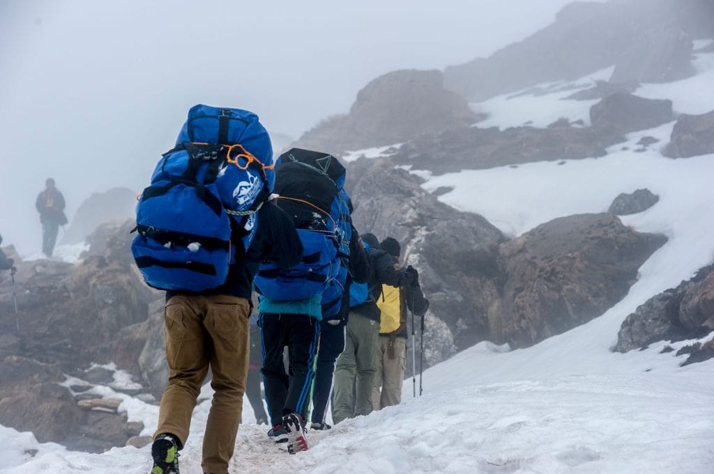
If traveling with a hired porter, keep individual duffel bags packed below 15kg to ensure comfortable transport across steep mountain ridges.
Cash in Nepalese Rupees
Carry sufficient cash in local currency before departing Kathmandu. ATMs are unavailable beyond Dhunche and Syabrubesi.
Daily Expense Estimate
Budget between 4,000 to 5,000 NPR per day to cover teahouse meals, hot showers, battery charging, and Wi-Fi access.
Small Denominations
Carry a supply of 100 and 500 NPR notes. Teahouses in remote high-altitude settlements often cannot break large 1,000 NPR bills.
Trail Customs & Rules
Practical rules for passing animals, stupas, and village paths along the Langtang and Gosaikund route
Pass Stupas Clockwise
- •Walk clockwise around mani walls, chortens, and sacred mani stones.
- •Spin metal prayer wheels with your right hand in a clockwise motion.
- •Never sit or place climbing gear on sacred stone structures.
Mule and Yak Right-of-Way
- •Step toward the mountain wall side when pack animals pass on narrow trails.
- •Never stay on the outer cliff edge where a sudden nudge can cause a fall.
- •Wait quietly until the entire caravan and herder pass completely.
Monastery and Portrait Rules
- •Ask permission before photographing village residents or working farmers.
- •Turn off camera flashes inside active monastery prayer halls.
- •Leave a small cash donation in the collection box when touring monasteries.
Waste and Water Management
- •Carry empty wrappers and plastic waste back down to the roadhead.
- •Avoid burning plastics or throwing wet wipes into teahouse pit toilets.
- •Filter tap water or use purification drops rather than buying disposable bottles.
Sacred Lake Behavior
- •Keep voices calm and avoid loud music around high-altitude holy lakes like Gosaikund.
- •Refrain from swimming or washing clothes in sacred glacial waters.
- •Respect local religious beliefs tied to the surrounding Tamang and Sherpa basins.
Teahouse and Meal Protocol
- •Sleep in the same lodge where you eat your evening and morning meals.
- •Keep muddy boots outside or in designated hallway boot racks.
- •Order breakfast the night before to keep early kitchen operations moving.
Permits & Emergency Directory
Current permit fee structures and official emergency contacts for the Langtang and Gosaikund region
Required Permits & Mandatory Fees
-
📜Langtang National Park Entry Permit NPR 3,000
Required for all trekkers entering the Langtang National Park protected area. Obtainable at the Nepal Tourism Board office in Kathmandu or at the Dhunche checkpoint.
-
📜TIMS Card (Trekkers' Information Management System) NPR 2,000
Mandatory registration card for trekkers traversing independent or guided routes in the region, processed through authorized trekking agencies or NTB counters.
-
📜Pasang Lhamu Rural Municipality Entry Fee NPR 2,000
Local development fee collected at trailheads within the municipal jurisdiction covering parts of the southern approach and surrounding village corridors.
Nepal Tourism Directory
Official contact channels for permits, park regulations, and emergency rescue assistance.
Power, Connectivity & Showers
Realistic day-to-day guide for charging, phones, and hygiene
Device Charging
Electricity in teahouses comes from small solar setups or micro-hydro. Charging devices in rooms is rare; expect to pay Rs 300 to 500 per device in the dining hall.
Mobile Connectivity
Nepal Telecom (NTC) signals hold up better than Ncell across the Langtang valley and up toward Gosaikund, though ridges block reception entirely in deep gorges.
Hot Showers
Gas-heated or solar showers cost Rs 400 to 600 per use. Above 3,500 meters, indoor temperatures drop quickly, making hot showers a risky trigger for rapid chilling.
Water Access
Tap water is unsafe to drink directly. Use chlorine dioxide tablets, iodine, or a microfilter, and carry two wide-mouth bottles for daily treatment.
Altitude Safety & Health
Practical guidelines for recognizing and managing altitude sickness in the Langtang and Gosaikund region
Early Symptom Recognition
Acute mountain sickness (AMS) manifests as a throbbing headache that two ibuprofen cannot touch, loss of appetite, nausea, and persistent insomnia.
Ataxia and Pulmonary Danger
Stumbling like a drunk individual, loss of coordination, or a wet gurgling cough indicate severe conditions like HACE or HAPE requiring immediate descent.
Hydration Strategy
Target 3 to 4 liters daily, factoring in hot lemon, black tea, and garlic soup alongside treated water to stay ahead of silent dehydration.
Emergency Evacuation Insurance
Ensure your insurance policy explicitly covers helicopter rescue and medical evacuation up to 5,000 meters, as trails lack vehicular road access.
The Golden Rule of Altitude
If symptoms worsen overnight or fail to improve with rest, descending 500 to 1,000 meters reverses symptoms fast and saves lives. Never wait for dawn if severe signs appear.
Highland Villages & Wildlife
Indigenous communities and wildlife along the trail
Highland Farming Life
Stone-walled terraces growing barley, buckwheat, and mountain potatoes.
Traditional Hearth & Hospitality
Stone teahouses warmed by central stoves where travellers gather in the evening.
Hand-Woven Wool Craftsmanship
Hand-spun sheep and yak wool woven into warm blankets and winter wear by village families.
Ancient Monasteries & Gompas
Centuries-old Buddhist shrines and prayer halls with sacred ritual significance.
Prayer Flags & Mani Walls
Stone walls carved with sacred Buddhist mantras lining paths approaching high settlements.
Sacred Mountain Peaks
Himalayan massifs revered locally as spiritual guardians and abodes of protective deities.
Himalayan Tahr & Musk Deer
Look for cliff-dwelling Himalayan tahr, musk deer, and pheasant species in upper alpine forests.
Rhododendron Blooms
Spring trails bloom with vibrant red and pink rhododendron blossoms in sub-alpine valleys.
Alpine Raptors
Golden eagles and lammergeiers (bearded vultures) soaring above high ridges and glacial moraines.
Essential Packing Checklist
Prepare 1 duffel bag (handled by porter team) and 1 daypack for personal warm layers & water.
Frequently Asked Questions
Practical details for the Langtang Gosaikund route