

Lobuche East Peak Climbing (17 Days) 17 Days Guide
Trail notes for Lobuche East Peak Climbing. Daily walking hours, pass elevations, teahouse stops, and permit logistics.
Lobuche East Peak Climbing
17-day high altitude expedition combining standard trekking trails in the Khumbu with glacier travel, fixed ropes, and an ascent of Lobuche East.
Essential Route Realities
Key milestones and geographical features along the Lobuche East route
Lukla Mountain Flight Approach
Boarding a twin-engine aircraft from Ramechhap or Kathmandu for the short descent onto Tenzing-Hillary Airport's angled tarmac, marking the official entry to the Khumbu.
Namche Bazaar Acclimatization
Spending two nights in the regional administrative hub at 3,440 meters, allowing red blood cell count to adjust before pushing higher into the alpine zone.
Tengboche Monastery Ridge
Walking beneath towering stone walls to visit the largest active monastery in the Khumbu region, set on an open saddle with clear views of Ama Dablam.
Khumbu Glacier Moraine Traverse
Navigating the uneven, rock-strewn lateral moraine path between Lobuche and Gorak Shep, flanked by exposed ice and glacial debris.
Everest Base Camp Foothold
Stepping onto the rocky perimeter of the Khumbu Glacier to stand at the iconic expedition staging ground at 5,364 meters without technical gear.
Kala Patthar Sunrise Viewpoint
Making the pre-dawn grunt up the black-stone ridge to 5,643 meters for an uninterrupted sightline of Everest's south face and Nuptse.
Lobuche High Camp Logistics
Transitioning from teahouses to tented accommodation on a barren, rocky ledge at 5,400 meters, where guides organize ropes, crampons, and oxygen kits.
Pre-Dawn Summit Ridge Ascent
Moving out in sub-freezing night temperatures across fixed ropes, steep snow ramps, and an exposed rocky crest to reach the true summit at 6,119 meters.
Trail Photos & Videos
High-definition captures and video clips from Himalayan passes, glacial lakes, Sherpa villages, and mountain summits.
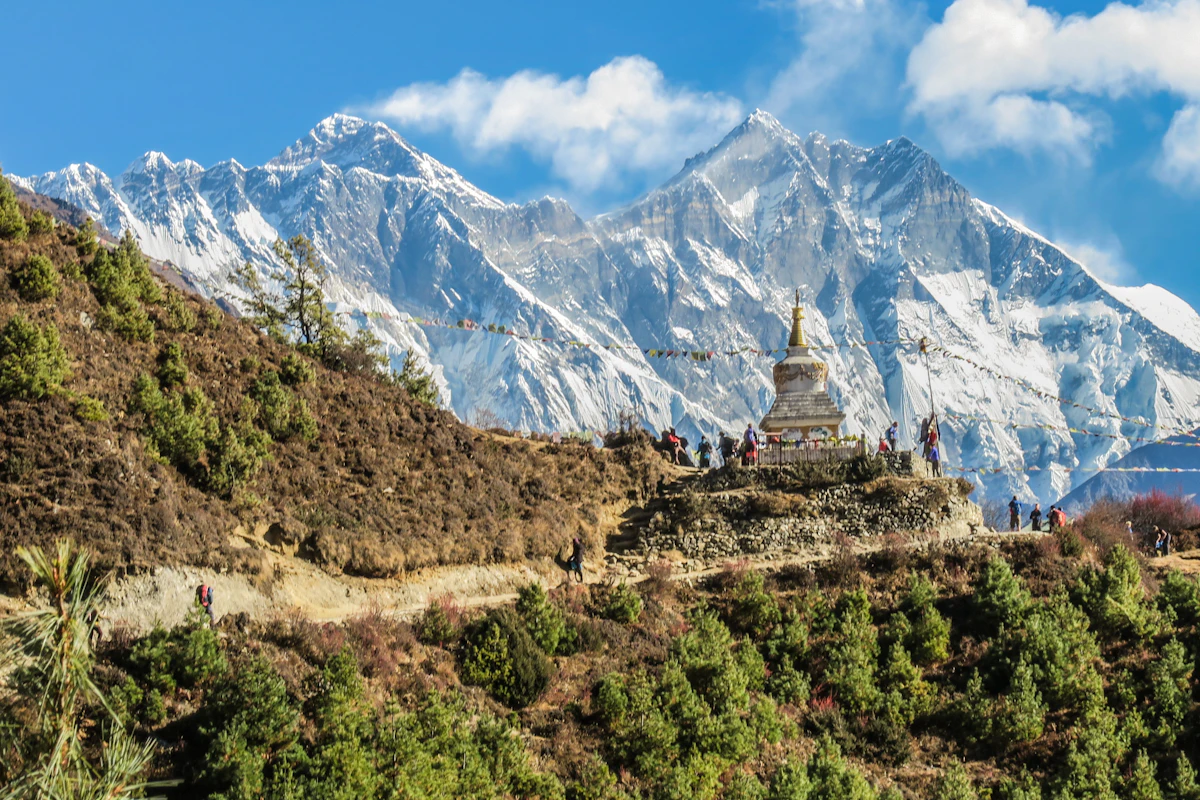

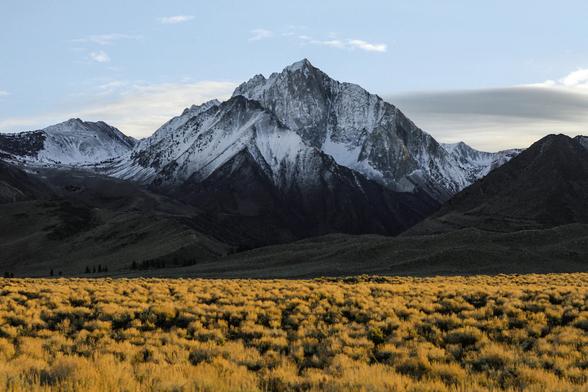
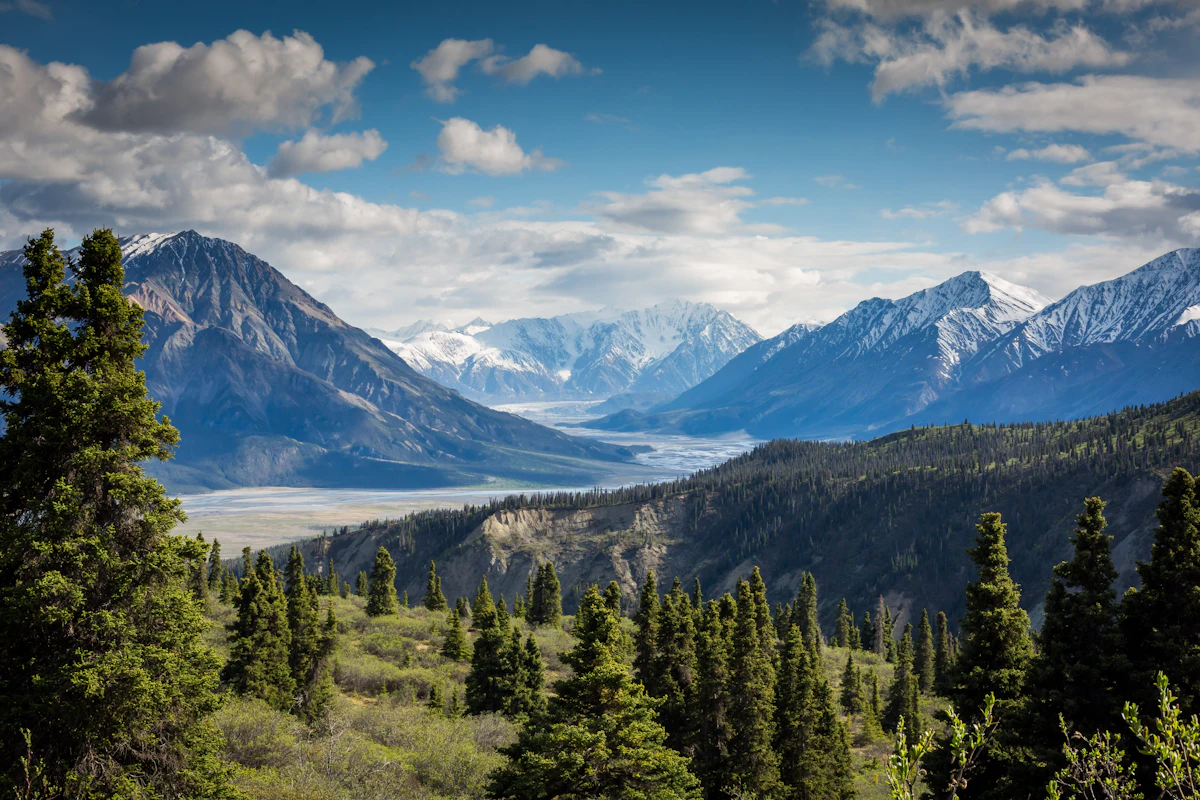

Lobuche East Peak Climbing (17 Days) Trail Map
Interactive OpenStreetMap topographic trail map tracing the route.
Key High-Altitude Stops
Compatible with Garmin, Apple Watch, Strava & Gaia GPS
Lobuche East Peak Climbing (17 Days) Weather Center
Real-time mountain weather and 5-day altitude forecasts across key Lobuche East Peak Climbing (17 Days) waypoints.
Loading weather for ...
Choose waypoint
Altitude Chart & Acclimatization Nodes
Strict adherence to "Hike High, Sleep Low" ensures safe high-altitude adaptation.
Complete Itinerary Route
Explore the detailed day-by-day routing, acclimatization schedule, and trek milestones.
Arrival in Kathmandu (1,350m)
Land at Tribhuvan International Airport and transfer to your hotel in Thamel. Afternoon gear check covers double boots, crampons, harness, and ice axe. Evening briefing reviews altitude protocols, permit paperwork, and the 17-day timeline with your climbing leader.
Fly to Lukla (2,860m), trek to Phakding (2,610m)
HighlightEarly morning flight to Lukla's sloped runway — 35 minutes from Kathmandu. Trail drops gently through Chaurikharka village, crossing the Dudh Koshi via suspension bridge. Pine forests line the riverbank before reaching Phakding's cluster of lodges beside the water.
Phakding to Namche Bazaar (3,440m)
HighlightCross five suspension bridges over the Dudh Koshi, entering Sagarmatha National Park at Monjo. Steep switchbacks climb through pine and rhododendron to the horseshoe ridge where Namche appears — a bustling Sherpa hub with bakeries, gear shops, and Saturday market.
Acclimatization day at Namche Bazaar (3,440m)
AcclimatizationHike to the Everest View Hotel ridge (3,880m) for first sight of Lhotse, Nuptse, and Ama Dablam. Visit the Sherpa Culture Museum and Sagarmatha National Park visitor center. Afternoon free for gear rental top-ups or coffee at a bakery with mountain views.
Namche to Tengboche (3,860m)
HighlightContour high above the Dudh Koshi with Everest framed by the valley. Descend to Phunki Tenga river crossing, then climb stone steps through rhododendron forest to Tengboche Monastery — spiritual heart of Khumbu — where evening puja echoes off the peaks.
Tengboche to Dingboche (4,410m)
HighlightTrail drops through birch forest to Debuche, crosses the Imja Khola, then climbs steadily to Pangboche village. Above the tree line, the valley opens to Chukhung Ri and Island Peak views. Dingboche sits on a glacial moraine with stone-walled potato fields.
Acclimatization day at Dingboche (4,410m)
AcclimatizationMorning hike to Nangkartshang Peak (5,083m) for panoramic views of Makalu, Lhotse, and the Imja Valley. Practice crampon technique on nearby snow slopes if conditions allow. Rest afternoon — hydration and calorie loading critical before higher camps.
Dingboche to Lobuche (4,940m)
HighlightTrail follows the Khumbu Glacier lateral moraine past memorial chortens for climbers lost on Everest. Thin air makes each step deliberate. Lobuche village perches on a rocky shelf with views of Pumori and the Khumbu Icefall — last teahouse stop before base camp.
Lobuche to Lobuche Base Camp (4,950m)
HighlightShort carry across glacial rubble to base camp on a flat moraine terrace. Afternoon dedicated to rope skills refresher: fixed-line ascents, crevasse rescue basics, and ice axe arrest drills. Tents pitched on insulated mats; kitchen tent serves hot meals at 4,950m.
Base Camp to High Camp (5,400m)
HighlightSteep climb up snow slopes and rocky bands to High Camp perched on a rocky shoulder. Route fixed with ropes by Sherpa team. Oxygen levels drop noticeably — breathing becomes laboured. Early dinner, then sleep by 7 PM for midnight alpine start.
Summit Lobuche East (6,119m) and descend to Base Camp
HighlightWake 11 PM, rope up by midnight. Climb snow ramp to the knife-edge southeast ridge — exposed but non-technical. Summit at dawn: Everest, Lhotse, Makalu, Cho Oyu spread below. Descend same route, rappelling fixed lines. Back at base camp by mid-afternoon for recovery.
Contingency / weather buffer day at Base Camp
AcclimatizationBuilt-in buffer for summit weather window or recovery. If summit completed, use for gear drying, hydration, and short acclimatization walks on the glacier. Sherpa team checks fixed lines and camp condition. Mental reset before the long descent begins.
Base Camp to Pangboche (3,985m)
HighlightRetrace moraine trail past Lobuche village, descending steeply to the Imja Khola crossing. Knee-jarring downhill on loose scree. Pangboche welcomes with thicker air, the oldest monastery in Khumbu, and a chance for a hot shower — first in days.
Pangboche to Namche Bazaar (3,440m)
HighlightCross the Imja Khola suspension bridge, climb to Tengboche for tea at the monastery. Descend through rhododendron forest to Phunki Tenga, then contour to Kyangjuma ridge. Final steep drop into Namche — celebrate with a bakery treat and cold beer.
Namche to Lukla (2,860m)
HighlightLong descent via Monjo and the five Dudh Koshi bridges. Legs heavy from cumulative elevation loss. Enter Lukla by late afternoon — last night in the mountains. Team dinner with Sherpa crew, tip distribution, and gear packing for morning flight.
Fly Lukla to Kathmandu (1,350m)
HighlightFirst flight out at 6:30 AM if weather holds — Lukla delays are common. Buffer day in Kathmandu absorbs any disruption. Afternoon free for souvenir shopping in Thamel or massage. Farewell dinner with climbing certificates and summit photos.
Departure from Kathmandu
HighlightPrivate transfer to Tribhuvan International Airport three hours before flight. Confirm onward tickets and visa paperwork. Depart Nepal with summit memories and the quiet satisfaction of standing on a 6,000-meter Himalayan peak.
What's Covered & What's Not
A clear breakdown so you know exactly what to budget for and what's already taken care of.
Required Trail Permits
- Sagarmatha National Park entry permit (NPR 3,000) and Khumbu Pasang Lhamu Rural Municipality entry fee (NPR 3,000) for the Khumbu approach.
Climbing Royalty & Permits
- NMA peak climbing royalty (seasonal rates vary) and Sagarmatha Pollution Control Committee (SPCC) waste deposit.
Local Transport
- Flight from Kathmandu or Manthali to Lukla airstrip, plus return flights.
Teahouse Accommodation
- Basic twin-share lodge lodging along the trekking route and tented/lodge stays at base camp.
International Airfare
- Flights from your home country to Tribhuvan International Airport in Kathmandu.
Nepal Tourist Visa
- On-arrival visa fees (USD $30 for 15 days, $50 for 30 days, or $125 for 90 days).
High-Altitude Rescue Insurance
- Mandatory medical and emergency evacuation insurance covering helicopter airlift above 6,000 meters.
On-Trail Extras
- Hot showers, battery charging, Wi-Fi tokens, bottled water, and personal summit gear rental in Kathmandu or Namche.
Trail Meals & Hydration Rules
What to eat for stamina and altitude safety
Dhal Bhat
Steamed rice, lentil soup, and vegetable curry with free refills available at most teahouses, providing steady calories for long hiking days.
Garlic Soup
Hot, clear broth containing local garlic cloves, often ordered in the evenings to help with acclimatization and dry throat irritation.
Boiled Potatoes
Starch-rich boiled or fried potatoes seasoned with salt and pepper, serving as a reliable energy source when appetite drops at altitude.
Sherpa Stew
Thick noodle soup packed with vegetables and potatoes, served steaming hot in the high-altitude teahouses.
Hot Water Refills
Fill two wide-mouth water bottles with boiled water at night; tuck them inside the sleeping bag to stay warm.
Ginger Lemon Tea
Steaming hot herbal tea that helps soothe dry airways caused by cold mountain air.
Electrolyte Tablets
Mix hydration salts into daily drinking water to replace essential minerals lost through heavy exertion.
Purification Tablets
Carry chlorine dioxide or Aquatabs to treat tap water when filtered boiled water is unavailable.
Vegetarian Staples
Vegetarian dishes are the safest and freshest meal choices in mountain lodges.
Gluten-Free Rice Options
Rice-based meals and boiled potatoes provide reliable, naturally gluten-free carbohydrates.
Black Tea Alternative
Order black tea without powdered milk if lactose intolerance is a concern.
Early Kitchen Orders
Place dinner orders before 5:00 PM to give lodge cooks enough time to prepare fresh meals.
Meat Above 3,500 Meters
Avoid meat dishes in high settlements because porter-carried meat lacks adequate refrigeration.
Alcohol at High Camp
Skip alcoholic drinks above 4,000 meters since alcohol accelerates dehydration and complicates acclimatization.
Untreated Stream Water
Never drink directly from taps or streams without boiling or chemical treatment.
Raw Vegetables
Skip uncooked salads and unpeeled fruit to prevent gastrointestinal illness on the trail.
Trip Preparation & Rules
Paperwork, flight baggage limits, and cash guidelines
Passport Validity & Tourist Visa
Ensure your passport is valid for at least six months beyond your arrival date. On-arrival visas can be purchased at Tribhuvan International Airport using cash in major foreign currencies.
High-Altitude Rescue Insurance
Verify that your insurance policy explicitly covers emergency helicopter evacuation up to 6,000 meters. Keep digital and printed copies of your policy details accessible at all times.
Passport-Sized Photos
Carry four physical passport-sized photographs. These are required for local registration desks, climbing paperwork, and obtaining local SIM cards in Kathmandu.
Khumbu Pasang Lhamu Permit
Local rural municipality entry permit (NPR 3,000) obtained upon arrival in Lukla or Monjo. Note: TIMS cards are not required or valid in the Khumbu region.
Sagarmatha National Park Permit
Mandatory national park entry permit (NPR 3,000 + 13% VAT = NPR 3,390) obtained in Kathmandu at the Tourism Board or directly at the Monjo park entrance.
Licensed Guide Requirement
Under Nepal Tourism Board regulations, foreign trekkers must trek with a licensed government guide for safety and environmental sustainability.
Strict Baggage Limits
Domestic mountain flights enforcing a strict total limit of 15 kilograms per passenger, split between a 10kg checked duffel and a 5kg carry-on.
Weather Contingency Buffer
Flight delays caused by cloud cover or wind are common. Build two to three buffer days into your schedule to account for potential groundings.
Manthali Airport Diversion
During peak trekking seasons, flights to Lukla operate out of Ramechhap Airport, requiring a pre-dawn road transfer from Kathmandu.
Daily Cash Requirement
Carry sufficient Nepalese Rupees for all personal expenses on the trail. Plan for roughly 4,000 to 5,000 NPR per day to cover hot showers, Wi-Fi, battery charging, and extra meals.
ATM Reliability
ATMs in Namche Bazaar are operational most of the time, but power outages and network failures happen frequently. Do not rely on them as your primary source of funds.
Exchange Rates in Kathmandu
Exchange your foreign currency into Nepalese Rupees while in Kathmandu or Thamel. Rates deteriorate rapidly once you leave the capital.
Trail Customs & Rules
Practical rules for passing animals, stupas, and village paths
Pass Stupas Clockwise
- •Always keep Mani walls, stupas, and chortens on your right side when passing.
- •Spin prayer wheels in a clockwise direction only.
- •Never sit on sacred prayer stones or place gear on religious structures.
Pack Animal Right-of-Way
- •Step toward the mountain wall when yaks, dzos, or mule trains approach.
- •Stay away from the cliff edge as laden animals can easily knock trekkers off balance.
- •Wait until the entire caravan passes before moving again.
Photography Protocols
- •Ask permission before photographing elders, children, or working porters.
- •Refrain from taking photos inside active monastery prayer halls.
- •Leave a small offering in the donation box if permitted inside local shrines.
Waste & Water Management
- •Carry all non-biodegradable trash, including empty batteries and wrappers, back down the valley.
- •Avoid throwing wet wipes or plastic into lodge pit toilets.
- •Filter or treat tap water instead of adding single-use plastic bottles to trail waste.
Teahouse Courtesy
- •Remove muddy boots at the lodge entrance before stepping onto dining room flooring.
- •Keep voice levels low in shared sleeping quarters after 9:00 PM.
- •Support your lodge by purchasing dinner and breakfast where you sleep.
Local Cultural Respect
- •Dress modestly in mountain villages by keeping shoulders and knees covered.
- •Remove hats and sunglasses when entering monasteries or Sherpa homes.
- •Greet locals with a respectful 'Namaste' using palms pressed together.
Permits & Emergency Directory
Current permit fee structures and official emergency contacts for this route
Required Permits & Mandatory Fees
-
📜Sagarmatha National Park Entry Permit NPR 3,000
Required for entry into the Sagarmatha National Park, obtained at the Nepal Tourism Board in Kathmandu or at the Monjo checkpoint.
-
📜Khumbu Pasang Lhamu Rural Municipality Fee NPR 3,000
Local government fee collected at Lukla or Phakding; replaces the older TIMS card in this region.
-
☘️NMA Climbing Royalty Variable by Season
Mandatory Nepal Mountaineering Association peak royalty required for Lobuche East climbing, varying between spring, autumn, and winter seasons.
Nepal Tourism Directory
Official contact channels for permits, park regulations, and emergency rescue assistance.
Power, Connectivity & Showers
Realistic day-to-day guide for charging, phones, and hygiene
Device Charging
Electricity in teahouses comes from solar arrays or micro-hydro generators. Charging phones or power banks in dining halls costs between NPR 300 to 600 per device. Carry a reliable 20,000mAh external battery pack and keep it close to your body heat at night to prevent rapid battery drain.
Mobile SIM & Wi-Fi
Nepal Telecom (NTC) and Ncell maintain mobile coverage across the Khumbu valley, though signals drop behind major ridgelines. Satellite-based Wi-Fi cards (such as Everest Link) are available at most lodges for purchase, though connection speeds fluctuate heavily with weather and user congestion.
Hot Showers
Gas-heated or solar showers are available up to Pheriche, typically costing NPR 400 to 700. Above 4,000 meters, indoor temperatures drop sharply; stepping into a hot shower and facing freezing ambient air increases the risk of cold-stress or respiratory issues. Pack wet wipes and biodegradable soap for sponge baths instead.
Water & Sanitation
Single-use plastic bottles are restricted in the Sagarmatha National Park. Carry two wide-mouth 1-liter Nalgene bottles and treat tap or lodge water using chlorine dioxide drops or municipal boiling services. Safe hydration is essential for managing altitude adaptation.
Altitude Safety & Health
How to handle altitude symptoms and emergency protocols
Daily Symptom Monitoring
Watch closely for early acute mountain sickness signs: a throbbing headache that ibuprofen fails to touch, persistent loss of appetite, nausea, and unusual dizziness.
Field Hydration Strategy
Count hot lemon, black tea, garlic soup, and boiled water toward the four-liter daily fluid intake to prevent thick blood and severe dehydration.
Emergency Evacuation Insurance
Ensure your insurance policy explicitly covers emergency helicopter rescue up to 6,000 meters, as high-altitude medical evacuation is expensive and requires prepayment guarantees.
Severe Ataxia & Pulmonary Signs
Immediate descent is mandatory if you notice stumbling like a drunk person, loss of coordination, a wet gurgling cough, or confusion.
The Golden Altitude Rule
If symptoms worsen after resting, dropping 500 to 1,000 meters reverses sickness fast and saves lives. Never wait until morning if breathing becomes labored at high camps.
Highland Villages & Wildlife
Indigenous communities and wildlife along the trail
Sherpa Settlement Architecture
Traditional stone and timber houses built with thick walls to withstand sub-zero winter temperatures.
Traditional Hearth & Hospitality
Central iron stoves burning dried yak dung or wood in teahouses where climbers gather to dry gear.
Woolen Weaving Traditions
Local families spinning sheep and yak wool into durable blankets and winter garments for high-altitude survival.
High-Altitude Monasteries
Stone gompas nestled beneath towering granite peaks where monks perform protective mountain rituals.
Carved Mani Walls
Long piles of slate stones inscribed with the mantra Om Mani Padme Hum, passed on the right side.
Sacred Peak Guardians
Local communities regard high summits as sacred abodes of protective deities requiring respectful behavior.
Himalayan Tahr & Musk Deer
Wild ungulates grazing steep rock faces and juniper scrub in the upper sub-alpine transition zones.
Rhododendron Forests
Dense thickets of native tree rhododendrons flowering in brilliant red and pink hues during spring months.
High-Altitude Raptors
Lammergeiers and golden eagles using thermal updrafts above glacial valleys and rocky moraines.
Essential Packing Checklist
Prepare 1 duffel bag (handled by porter team) and 1 daypack for personal warm layers & water.
Frequently Asked Questions
Practical answers for planning your Lobuche East expedition