
Dolpo to Mustang Trek (22-27 Days)
Difficulty: 5/5Duration: 27 DaysDistance: 320 km Table of Contents Introduction to Dolpo to Mustang Trek (22-27 Days) Route Highlights & … <a class="read-more text-primary fw-semibold" href="https://www.trekkingtrials.com/trek/dolpo-to-mustang-trek-22-27-days/">Read More »</a>
Dolpo to Mustang Trek
27-day traverse across Dolpo to Mustang. Daily walking covers remote mountain terrain, high plateau passes, and deep river gorges with nights spent in basic highland settlements.
 Table of Contents
Key Trail Realities
What to expect along the route
Remote Trans-Himalayan Landscapes
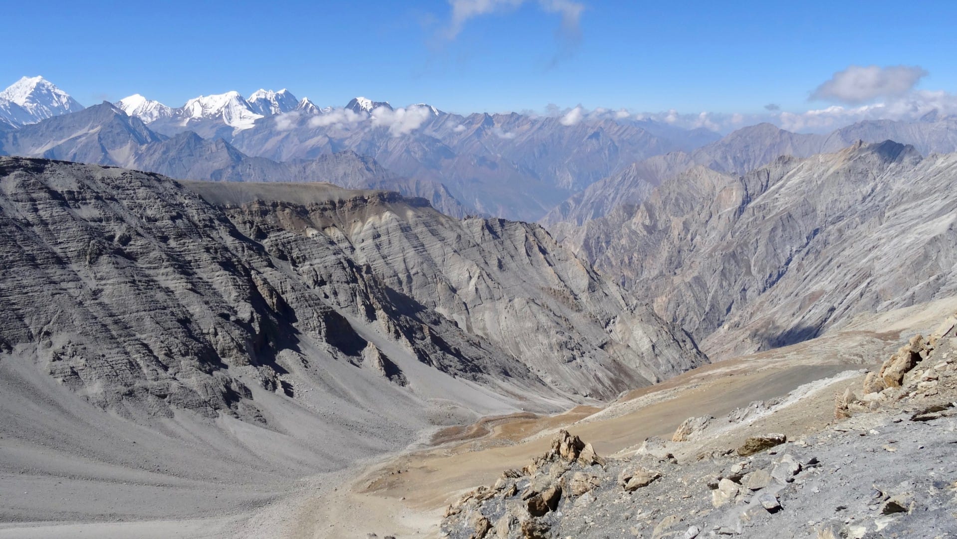
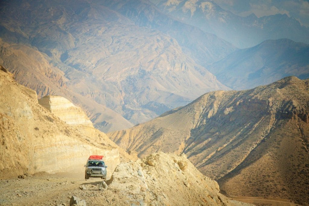
Traverse arid high-altitude deserts, eroded canyons, and ancient Tibetan-influenced settlements along the remote borderlands between Upper Dolpo and Mustang.
High Alpine Pass Crossings
Climb over exposed mountain passes exceeding 5,000 meters, requiring careful pacing over loose scree, steep stone switchbacks, and potential early-season snow.
Challenging Remote Logistics
Operate without cellular reception or reliable electricity for multiple weeks, relying entirely on self-contained gear, group satellite communication, and local water sources.
Ancient Monasteries and Cave Dwellings
Pass centuries-old Buddhist gompas, chortens, and cliffside cave settlements that preserve traditional Tibetan cultural heritage isolated from modern infrastructure.
Extended Wilderness Autonomy
Travel through vast valleys far from road access, where logistics depend on organized camping support, pack animals, and experienced local expedition crew.
Strict Restricted Area Permits
Comply with mandatory special permit regulations for Upper Dolpo and Upper Mustang, requiring a licensed government guide and a minimum two-person trekking group.
High-Altitude Acclimatization Demands
Manage sustained sleeping elevations above 4,000 meters for consecutive weeks, where monitoring fluid intake and recognizing early altitude symptoms are essential.
Rugged River Valley Traverses
Navigate challenging valley floors, cross suspension bridges over glacial meltwater rivers, and ascend exposed ridges subject to strong afternoon wind.
Trail Photos & Videos
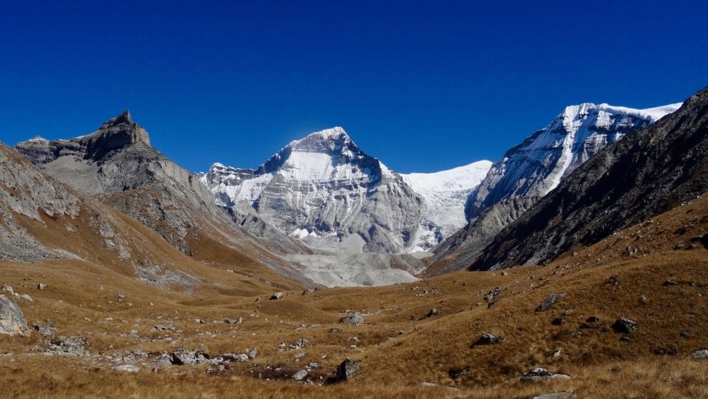
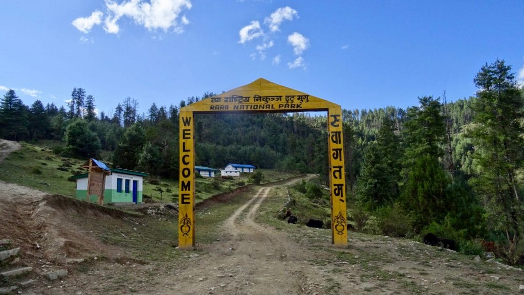
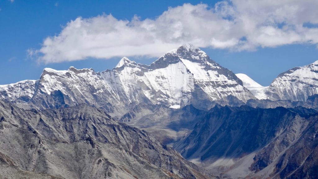
High-definition captures and video clips from Himalayan passes, glacial lakes, Sherpa villages, and mountain summits.


Dolpo to Mustang Trek (22-27 Days) Trail Map
Interactive OpenStreetMap topographic trail map tracing the route.
Key High-Altitude Stops
Compatible with Garmin, Apple Watch, Strava & Gaia GPS
Dolpo to Mustang Trek (22-27 Days) Weather Center
Real-time mountain weather and 5-day altitude forecasts across key Dolpo to Mustang Trek (22-27 Days) waypoints.
Loading weather for ...
Choose waypoint
Altitude Chart & Acclimatization Nodes
Strict adherence to "Hike High, Sleep Low" ensures safe high-altitude adaptation.
Complete Itinerary Route
Explore the detailed day-by-day routing, acclimatization schedule, and trek milestones.
Arrival in Kathmandu (1,350m)
Arrive at Tribhuvan International Airport and transfer to your hotel. Use the afternoon to review expedition gear, confirm permits, and complete the official briefing covering high-altitude safety requirements before departing for the western trailheads.
Kathmandu to Nepalgunj (150m)
Board a domestic flight heading south to the Terai plains of Nepalgunj. The city sits near the Indian border and is the primary staging hub for remote western mountain flights. Prepare for early morning mountain airstrip connections tomorrow.
Nepalgunj to Juphal (2,475m) and Trek to Dunai (2,140m)
HighlightFly over rugged ridges into the mountain airstrip at Juphal. Descend along the Thulo Bheri River through pine terraces and stone-walled fields, arriving at Dunai, the administrative headquarters of the Dolpo district, by early afternoon.
Dunai to Tarakot (2,540m)
HighlightFollow the southern bank of the Bheri River past cascading waterfalls and suspension bridges. The trail winds through deep gorges before opening up to Tarakot, an ancient fortified settlement perched above the river junction with terraced barley fields.
Tarakot to Laina Odar (3,375m)
Ascend alongside the Barbung Khola through steep, narrow canyon walls. The path requires careful footing along carved rock ledges. Reach Laina Odar, a natural rock overhang used by drovers and trekkers for overnight shelter in the gorge.
Laina Odar to Tok Kyang (3,910m)
HighlightClimb higher into the upper Tarap Valley as the landscape shifts from narrow gorges to expansive alpine plateaus. Pass mani walls, chortens, and scattered stone settlements characteristic of traditional Tibetan-influenced Dolpo culture.
Acclimatization Day in Tok Kyang (3,910m)
AcclimatizationRest and adapt to the rising elevation above 3,900 meters. Take a short hike toward nearby monastic sites on the valley slopes to support red blood cell adaptation before crossing higher wilderness passes in the days ahead.
Tok Kyang to Dho Tarap (4,040m)
Trek across wide pasturelands flanked by stone walls. Arrive at Dho Tarap, one of the highest permanent human settlements in the Himalayas. Explore the village's unique double-walled houses, ancient monasteries, and local inhabitants trading salt and grain.
Acclimatization Day in Dho Tarap (4,040m)
AcclimatizationSpend a dedicated day at altitude visiting nearby Gompas such as Ribo Bhumpa. Hydrate continuously with garlic soup and black tea to combat the dry mountain air and prepare physical reserves for the crossing of the Numla La pass.
Dho Tarap to Numa La Base Camp (4,400m)
HighlightLeave the main Tarap Valley floor behind, following an ascending trail alongside the Tarap Chu. Camp below the western approaches of the Numa La pass as temperatures drop sharply after sunset in the high alpine wilderness.
Cross Numa La Pass (5,309m) to Danigar (4,510m)
HighlightStart before dawn on a steep, scree-strewn ascent to the summit of the Numa La pass at 5,309 meters. Sweeping panoramic views open toward Dhaulagiri II and surrounding peaks before descending into the remote Dang Chu valley.
Danigar to Pelung Tang (4,465m) via Baga La
HighlightTraverse high valley trails beneath towering rock faces. Approach the lower slopes leading to the Baga La pass, navigating moraine ridges and glacial streams before setting up camp at Pelung Tang beneath towering ice walls.
Cross Baga La Pass (5,190m) to Yak Kharka (3,980m)
HighlightClimb steadily over frozen boulders to reach the summit of Baga La at 5,190 meters. Descend steeply down loose stone trails through pine forests into the upper reaches of the Phoksundo lake drainage system at Yak Kharka.
Yak Kharka to Ringmo (3,640m) / Phoksundo Lake
HighlightDescend through birch forests past the towering Suligad waterfall. Arrive at the turquoise waters of Phoksundo Lake and the traditional Bon-po village of Ringmo. Spend the afternoon exploring the lakeshore and ancient monastery.
Rest and Exploration Day at Phoksundo Lake (3,640m)
HighlightRest beside the deep blue waters of Phoksundo Lake. Take a short hike to viewpoint ledges overlooking the lake outflow and the traditional stone village of Ringmo to recover stamina before entering the northern wilderness corridor.
Ringmo to Chunuwar (3,110m)
HighlightFollow the outflow river downstream, crossing suspension bridges suspended high above roaring gorges. The trail winds through dense pine and bamboo forests before reaching the remote outpost of Chunuwar, home to a local health post.
Chunuwar to Saldang (3,770m)
Climb away from the river canyon onto high arid paths leading into the remote northern valleys of Upper Dolpo. Reach Saldang, one of the largest and most prosperous trading villages in the region, surrounded by barley terraces.
Saldang to Yangze (3,750m)
HighlightTrek north along the Nagon Khola through wind-swept valleys and barren red-rock canyons. Arrive at Yangze, a small traditional settlement featuring an ancient Bon-po monastery perched on a rocky outcrop above the river.
Yangze to Sibu (4,560m)
HighlightRetrace steps down the valley before turning eastward toward the high mountain passes connecting Dolpo to Mustang. Camp at Sibu, a sparse wilderness resting spot situated below the long ascent to the Jeng La pass.
Cross Jeng La Pass (5,110m) to Tok Kyang Camp / Jeng La Phedi
HighlightClimb a steep, rocky ridge to cross the Jeng La pass at 5,110 meters. Gaze across the vast expanse of the Dhaulagiri massif before descending into the Tarap basin valley floor for a wilderness camp.
Jeng La Phedi to Chharka Bhot (4,300m)
Traverse high plateau trails alongside the Barbung Khola through remote desert landscapes. Arrive at Chharka Bhot, an isolated Tibetan-style village featuring an old fortress and stone houses sheltered against cold plateau winds.
Chharka Bhot to Yak Kharka (4,780m)
HighlightAscend steadily through barren high-altitude wilderness along ancient salt-trade routes. The air thins noticeably as you make camp at Yak Kharka, preparing for the crossing of the Sangda La pass.
Cross Sangda La Pass (5,125m) to Sangda Phedi (4,200m)
HighlightTrek over the rugged Sangda La pass at 5,125 meters through shifting scree and glacial winds. Descend long, exposed ridges down to a sheltered campsite at Sangda Phedi overlooking the Kali Gandaki drainage.
Sangda Phedi to Sangda (3,700m)
Descend along steep slate slopes and traversing cliffside paths. Reach the remote village of Sangda, marking the transition from the wild isolation of Dolpo into the northern fringes of the Mustang region.
Sangda to Phalyak (3,150m)
HighlightTrek across dry, windswept plateaus with distant views of the Annapurna and Nilgiri peaks. Pass through traditional Thakali farming settlements before arriving at Phalyak, featuring flat-roofed houses and barley fields.
Phalyak to Jomsom (2,720m)
Descend into the windy Kali Gandaki river valley. Complete the traverse from Dolpo to Mustang as you arrive in Jomsom, the administrative hub of Mustang district. Celebrate the completion of the trek with local Dhal Bhat.
Jomsom to Pokhara / Kathmandu
Board an early morning scenic flight from Jomsom through the deep Kali Gandaki gorge flanked by Dhaulagiri and Annapurna. Land in Pokhara or connect onward to Kathmandu, concluding your 27-day wilderness expedition.
What's Covered & What's Not
A clear breakdown so you know exactly what to budget for and what's already taken care of.
Lower Dolpo and Upper Dolpo Restricted Area Permits
- Mandatory restricted area entry fees required by the Department of Immigration for the 27-day transit.
Annapurna Conservation Area Permit (ACAP) and Shey Phoksundo National Park Permit
- Conservation entry fees covering protected areas across Dolpo and Mustang.
Domestic Flight & Ground Transfer Logistics
- Flight from Kathmandu to Nepalgunj and Juphal, plus exit jeeps from Jomsom back to Pokhara or Kathmandu.
Licensed Guide & Special Area Registered Escort
- Government-mandated certified guide required for restricted trans-Himalayan border zones.
International Airfare
- Flights from your home country to Kathmandu (KTM).
Nepal Tourist Visa
- Purchased on arrival at Tribhuvan International Airport ($50 USD for 30 days or $125 USD for 90 days).
High-Altitude Emergency Rescue Insurance
- Mandatory travel policy covering helicopter evacuation above 5,500 meters.
On-Trail Personal Extras
- Hot shower fees, battery charging in lodges, bottled or treated water, and tip money.
Trail Meals & Hydration Rules
What to eat for stamina and altitude safety
Dhal Bhat Power
Rice, lentil soup, spiced potato, and spinach. Always comes with free refills to refuel after 6 hours on trail.
Garlic Soup
Thin clear garlic broth. Local guides drink this daily above 3,500m to help with blood circulation and warmth.
Boiled & Fried Potatoes
Dense carbohydrate source served with local cheese or chili paste in high settlements.
Tibetan Bread & Honey
Deep-fried puffed flatbread. Hearty breakfast before an early morning climb.
Local Noodle Soup
Thick vegetable and hand-pulled flour noodle soup served steaming hot in remote valley teahouses.
Boiled Eggs
Safe, reliable protein source available every morning at lodge kitchens.
Boiled Water Bottles
Buy boiled water at night and keep the bottle inside your sleeping bag for warmth.
Ginger Lemon Honey Tea
Warm drink that cuts the dry mountain cough and stays hot in an insulated thermos.
Electrolyte Packs
Add one electrolyte sachet to 1L of water daily to replace salts lost on steep ascents.
Water Purification Drops
Use Aquatabs or chlorine dioxide tablets for tap water; wait full 30 minutes before drinking.
Vegetarian Focus
Vegetarian dhal bhat and veg noodles are always the freshest food on high trails.
Naturally Gluten-Free
Rice dishes, plain boiled potatoes, and buckwheat porridge are naturally gluten-free.
Black Chiya Option
Ask for black tea to avoid powdered milk if you are lactose sensitive.
Lodge Kitchen Flexibility
Cooks can prepare food with less chili or no salt upon request if you ask before 5:00 PM.
No Meat Above 3,500m
Meat is carried up on foot for days without refrigeration. Stick to vegetarian meals high up.
No Alcohol at High Camp
Alcohol causes rapid dehydration and masks early symptoms of altitude sickness.
Never Drink Untreated Water
Never drink directly from village taps or streams without filtration or purification tablets.
Skip Raw Salads
Stick to thoroughly cooked hot vegetables to prevent stomach upsets.
Trip Preparation & Rules
Paperwork, flight baggage limits, and cash guidelines
Passport & Tourist Visa
Passport valid for at least 6 months. Secure your 30-day tourist visa on arrival at Tribhuvan International Airport.
High-Altitude Rescue Insurance
Mandatory policy explicitly covering emergency helicopter evacuation up to 6,000 meters. Keep printed copies and digital backups accessible.
Passport Photos
Carry four physical passport photos for restricted area paperwork and local permit checkpoints.
Upper Mustang Restricted Area Permit (RAP)
Mandatory Department of Immigration restricted area permit (USD 500 per person for the first 10 days, USD 50/day thereafter), issued via a registered Nepali agency.
Annapurna Conservation Area Permit (ACAP)
Standard conservation entry permit (NPR 3,000) required for all trails within the Annapurna Conservation Area Project boundary.
Agency & Guide Requirement
Restricted area regulations require a certified licensed Nepali guide and processing through a registered trekking company.
Domestic Baggage Limits
Mountain flights enforce a strict 15kg total limit (10kg checked duffel, 5kg carry-on). Excess weight incurs heavy per-kilogram fees.
Weather Diversions
Flights to regional airstrips like Juphal or Jomsom depend entirely on visibility. Build three buffer days into your schedule for delays.
Charter Contingency
When commercial flights stall for days due to fog or wind, groups occasionally pool funds to charter private helicopter flights.
Daily Cash Budget
Budget between 4,000 and 6,000 Nepalese Rupees per day for meals, hot showers, charging batteries, and basic teahouse extras.
ATM Availability
ATMs exist in district hubs like Jomsom or Dunai but frequently run out of cash or experience power failures. Carry your full trekking budget in local currency from Kathmandu.
Banknotes Quality
Teahouse owners in remote trans-Himalayan valleys reject torn, heavily taped, or dirty foreign banknotes. Exchange pristine foreign currency in Kathmandu.
Trail Customs & Rules
Practical rules for passing animals, stupas, and remote mountain villages
Pass Stupas Clockwise
- •Always keep Mani walls, chortens, and prayer wheels on your right.
- •Walk around holy monuments in a clockwise direction.
- •Never sit on stone prayer walls or stack random cairns.
Pack Animal Right-of-Way
- •Stand on the mountain wall side when yak or mule caravans pass.
- •Never stand on the cliff edge where a sudden nudge can send you down.
- •Give working animals full clearance on narrow mountain ledges.
Photography and Monasteries
- •Ask permission before photographing elders, monks, or local residents.
- •Keep cameras off inside active monastery prayer halls.
- •Leave a small offering in the donation box if you enter a sacred site.
Environmental Impact
- •Pack out all non-degradable waste and plastic wrappers.
- •Avoid burning toilet paper or plastic in lodge fire pits.
- •Respect local water sources and use purification tablets.
Lodge and Cultural Respect
- •Remove muddy boots before entering teahouse dining rooms.
- •Keep voices low in shared sleeping quarters after dark.
- •Support local kitchen economies by eating meals at the lodge where you sleep.
Appropriate Attire
- •Dress modestly in villages and monastery compounds.
- •Avoid hiking shirtless or wearing overly revealing clothing.
- •Cover shoulders and knees when visiting sacred religious shrines.
Permits & Emergency Directory
Current permit fee structures and official emergency contacts for the Dolpo to Mustang traverse
Required Permits & Mandatory Fees
-
📜Shey Phoksumdo National Park Permit NPR 3,000
Required for entering the protected area within Lower and Upper Dolpo. Obtained in Kathmandu or Pokhara through registered agencies.
-
📜Annapurna Conservation Area Permit (ACAP) NPR 3,000
Mandatory conservation entry permit required upon entering the Mustang section of the traverse.
-
📜Upper Dolpo & Upper Mustang Restricted Area Permits $500 (Dolpo) + $500 (Mustang)
Special restricted area permits are mandatory for foreign nationals traversing Upper Dolpo and Upper Mustang. These require a minimum of two trekkers, a licensed guide, and processing through a bonded Nepal trekking agency.
Nepal Tourism Directory
Official contact channels for permits, park regulations, and emergency rescue assistance.
Power, Connectivity & Showers
Realistic day-to-day guide for charging, phones, and hygiene
Device Charging
Electricity is unreliable in remote western regions. Teahouses charge NPR 300 to 600 per device or power bank in the dining hall. Bring a high-capacity solar charger or 20,000mAh battery bank.
Mobile Connectivity
Nepal Telecom (NTC) provides intermittent cellular signals in lower Dolpo and parts of Mustang, but signals drop entirely across high mountain passes and deep gorges. Satellite messengers are recommended for remote safety.
Hot Showers
Basic bucket showers or gas-heated systems are available in lower villages for NPR 400 to 600. Above 4,000 meters, freezing nighttime temperatures make cold exposure risky; rely on biodegradable wet wipes.
Drinking Water
Tap and stream water must be purified. Carry two 1L Nalgene bottles and chlorine dioxide tablets or a UV purifier. Boiling water at teahouses costs NPR 100 to 300 per liter.
Altitude Safety & Health
How to handle altitude symptoms and emergency protocols
Daily Symptom Monitoring
Watch closely for early AMS signs: persistent headache, loss of appetite, nausea, dizziness, and insomnia.
Helicopter Evacuation
In case of severe HAPE or HACE, guides dispatch emergency rescue helicopters to Kathmandu hospitals.
Satellite SOS Communication
Carry a Garmin inReach or ensure your guide carries satellite SOS for dead-zone sections.
Hydration and Electrolytes
Count hot lemon, black tea, and garlic soup toward daily hydration goals alongside treated water.
The Golden Altitude Rule
If you have a headache, nausea, or dizziness, do NOT ascend. If symptoms worsen after resting, descend 300–500m immediately. Descent is the only guaranteed cure.
Highland Villages & Wildlife
Indigenous communities and wildlife along the trail
Highland Farming Life
Stone-walled terraces growing barley, buckwheat, and mountain potatoes.
Traditional Hearth & Hospitality
Stone teahouses warmed by central stoves where travellers gather in the evening.
Hand-Woven Wool Craftsmanship
Hand-spun sheep and yak wool woven into warm blankets and winter wear by village families.
Ancient Monasteries & Gompas
Centuries-old Buddhist shrines and prayer halls with sacred ritual significance.
Prayer Flags & Mani Walls
Stone walls carved with sacred Buddhist mantras lining paths approaching high settlements.
Sacred Mountain Peaks
Himalayan massifs revered locally as spiritual guardians and abodes of protective deities.
Himalayan Tahr & Musk Deer
Look for cliff-dwelling Himalayan tahr, musk deer, and pheasant species in upper alpine forests.
Rhododendron Blooms
Spring trails bloom with vibrant red and pink rhododendron blossoms in sub-alpine valleys.
Alpine Raptors
Golden eagles and lammergeiers (bearded vultures) soaring above high ridges and glacial moraines.
Essential Packing Checklist
Prepare 1 duffel bag (handled by porter team) and 1 daypack for personal warm layers & water.
Frequently Asked Questions
Practical answers for planning the Dolpo to Mustang Trek