

Gokyo Lakes Trek – 14-16 Days 16 Days Guide
Trail notes for Gokyo Lakes Trek - 14-16 Days. Daily walking hours, pass elevations, teahouse stops, and permit logistics.
Gokyo Lakes Trek - 14-16 Days
16-day Gokyo Lakes Trek from Lukla to 5,357m Gokyo Ri. Daily climbs of 400-800m on stone stairs, cold nights above 3,500m, high-altitude lake basin.
Gokyo Lakes Trek Realities
Key geographic and trail milestones along the route
Turquoise Glacial Lakes
Reach the series of high-altitude oligotrophic meltwater lakes nestled beneath Cho Oyu and the Ngozumpa Glacier, shimmering in deep shades of blue above 4,700 meters.
Gokyo Ri Summit Panorama
Climb the steep, loose-gravel switchbacks of Gokyo Ri to stand at 5,357 meters for expansive early morning views of Everest, Lhotse, Makalu, and Cho Oyu.
Ngozumpa Glacier Crossing
Navigate the uneven moraine ridges and shifting ice blocks of Nepal's longest glacier on the trail between Gokyo and Dragnag.
Renjo La Pass Alternative
Cross the 5,360-meter western pass connecting the remote Thame valley with Gokyo, offering sweeping views across the Tibetan borderlands for experienced trekkers.
Renovation and Teahouse Infrastructure
Stay in stone-built mountain lodges featuring central dining room stoves fueled by dried yak dung or imported wood in settlements like Machermo and Phortse.
Phortse Village Cultural Center
Walk through terraced potato fields and stone alleys in a hillside village renowned for producing high-altitude mountain guides and climbing instructors.
Sagarmatha National Park Entry
Pass through checkpoint stations at Monjo and Namche Bazaar, where park wardens verify conservation permits and local municipality entry stamps.
Dudh Koshi River Gorge Crossings
Cross high suspension bridges suspended above roaring glacial meltwater rivers, sharing stone staircases with pack yak and dzo caravans carrying trail supplies.
Trail Photos & Videos
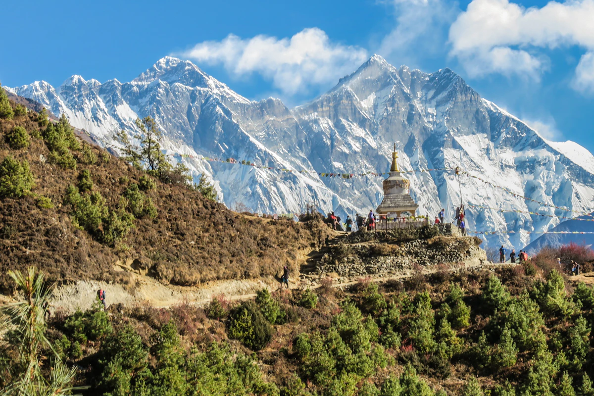
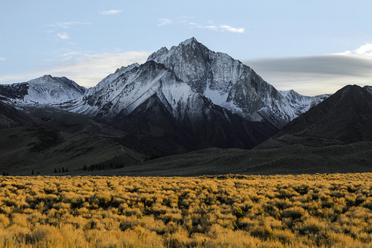
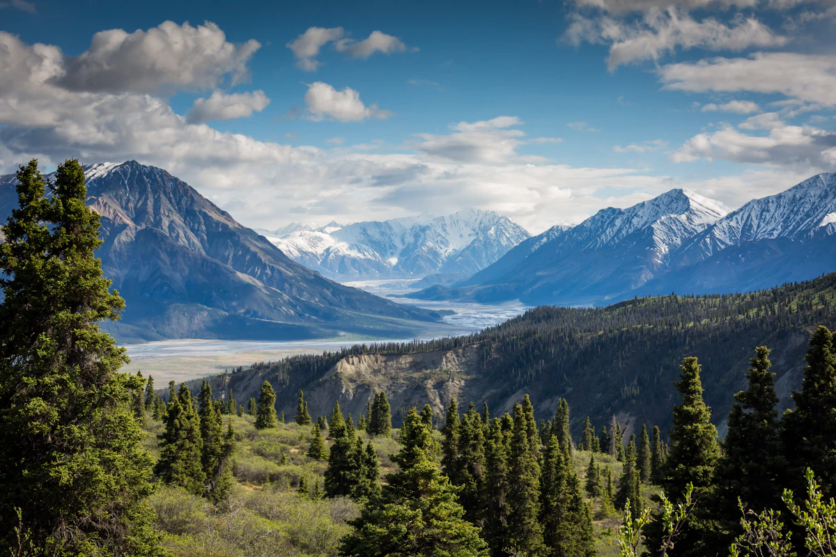
High-definition captures and video clips from Himalayan passes, glacial lakes, Sherpa villages, and mountain summits.


Gokyo Lakes Trek – 14-16 Days Trail Map
Interactive OpenStreetMap topographic trail map tracing the route.
Key High-Altitude Stops
Compatible with Garmin, Apple Watch, Strava & Gaia GPS
Gokyo Lakes Trek – 14-16 Days Weather Center
Real-time mountain weather and 5-day altitude forecasts across key Gokyo Lakes Trek – 14-16 Days waypoints.
Loading weather for ...
Choose waypoint
Altitude Chart & Acclimatization Nodes
Strict adherence to "Hike High, Sleep Low" ensures safe high-altitude adaptation.
Complete Itinerary Route
Explore the detailed day-by-day routing, acclimatization schedule, and trek milestones.
Kathmandu to Lukla flight then trek to Phakding
HighlightThe day starts with an early morning flight to Lukla where the airstrip sits on a steep mountainside and weather can delay departures. After landing you descend through Chaurikharka village on a wide dirt track that turns into a rocky path beside the Dudh Koshi River. The trail is mostly downhill but includes several short climbs that test legs not yet used to altitude. Phakding sits in a narrow valley where the river noise is constant and evenings cool quickly once the sun drops behind the ridges. Teahouses here are simple with shared bathrooms and limited hot water.
Phakding to Namche Bazaar
HighlightYou cross the Dudh Koshi on suspension bridges that sway under loaded porters and then enter Sagarmatha National Park at Monjo where permits are checked. The trail follows the river through pine forest before the steep switchbacks to Namche begin, a relentless climb of stone steps that gains over 800 meters in a few kilometers. Altitude effects often appear on this section; headaches and shortness of breath are common so pace yourself and drink water frequently. Namche is a large Sherpa town with bakeries, gear shops, and a weekly market on Saturdays. Nights are cold and rooms are unheated so a good sleeping bag is essential.
Namche Bazaar acclimatization hike to Khumjung and Everest View Hotel
AcclimatizationA rest day in Namche does not mean staying in bed; you hike up to the Everest View Hotel at 3,880 meters for the first clear sight of the high peaks if clouds allow. The trail climbs through rhododendron forest and past the Sherpa village of Khumjung where the monastery houses a purported yeti scalp. Walking at this elevation helps your body adjust but the air is noticeably thinner and any exertion feels harder than at lower villages. Descend by early afternoon to avoid the wind that funnels up the valley and chills exposed ridges. Use the rest of the day to check gear, buy snacks, and charge devices at teahouses with solar power.
Namche Bazaar to Dole
HighlightLeaving Namche you contour above the valley on a narrow trail that traverses steep slopes with drop-offs to the river far below. The path passes through Mong La at 3,975 meters where a chorten marks the highest point before a steep descent to Phortse Tenga and then a long climb through birch and rhododendron forest to Dole. The forest section can be muddy after rain and slippery on roots; trekking poles help on the descent. Dole is a small settlement with a handful of teahouses clustered near a stream; water must be boiled or treated as the source is shared with yaks. Temperatures drop below freezing at night and walls are thin.
Dole to Machhermo
HighlightThe trail climbs gradually along the valley side above the tree line where the landscape opens to alpine meadows and views of Kangtega and Thamserku. You pass summer herder huts at Lhabarma and cross a few small streams that run cold and clear from glaciers. The altitude gain is modest but the air is thin enough that a slow pace prevents unnecessary fatigue. Machhermo sits in a bowl beneath a rocky ridge; the teahouses are basic and often full during peak season so arrive by early afternoon to secure a room. A small clinic run by the Himalayan Rescue Association operates here during spring and autumn for altitude consultations.
Machhermo to Gokyo
HighlightYou follow the valley floor past the first of the Gokyo lakes, Longponga Tsho, where the water is a striking turquoise against gray moraine. The trail then climbs a steep moraine ridge to reach the second lake, Taboche Tsho, and the third, Dudh Pokhari, beside which Gokyo village sits. The final ascent is short but the altitude makes each step feel heavier; take frequent breaks and monitor for headache or nausea. Gokyo has a dozen teahouses, some with attached bathrooms and solar showers that work only on sunny days. The lake freezes at the edges in winter and wind off the water cuts through clothing quickly.
Gokyo acclimatization hike to Gokyo Ri
AcclimatizationAn early start before dawn gets you to the summit of Gokyo Ri at 5,357 meters for sunrise over Cho Oyu, Gyachung Kang, and the Ngozumpa Glacier. The climb is a steady slog up a scree slope with no technical difficulty but the altitude reduces oxygen to half of sea level; move slowly and breathe deeply. At the top the wind is often strong and temperatures can be well below zero even in spring so a down jacket and windproof layer are mandatory. Descend by mid-morning to avoid afternoon clouds that obscure the view and bring snow flurries. The rest of the day is for recovery, hydration, and checking feet for blisters.
Gokyo to Fourth and Fifth Lakes exploration
HighlightA side trip north along the eastern shore of Dudh Pokhari leads to the fourth lake, Thonak Tsho, and the fifth, Ngozumpa Tsho, each set against the massive Ngozumpa Glacier. The trail is faint in places, crossing rocky moraine and occasional snow patches that persist into summer. There are no teahouses beyond Gokyo so carry water, snacks, and extra layers; the wind off the glacier is constant and cold. The fifth lake sits at the glacier snout where ice calves into the water and the sound echoes off the valley walls. Return to Gokyo by early afternoon before the daily cloud buildup reduces visibility and makes navigation harder.
Gokyo to Dragnag via Ngozumpa Glacier
HighlightYou leave Gokyo heading west across the lateral moraine of the Ngozumpa Glacier, the longest glacier in the Himalaya, following a path that weaves between boulders and meltwater streams. The terrain is uneven and requires careful footing; loose rocks shift underfoot and the glacier surface is hidden under debris. Dragnag is a seasonal settlement with only a few teahouses used by trekkers crossing Renjo La; facilities are minimal and electricity is scarce. The valley narrows here and the wind tunnels through the gap, making evenings feel colder than the altitude suggests. Water sources are glacial streams that run milky with silt; filter and boil thoroughly.
Gokyo to Lungden via Renjo La Pass (5,360 m)
HighlightThe crossing of Renjo La at 5,360 meters is the highest point of the trek and demands an early start before dawn to avoid high winds and afternoon snow. The ascent from Dragnag is steep on loose scree and may require crampons if snow covers the trail; the descent on the west side is equally steep and hard on knees. At the pass you can see the Tibetan plateau stretching north and the Everest massif to the east if weather permits. Lungden sits in a broad valley at 4,380 meters with a handful of teahouses that cater to pass trekkers; rooms are cold and often shared with other groups. Arrive exhausted but with a sense of accomplishment.
Lungden to Thame
HighlightThe trail descends steadily through a wide valley carved by the Bhote Koshi River, passing yak pastures and chortens marking ancient trade routes to Tibet. The path is well-trodden but can be dusty in dry season and muddy after rain; gaiters help keep boots clean. Thame is a historic Sherpa village with a monastery perched above the houses and the birthplace of several Everest summiteers. Teahouses here are more established than at higher elevations, some offering hot showers for a fee and better food variety including momos and thukpa. The lower altitude means better sleep and appetite returns noticeably.
Thame to Namche Bazaar
HighlightYou retrace the trail along the Bhote Koshi through pine and rhododendron forest, crossing several suspension bridges that span deep gorges. The descent is gentle on the lungs but steady on the knees; trekking poles reduce impact. Namche feels busier on return with more trekkers and porters moving between Lukla and higher valleys. Use the afternoon to replace worn gear, buy souvenirs, and enjoy a hot shower if the teahouse has gas-heated water. The market area has internet cafes with slow but usable connections for checking messages. Nights are still cold but the thicker air makes breathing easier.
Namche Bazaar to Lukla
The final long descent drops you back to the Dudh Koshi valley through Monjo and Phakding, retracing the first days in reverse. The trail is familiar but fatigue accumulates; the long stone stair sections down to the river are hard on quadriceps. Lukla is a bustling airstrip town where trekkers celebrate completion with beer and fried potatoes at lodges near the runway. Flight schedules for the next morning are posted at the airport counter; confirm your seat and be ready for early check-in. Rooms in Lukla are more comfortable with attached bathrooms in some lodges, but noise from generators and late-night parties can disturb sleep.
Lukla to Kathmandu flight
Flights to Kathmandu depart early when the air is calm; delays are common if clouds build over the mountains so patience is required. The 30-minute flight follows the river valleys you walked, giving a bird's-eye view of the terrain covered over two weeks. On arrival in Kathmandu the heat, traffic, and noise are a sharp contrast to the quiet mountains. Transfer to a hotel in Thamel where a hot shower, clean sheets, and a varied menu feel like luxury. Use the rest of the day to rest, do laundry, and back up photos before the final departure.
Kathmandu buffer day
A buffer day in Kathmandu absorbs any flight delays from Lukla and gives time to recover from the trek. Visit Swayambhunath or Boudhanath stupas if energy allows, or simply wander Thamel for last-minute gifts like pashmina, singing bowls, or yak wool socks. Medical clinics in Thamel offer post-trek checkups for lingering coughs or altitude-related issues. Rehydrate well and eat plenty of protein to rebuild muscle; dal bhat with extra lentils is a reliable staple. Confirm international flight details and arrange airport transfer for the next day.
Kathmandu departure
HighlightDeparture day starts with a hotel breakfast and a drive to Tribhuvan International Airport, allowing at least three hours before international flights for security and immigration. Traffic in Kathmandu is unpredictable; leave early to avoid missing check-in. The trek ends here but the routine of early starts, steady walking, and simple meals stays with you. Keep the permit and TIMS card as souvenirs or for future reference. If returning to Nepal, the Gokyo region offers more routes like the Three Passes or a return to Everest Base Camp from a different angle.
What's Covered & What's Not
A clear breakdown so you know exactly what to budget for and what's already taken care of.
Sagarmatha National Park Entry Permit
- Required conservation area entry permit issued by the Nepal Tourism Board in Kathmandu or at the Monjo checkpoint (NPR 3,000).
Khumbu Pasang Lhamu Rural Municipality Fee
- Local government tax collected at Lukla or Monjo to fund trail maintenance and local administration (NPR 3,000).
Teahouse Accommodation
- Basic twin-share lodge room along the Dudh Koshi valley and Gokyo lake basins (typically Rs 500 to Rs 1,000 per night when meals are purchased on-site).
Licensed Guide Wages and Insurance
- Mandatory certified trekking guide covering daily professional fees, meals, lodging, and mandatory mountain rescue insurance per Nepal Tourism Board regulations.
International Airfare
- Flights from your home country to Tribhuvan International Airport in Kathmandu.
Nepal Tourist Visa
- On-arrival visa fees payable at Kathmandu airport ($30 USD for 15 days, $50 USD for 30 days, or $125 USD for 90 days).
Emergency Evacuation Insurance
- Mandatory travel insurance policy specifically covering high-altitude helicopter rescue and medical evacuation above 5,000 meters.
On-Trail Extras and Hot Showers
- Personal expenses such as Wi-Fi vouchers, battery charging, hot showers, bottled or purified water, tips, and hot drinks.
Trail Meals & Hydration Rules
What to eat for stamina and altitude safety
Dhal Bhat Power
Rice, lentil soup, spiced potato, and spinach. Always comes with free refills to refuel after long hours on trail.
Garlic Soup
Thin clear garlic broth. Local guides consume this daily above 3,500m to help with blood circulation and warmth.
Boiled & Fried Potatoes
Dense carbohydrate source served with local yak cheese or chili paste in high settlements.
Tibetan Bread & Honey
Deep-fried puffed flatbread. Hearty breakfast option before starting an early morning climb.
Sherpa Stew (Shyakpa)
Thick vegetable and hand-pulled flour noodle soup served steaming hot in mountain lodges.
Boiled Eggs
Reliable protein source available every morning at lodge kitchens along the route.
Boiled Water Bottles
Purchase boiled water at night and keep the bottle inside your sleeping bag for warmth.
Ginger Lemon Honey Tea
Warm drink that cuts the dry mountain cough and stays hot in an insulated thermos.
Electrolyte Packs
Add one electrolyte sachet to water daily to replace salts lost on steep ascents.
Water Purification Drops
Use Aquatabs or chlorine dioxide tablets for tap water and wait the full 30 minutes before drinking.
Vegetarian Focus
Vegetarian dhal bhat and veg noodles remain the freshest food items available in high settlements.
Naturally Gluten-Free
Rice dishes, plain boiled potatoes, and buckwheat porridge offer naturally gluten-free calories.
Black Chiya Option
Request black tea to avoid powdered milk if you have lactose sensitivities.
Lodge Kitchen Flexibility
Cooks can prepare meals with less spice or salt upon request if you order early.
No Meat Above 3,500m
Meat is carried up on foot for days without refrigeration. Stick to vegetarian options at high altitudes.
No Alcohol at High Altitude
Alcohol causes rapid dehydration and masks early symptoms of altitude sickness.
Never Drink Untreated Water
Never drink directly from village taps or streams without proper filtration or purification tablets.
Skip Raw Salads
Stick to thoroughly cooked hot vegetables to prevent stomach upsets during the trek.
Trip Preparation & Rules
Paperwork, flight baggage limits, and cash guidelines
Passport & Tourist Visa
Passport valid for 6+ months. Get 30-day visa ($50 USD cash) on arrival at Kathmandu airport.
Helicopter Evacuation Insurance
Policy must explicitly cover high-altitude rescue up to 6,000m+. Keep policy number on your phone.
Passport Photos
Bring 4 printed passport photos for local permit counters and SIM card registration.
Copies of Important Documents
Keep physical and digital copies of your passport, visa stamp, insurance, and emergency contacts separate from originals.
Khumbu Pasang Lhamu Permit
Local rural municipality entry permit (NPR 3,000) obtained upon arrival in Lukla or Monjo. Note: TIMS cards are not required or valid in the Khumbu region.
Sagarmatha National Park Permit
Mandatory national park entry permit (NPR 3,000 + 13% VAT = NPR 3,390) obtained in Kathmandu at the Tourism Board or directly at the Monjo park entrance.
Licensed Guide Requirement
Under Nepal Tourism Board regulations, foreign trekkers must trek with a licensed government guide for safety and environmental sustainability.
Strict 15kg Weight Limit
Mountain flights strictly limit weight to 10kg checked duffel + 5kg hand pack. Extra weight incurs high per-kilogram surcharges.
Weather-Dependent Ramechhap Diversion
During peak spring and autumn seasons, flights to Lukla often depart from Ramechhap (Manthali Airport), requiring a 4-hour pre-dawn road transfer from Kathmandu.
Carry Essential Gear in Cabin
Pack essential layers, medications, water purification, and camera gear in your 5kg carry-on in case checked duffels arrive on a later flight.
Carry Cash in Nepalese Rupees
Carry Rs 4,000–5,000 per day in cash to cover hot showers, Wi-Fi tokens, battery charging, and extra snacks.
Unreliable ATM Networks
ATMs in Namche Bazaar can run out of cash, face power outages, or experience network drops. Withdraw sufficient cash in Kathmandu.
Small Denominations Matter
Teahouse operators struggle to break 1,000-rupee notes for small purchases. Stock up on Rs 100 and Rs 500 notes before heading onto the trail.
Trail Customs & Rules
Practical rules for passing animals, stupas, and village paths
Pass Stupas Clockwise
- •Always keep Mani walls, stupas, and chortens on your right side when passing.
- •Spin prayer wheels exclusively in a clockwise direction.
- •Never sit on stone mani walls or touch sacred offerings.
Pack Animal Right-of-Way
- •Step toward the mountain wall side when yak, dzo, or mule caravans approach.
- •Avoid standing near the cliff or drop-off edge where startled animals could push past.
- •Wait patiently for the entire pack train to clear before resuming walking.
Photography and Monasteries
- •Ask permission before photographing local Sherpa residents or monks.
- •Never photograph inside active prayer halls or sanctuaries unless explicitly permitted by resident monks.
- •Leave a small cash donation in the monastery box if viewing interior shrines.
Waste and Water Management
- •Pack out all non-biodegradable trash, including battery wrappers and energy bar foil.
- •Avoid burning plastics or toilet paper in lodge stoves.
- •Refill water bottles using purification drops or iodine rather than purchasing single-use plastic bottles.
Lodge and Cultural Respect
- •Remove footwear before entering teahouse sleeping rooms or monastery prayer spaces.
- •Keep conversations quiet in communal dining rooms after 9:00 PM as wooden partitions offer little sound insulation.
- •Dress modestly with covered shoulders and knees when visiting mountain villages.
Sacred Water Sources
- •Treat high-altitude tarns and glacial streams with respect by avoiding soap or chemical runoff.
- •Do not wash clothes or gear directly in sacred glacial lakes like Gokyo Cho or Thonak Tsho.
- •Refrain from shouting or disturbing the quiet atmosphere near high-altitude passes and shrines.
Permits & Emergency Directory
Current permit fee structures and official emergency contacts for the Gokyo route
Required Permits & Mandatory Fees
-
📜Sagarmatha National Park Entry Permit NPR 3,000
Mandatory entry permit required for entering the Sagarmatha National Park. Obtainable at the Nepal Tourism Board office in Kathmandu or at the Monjo checkpoint.
-
🛂Khumbu Pasang Lhamu Rural Municipality Fee NPR 3,000
Local government fee collected at Lukla or Monjo. This replaces the old TIMS card for this region and funds local municipal infrastructure.
-
🛂Mandatory Evacuation Insurance Policy Dependent
Required by regional authorities for all trekkers going above 5,000 meters. Must explicitly cover high-altitude helicopter rescue up to 6,000 meters.
Nepal Tourism Directory
Official contact channels for permits, park regulations, and emergency rescue assistance.
Power, Connectivity & Showers
Realistic day-to-day guide for charging, phones, and hygiene
Device Charging Realities
Electricity in teahouses comes from small hydro projects and solar arrays. Charging devices in common rooms typically costs Rs 300 to 600 per full charge, and rooms rarely have functional wall outlets. Carry a reliable 20,000mAh power bank.
Mobile SIM & Data Access
Nepal Telecom (NTC) and Ncell signals reach most of the main valley floors, though dead zones exist between ridges. Local Everest Link Wi-Fi prepaid cards function in many lodges, but connection speeds drop heavily above 4,000 meters.
Hot Showers & Hygiene
Hot showers powered by gas or solar range from Rs 400 to 600 per use. Above Machermo, ambient temperatures drop sharply, making wet wipe cleanups safer and more practical than risking cold damp exposure.
Water Management
Single-use plastic bottles are discouraged and restricted in parts of the conservation area. Fill two wide-mouth bottles with boiled water at teahouses or use chlorine dioxide / UV purification tablets on tap water.
Altitude Safety & Health
How to handle altitude symptoms and emergency protocols
Daily Symptom Monitoring
Watch closely for early acute mountain sickness signs: a throbbing headache that does not respond to standard painkillers, loss of appetite, persistent nausea, and insomnia.
Hydration Strategy
Count hot lemon, black tea, and garlic soup toward your daily hydration goal of 3 to 4 liters, but drink before you feel thirsty to prevent silent dehydration.
Evacuation Insurance
Verify that your insurance policy explicitly covers emergency helicopter rescue up to 6,000 meters, as rescue from Gokyo Ri or Renjo La requires aerial extraction.
Immediate Descent
Dropping 500 to 1,000 meters reverses worsening symptoms fast and saves lives when severe altitude illness strikes.
The Golden Altitude Rule
If you have a throbbing headache, dizziness, or ataxia like a drunk stumble, do NOT ascend. If symptoms persist or worsen after resting, descend 300 to 500 meters immediately. Descent is the only guaranteed cure for high-altitude pulmonary or cerebral edema.
Highland Villages & Wildlife
Sherpa communities and alpine ecology of the Gokyo Valley
Sherpa Agro-Pastoral Life
Stone-walled potato and buckwheat fields terrace the valley sides; yak and dzopkyo herds graze summer pastures above Gokyo.
Traditional Stone Teahouses
Two-storey stone lodges with central wood-burning stoves (bukhari) on the ground floor — family quarters upstairs, travellers below.
Hand-Woven Radi & Pangden
Women weave heavy wool radi (blankets) and striped pangden (aprons) on backstrap looms; practical gifts bought directly in Namche or Khumjung.
Gokyo Lakes (Panch Pokhari)
Five glacial lakes revered by both Hindus and Buddhists; pilgrims bathe at the third lake (Dudh Pokhari) during Janai Purnima festival each August.
Gokyo & Thame Monasteries
Gokyo Gompa sits beside the third lake; Thame Gompa (accessible via side valley) is one of Khumbu's oldest, linked to Tenzing Norgay's lineage.
Mani Walls & Chortens at Every Pass
Long stone walls carved with 'Om Mani Padme Hum' line the approach to Namche, Dole, and Gokyo — walk clockwise, add a stone if you wish.
Himalayan Tahr on Cliff Bands
Rufous-coated tahr graze vertical slopes above Dole and Machhermo; best spotted mid-morning when they move to sun-warmed ledges.
Himalayan Monal (Danphe) in Rhododendron Forest
Nepal's national bird flashes iridescent plumage in forests below Namche and around Mong La — listen for sharp whistles at dawn.
Lammergeier & Golden Eagle Over Ngozumpa
Bearded vultures (lammergeiers) drop bones on the glacier moraine; golden eagles patrol the ridges above Gokyo Ri year-round.
Essential Packing Checklist
Prepare 1 duffel bag (handled by porter team) and 1 daypack for personal warm layers & water.
Frequently Asked Questions
Honest answers about the Gokyo Lakes Trek route