
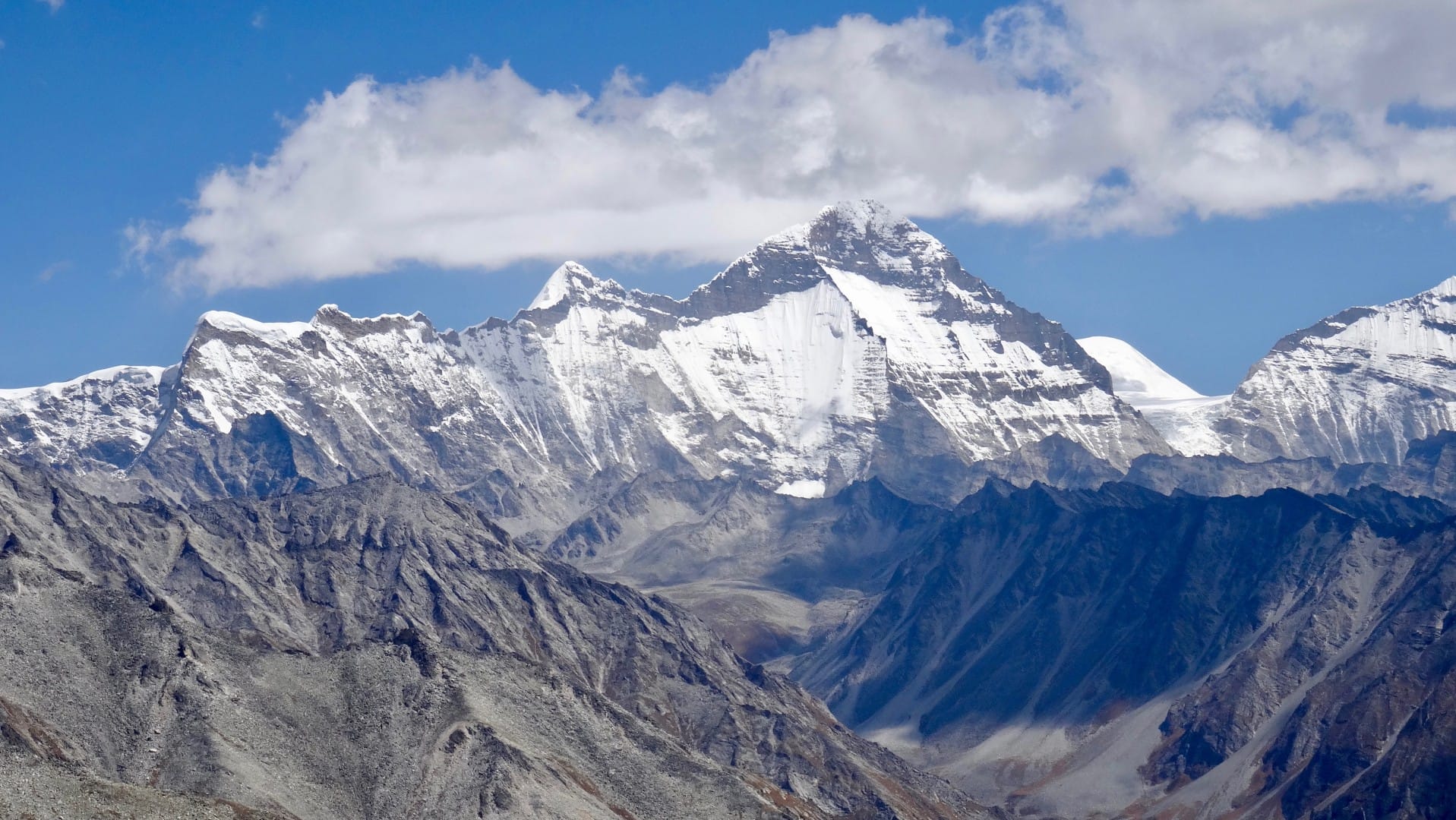
Upper Dolpo Trek (16-24 Days) 24 Days Guide
Trail notes for Upper Dolpo Trek (16-24 Days). Daily walking hours, pass elevations, teahouse stops, and permit logistics.
Upper Dolpo Trek
24-day remote wilderness journey traversing high passes, deep river gorges, and ancient Tibetan-Buddhist settlements in western Nepal.
Key Trail Realities
What to expect along the route
Shey Gompa Monastery Trail
Traverse remote dry-stone paths leading to the sacred 11th-century monastery nestled beneath Crystal Mountain.
High Alpine Pass Crossings
Navigate challenging 5,000-meter passes including Kang La and Saldang La with loose scree and biting morning winds.
Phoksundo Lake Waters
Camp beside the deep turquoise waters of Phoksundo Lake beneath the towering 600-meter face of Ringmo cliff.
Restricted Trans-Himalayan Valleys
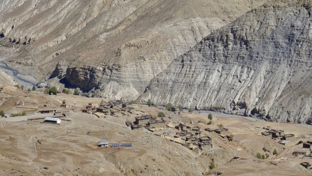
Explore ancient Tibetan-influenced settlements in Upper Dolpo where traditional salt-trade and yak-herding customs remain unchanged.
Jumla to Juphal Route Logistics
Connect remote western mountain airstrips through long overland jeep tracks and rugged footpaths requiring careful daily pacing.
Isolated Mountain Campsites
Set up tents across high-altitude riverbanks and windswept plateaus where teahouse infrastructure is entirely absent.
Shey Phoksundo National Park Terrain
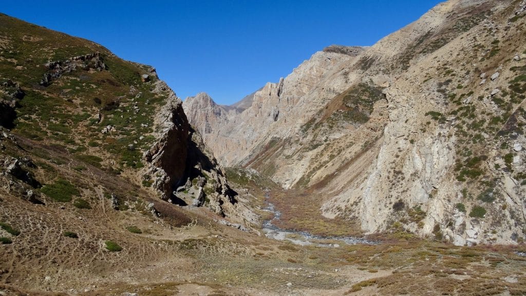
Climb steep, barren ridgelines and descend through narrow river gorges within Nepal's largest protected conservation area.
High Elevation Acclimatization
Manage sustained days spent above 4,000 meters with careful hydration routines and slow, deliberate climbing rhythms.
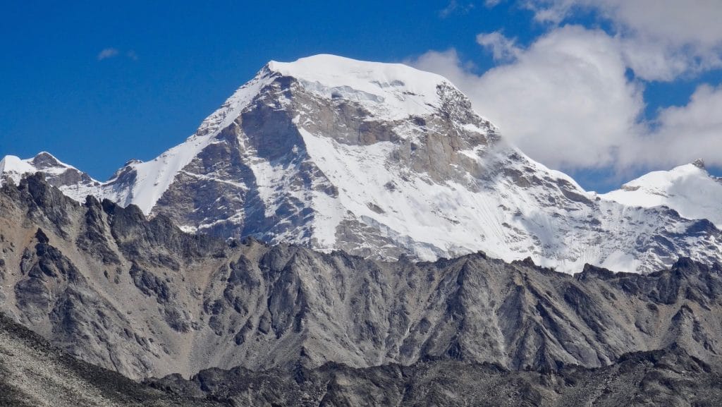
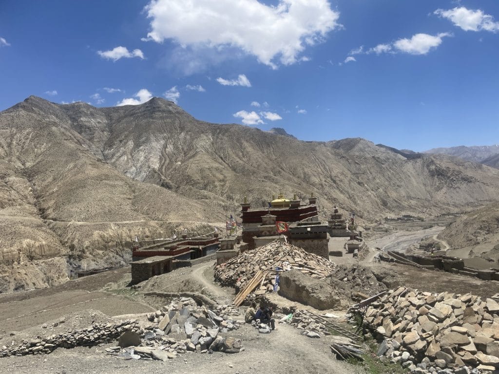
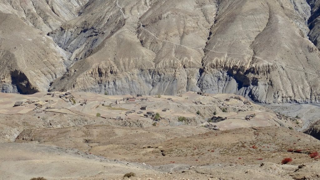
Trail Photos & Videos
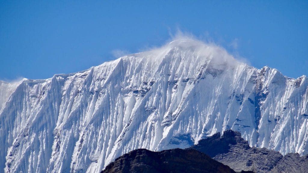
High-definition captures and video clips from Himalayan passes, glacial lakes, Sherpa villages, and mountain summits.
Upper Dolpo Trek (16-24 Days) Trail Map
Interactive OpenStreetMap topographic trail map tracing the route.
Key High-Altitude Stops
Compatible with Garmin, Apple Watch, Strava & Gaia GPS
Upper Dolpo Trek (16-24 Days) Weather Center
Real-time mountain weather and 5-day altitude forecasts across key Upper Dolpo Trek (16-24 Days) waypoints.
Loading weather for ...
Choose waypoint
Altitude Chart & Acclimatization Nodes
Strict adherence to "Hike High, Sleep Low" ensures safe high-altitude adaptation.
Complete Itinerary Route
Explore the detailed day-by-day routing, acclimatization schedule, and trek milestones.
Arrival in Kathmandu (1,350m)
Arrive at Tribhuvan International Airport and transfer to your hotel. Use the afternoon to review permits, confirm trekking gear, and complete the official briefing covering Restricted Area regulations and high-altitude safety protocols before departing for western Nepal.
Kathmandu to Nepalgunj (150m)
Board a domestic afternoon flight heading southwest to the Terai plains of Nepalgunj. The climate shifts dramatically to a hot, tropical atmosphere near the Indian border. Finalize logistics and check permits for the remote Dolpo restricted sector early the following morning.
Nepalgunj to Juphal (2,475m) and Trek to Dunai (2,140m)
HighlightCatch an early morning STOL flight over rugged mountain ridges into the narrow airstrip at Juphal. Step off the plane into crisp mountain air, organize loads with porters, and descend along the Thuli Bheri River on a stone-paved path to reach Dunai by mid-afternoon.
Dunai to Tarakot (2,540m)
HighlightFollow the southern bank of the Bheri River past suspension bridges and terraced agricultural fields. Red cliff faces tower above the valley floor as the trail approaches Tarakot, an ancient fortified village featuring historical dzong ruins and tiered barley cultivation.
Tarakot to Laina Odar (3,370m)
HighlightAscend alongside the Barbung Khola through steep, narrow gorges where the river cuts deep through limestone canyons. The path crosses several wooden cantilever bridges before reaching Laina Odar, a natural rock shelter historically used by mule caravans and nomadic herders.
Laina Odar to Toltol (3,520m)
Traverse high above the raging river on carved ledge paths exposed to the canyon below. Pine forests gradually thin out as the landscape transitions into arid Tibetan-style terrain. Arrive at Toltol, a small cluster of stone lodges tucked beneath towering rock walls.
Toltol to Dho Tarap (3,944m)
Climb steadily past Tarap Chu river flats where blue sheep graze on steep scree slopes. Stone walls and whitewashed chortens mark the entry into Dho Tarap, a large valley settlement inhabited by permanent residents practicing traditional Bon-po and Tibetan Buddhist traditions.
Acclimatization Day in Dho Tarap (3,944m)
AcclimatizationAllow red blood cell count to adjust to the nearly 4,000-meter altitude with a short morning hike up to nearby Gompas. Observe local villagers spinning prayer wheels, tending yaks, and threshing barley using age-old agricultural methods unique to inner Dolpo.
Dho Tarap to Numla Base Camp (4,400m)
HighlightLeave the main valley behind and head west across wide pasture lands following the Tarap Chu upstream. The tree line completely disappears, leaving an expansive high-altitude desert landscape beneath towering peaks. Pitch tents or secure basic shelter at the foot of the Num La.
Numla Base Camp over Num La Pass (5,310m) to Pelung Tang (4,465m)
HighlightStart before dawn on loose, frozen scree leading to the summit ridge of the Num La. The 5,310-meter pass delivers sweeping views across Dhaulagiri and the rugged Dolpo mountains. Descend steeply down a rocky gully to reach the isolated grazing flats of Pelung Tang.
Pelung Tang to Dho Tarap Valley Junction (3,880m)
Follow the Nam Khong Khola downstream through narrow ravines and rugged mountain terrain. The trail drops continuously below 4,000 meters, easing breathing rates and restoring energy levels as the route approaches lower camp areas along the river corridor.
Valley Junction to Tokyu (4,240m)
HighlightClimb gently along the valley floor past ancient mani walls and solitary hermit caves. Tokyu sits at over 4,200 meters as one of the highest permanent settlements in the region, featuring a striking monastery perched on a rocky bluff above the river.
Tokyu over Jeng La Pass (5,110m) to Naga Odar (4,390m)
HighlightTackle the second major high pass of the expedition with a sustained, lung-burning ascent to the Jeng La cairn at 5,110 meters. Northern Dhaulagiri dominates the southeastern skyline from the pass. Descend along a rocky trail to find shelter at the remote campsite of Naga Odar.
Naga Odar to Saldang (3,770m)
HighlightDescend through arid canyons and cross suspension bridges spanning rushing glacial streams. Saldang appears as a sprawling whitewashed village spread across barren hillsides, functioning as the largest trading hub in upper Dolpo with direct historic links to Tibet.
Saldang to Yangze Gompa (3,750m)
HighlightVenture deeper north into remote Tibetan-border country along the Nagon Khola. The path passes scattered farm hamlets and wind-swept plateaus before arriving at Yangze, home to an ancient Bon monastery believed to be over eight centuries old.
Yangze to Sibu (4,560m)
HighlightRetrace steps southward along the river confluence and continue upstream toward the base of the upcoming northern pass crossings. Sibu is a tiny, wind-battered hamlet positioned at the junction where caravans prepare for the crossing toward Jomsom.
Sibu to Jeng La High Camp (4,900m)
HighlightClimb steadily along barren stream beds and rocky moraine ridges leading toward the base of the formidable Karo La. The air grows noticeably thinner above 4,500 meters, requiring slow, deliberate pacing to conserve energy for tomorrow's high-altitude push.
High Camp over Karo La Pass (5,095m) to Tok Kyang (4,200m)
HighlightCross the Karo La pass at 5,095 meters across windswept plateaus flanked by snow-capped peaks. The descent leads past remote yak herder pastures into the upper reaches of the Mustang border region, dropping into the isolated settlement of Tok Kyang.
Tok Kyang to Chharka (4,300m)
HighlightFollow the Barbung Khola through wide, desolate valleys where nomadic camps frequently dot the landscape. Reach Chharka village, a cluster of stone houses dominated by a prominent cliffside monastery guarding the ancient salt-trade route.
Chharka to Molang Khola (4,850m)
HighlightAscend away from Chharka through barren canyon terrain and dry riverbeds. The path climbs continuously toward high summer pastures beneath ridge lines that separate upper Dolpo from the Kali Gandaki valley. Camp out in the open wilderness of Molang Khola.
Molang Khola over Sangda La Pass (5,120m) to Sangda (3,700m)
HighlightTackle the final high pass of the expedition across the Sangda La ridge at 5,120 meters. The descent is exceptionally steep, dropping over 1,400 meters down loose slate trails and eroded switchbacks to reach the remote village of Sangda.
Sangda to Phhedi (3,300m)
Descend along hanging canyon walls above the Kali Gandaki drainage basin. Vegetation begins to reappear as altitude decreases significantly, offering a welcome transition back toward settled valley floors and lower mountain farming terraces.
Phhedi to Kagbeni (2,810m)
Complete the final wilderness descent to the historic walled town of Kagbeni, situated at the gateway of Lower Mustang. Celebrate the completion of the traverse with reliable electricity, hot showers, and fresh bakery items after weeks in remote tents.
Kagbeni to Jomsom (2,720m) and Flight to Pokhara & Kathmandu
Take a morning jeep transfer along the Kali Gandaki corridor to Jomsom airstrip. Board the early mountain flight to Pokhara, connecting directly to Kathmandu where expedition gear is unpacked and permits are closed out.
What's Covered & What's Not
A clear breakdown so you know exactly what to budget for and what's already taken care of.
Restricted Area Permit (RAP)
- Mandatory Upper Dolpo restricted area permit ($500 USD per 10 days per person).
Shey Phoksundo National Park Permit
- Conservation area entry fee (NPR 3,000 per person) for protected zone access.
Dolpo Local Municipality Fee
- Rural municipality entry fee collected at trail checkpoints.
Domestic Flight Logistics
- Flights between Nepalgunj and Juphal airstrip (weather dependent).
International Airfare
- Flights arriving at Tribhuvan International Airport in Kathmandu.
Nepal Tourist Visa
- On-arrival visa fees purchased at Kathmandu airport immigration.
Emergency Evacuation Insurance
- Specialized travel insurance covering high-altitude helicopter rescue above 5,000 meters.
On-Trail Incidentals
- Teahouse extras including battery charging, hot water flasks, and Wi-Fi access where available.
Trail Meals & Hydration Rules
What to eat for stamina and altitude safety
Dhal Bhat Power
Rice, lentil soup, spiced potato, and spinach. Always comes with free refills to refuel after long trekking days across high Dolpo passes.
Garlic Soup
Thin clear garlic broth. Local guides recommend this daily above 3,500m to assist with blood circulation and warmth in cold weather.
Boiled & Fried Potatoes
Dense carbohydrate source harvested locally in the high valleys, often served with salt or chili paste.
Tibetan Bread & Honey
Thick fried flatbread served at teahouses. Provides high calorie density before morning departures.
Thukpa Noodle Soup
Hot broth with handmade wheat noodles, vegetables, and local herbs to warm up at high altitudes.
Boiled Eggs
Reliable protein source available at breakfast in most remote lodge kitchens.
Boiled Water Refills
Request boiled water at lodges each evening. Store the hot Nalgene bottle inside your sleeping bag for overnight warmth.
Ginger Lemon Honey Tea
Warm drink that soothes the dry throat caused by cold, windy mountain air.
Electrolyte Packets
Mix one electrolyte sachet into water daily to maintain salt balance during steep climbs.
Chlorine Purification Tablets
Carry backup chemical treatment drops or chlorine dioxide tablets for untreated stream sources.
Vegetarian Preference
Vegetarian dhal bhat and noodle dishes use fresher ingredients on remote routes.
Rice and Potato Staples
Naturally gluten-free options are abundant since most meals revolve around rice and root vegetables.
Black Tea Alternative
Order black tea ('kalo chiya') instead of milk tea if you experience lactose sensitivity at altitude.
Advance Dinner Orders
Place evening meal orders early so lodge cooks have time to prepare food over firewood or gas.
Meat Above 3,500m
Meat carried into remote Dolpo settlements lacks proper refrigeration. Stick to vegetarian meals in high camps.
Alcohol at High Altitude
Alcohol accelerates dehydration and suppresses breathing rate, masking early signs of altitude sickness.
Untreated Tap Water
Never drink directly from village spouts or rivers without boiling or purification drops.
Raw Vegetables
Avoid uncooked greens and unpeeled fruit to prevent gastrointestinal illness on the trail.
Trip Preparation & Rules
Paperwork, remote area permits, and cash guidelines
Passport & Tourist Visa
Passport valid for at least 6 months. Secure a 30-day tourist visa ($50 USD cash) on arrival at Tribhuvan International Airport.
High-Altitude Rescue Insurance
Insurance policy must explicitly cover emergency helicopter evacuation above 5,000m. Carry a printed copy of the policy and emergency contact numbers.
Passport-Sized Photographs
Bring 4 physical passport photos for restricted area permit processing and local checkpoint registration.
Registered Guide Documentation
Ensure your licensed trekking guide holds official credentials from the Nepal Tourism Board as required by regional regulations.
Shey Phoksundo National Park Permit
Required for entering the protected conservation zones. Issued through the Department of National Parks and Wildlife Conservation in Kathmandu.
Upper Dolpo Restricted Area Permit
Mandatory special permit processed via an authorized Nepal trekking agency. Requires a minimum group size of two trekkers accompanied by a licensed guide.
Lower Dolpo Restricted Area Permit
Required depending on the specific loop variation taken through the southern approaches.
Rural Municipality Entry Fee
Local administrative fees collected at regional checkpoints along the trail to support local infrastructure.
Domestic Luggage Limits
Twin-engine flights from Nepalgunj to Juphal strictly enforce a 10kg checked duffel and 5kg hand luggage limit. Excess weight is left behind.
Weather-Dependent Schedules
Flights between Nepalgunj and Juphal depend entirely on clear visibility through the mountain corridors. Build 2 to 3 contingency days into your schedule.
Compact Pack Discipline
Pack light to stay under domestic airline limits without incurring heavy surcharges or forcing gear separation.
Early Morning Departures
Mountain flights depart at dawn before valley winds pick up. Arrive at the domestic terminal early.
Cash in Nepalese Rupees
Carry sufficient physical NPR cash for the entire 24-day route. No functional ATMs exist past Dunai.
Absence of Electronic Banking
Credit cards and digital wallets are completely unusable in remote Dolpo settlements. Cash remains the sole medium of exchange.
Small Denominations
Carry smaller 100, 500, and 1000 rupee notes. Teahouse owners cannot break large 2500 or 5000 rupee notes for minor purchases.
Daily Expense Budgeting
Budget roughly 4,000 to 5,000 NPR daily per person for basic lodge accommodation, meals, hot water, and device charging.
Trail Customs & Rules
Practical rules for passing animals, stupas, and village paths in Dolpo
Pass Stupas Clockwise
- •Always keep Mani walls, chortens, and prayer stones to your right side.
- •Spin prayer wheels clockwise.
- •Never sit or place gear on inscribed stones.
Pack Animal Right-of-Way
- •Step toward the mountain wall side when yak or mule caravans pass.
- •Never stand on the outer cliff edge as animals push past.
- •Wait until the entire caravan clears before resuming walking.
Photography Protocol
- •Ask permission before photographing residents or monks.
- •Avoid flash photography inside dark monastery halls.
- •Place a small donation in the box when touring gompas.
Waste & Water Management
- •Carry all non-degradable trash out of the restricted valleys.
- •Avoid throwing wet wipes or plastic into lodge fire pits.
- •Use water purification drops instead of adding to plastic waste.
Cultural & Sacred Sites
- •Remove hats and sunglasses before entering monastery prayer rooms.
- •Do not touch sacred statues or musical instruments.
- •Dress modestly with covered shoulders and knees in villages.
Local Interactions
- •Greet locals with the traditional 'Namaste' palms together.
- •Avoid handing out sweets or cash to children.
- •Respect local water sources and avoid washing gear directly in drinking taps.
Permits & Emergency Directory
Current permit fee structures and official emergency contacts for Upper Dolpo
Required Permits & Mandatory Fees
-
📜Shey Phoksundo National Park Permit NPR 3,000
Required entry permit for all travelers entering the Shey Phoksundo National Park region, obtained in Kathmandu or Dunai.
-
🛡️Upper Dolpo Restricted Area Permit $500 USD for first 10 days
Mandatory restricted area permit for entering Upper Dolpo, requiring a minimum group size of two and a government-registered guide.
-
🛂Dolpo Buddha / Tripura Sundari Rural Municipality Fee NPR 2,000
Local government development fee collected at regional checkpoints along the trail.
Nepal Tourism Directory
Official contact channels for permits, park regulations, and emergency rescue assistance.
Power, Connectivity & Showers
Realistic day-to-day guide for charging, phones, and hygiene
Device Charging
Electricity in remote Dolpo villages comes from local micro-hydro or solar setups. Charging devices in lodge dining rooms typically costs Rs 300 to 600 per full charge. Carry a high-capacity power bank and keep it warm inside your sleeping bag at night to preserve battery performance.
Mobile SIM & Wi-Fi
Nepal Telecom (NTC) has better coverage in parts of Dolpo compared to Ncell, but signals disappear entirely in deep gorges and high mountain passes. Satellite communication or local satellite phones are used by lodge owners for emergencies. Do not rely on mobile data past Dunai.
Hot Showers
Hot showers are available at lower elevations in basic teahouses, usually powered by gas cylinders or solar panels, costing Rs 400 to 600. Above 4,000 meters, freezing temperatures make indoor plumbing unreliable. Pack biodegradable wet wipes and dry shampoo for high-altitude camps.
Water & Sanitation
Stream water must be treated using chlorine dioxide tablets, iodine, or a reliable micro-filter before drinking. Boiling water at teahouses costs Rs 150 to 300 per liter. Keep your water bottles inside your sleeping bag overnight to prevent them from freezing solid.
Altitude Safety & Health
How to handle altitude symptoms and emergency protocols
Daily Symptom Monitoring
Watch closely for early acute mountain sickness signs: a persistent headache that two ibuprofen don't touch, loss of appetite, nausea, and insomnia.
Hydration Tactics
Count hot lemon, black tea, and garlic soup toward your daily 4-liter fluid intake to combat dry high-altitude air.
Helicopter Evacuation
Ensure your insurance policy explicitly covers emergency helicopter rescue up to 6,000 meters for remote Dolpo terrain.
Severe Complications
Watch for ataxia (stumbling like a drunk) and a gurgling cough indicating HAPE or HACE. Descend immediately.
The Golden Altitude Rule
Dropping 500 to 1,000 meters reverses altitude symptoms fast and saves lives. Never push higher if symptoms worsen.
Highland Villages & Wildlife
Indigenous communities and wildlife along the trail
Bhotia & Tibetan Heritage
High-altitude settlements inhabited by communities of Tibetan descent preserving ancient dialects, traditional flat-roofed stone architecture, and distinct cultural practices.
Agropastoral Economy
Villagers rely on barley farming, buckwheat cultivation, and seasonal yak herding across harsh trans-Himalayan valleys where trade routes once linked Nepal with Tibet.
Traditional Hearth & Hospitality
Stone teahouses warmed by central dried-dung or wood stoves where travellers gather in the evening, sharing space with local family members.
Shey Gompa & Ancient Monasteries
Centuries-old Buddhist shrines, including the legendary crystal monastery of Shey Gompa, holding deep spiritual significance for remote mountain inhabitants.
Chortens & Mani Walls
Stone-built chortens and extensive mani walls inscribed with sacred Tibetan Buddhist mantras marking approaches to high settlements and mountain passes.
Sacred Mountain Sanctuaries
Jagged limestone peaks and sacred summits revered locally as abodes of protective deities, demanding respectful observance from every traveller.
Blue Sheep & Snow Leopards
Steep rocky slopes harbor herds of blue sheep (bharal), the primary prey species for elusive snow leopards roaming the high ridges of Dolpo.
High-Altitude Raptors
Lammergeiers (bearded vultures) and golden eagles glide effortlessly on thermal currents above barren canyon floors and high wind-swept plateaus.
Trans-Himalayan Flora
Hardy alpine scrub, caragana bushes, and medicinal herbs adapted to extreme cold and arid desert conditions across the high plateau passes.
Essential Packing Checklist
Prepare 1 duffel bag (handled by porter team) and 1 daypack for personal warm layers & water.
Frequently Asked Questions
Practical details for the Upper Dolpo Trek