
Great Mustang Loop Trek (14-18 Days) 18 Days Guide
Trail notes for Great Mustang Loop Trek (14-18 Days). Daily walking hours, pass elevations, teahouse stops, and permit logistics.
Great Mustang Loop Trek
18-day route through Upper and Lower Mustang. Daily walking averages 5 to 7 hours across arid plateaus, wind-scoured ridges, and deep river gorges.
Key Trail Realities
What to expect along the route
Jomsom to Kagbeni Wind Corridor
Strong afternoon valley winds test gear as the trail leaves the Kali Gandaki riverbed and enters the restricted desert terrain of Upper Mustang.
Ancient Cave Dwellings of Lo Manthang
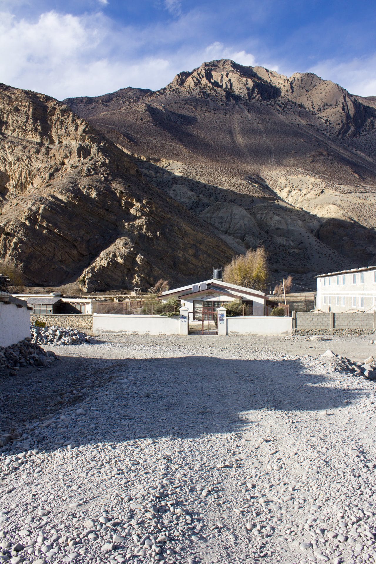
Centuries-old cliff dwellings carved directly into sandstone vertical walls dominate the arid plateau landscape north of the Mustang gate.
Chhongle Pass Crossing
Reaching high elevations over 4,000m on rocky trails requires careful pacing across exposed ridges with views extending toward the Tibetan plateau.
Walled City Arrival
Entering the historic capital of Lo Manthang through its single north gate reveals medieval mud-brick houses and active centuries-old monasteries.
Traditional Thakali Lodges
Teahouse stays feature central wood-burning stoves and hearty portions of local dal bhat served with locally grown buckwheat and root vegetables.
Ghami Red Wall Escarpment
The trail passes beneath massive terracotta cliffs marked by ancient prayer walls and remnants of early defensive fortresses.
Muktinath Sacred Springs
The descent connects through the pilgrimage site of Muktinath, featuring 108 stone water spouts and an eternal natural gas flame.
High Desert Terrain and Gorges
Walking paths traverse eroded canyons, dry riverbeds, and wind-scoured plateaus requiring sturdy footwear and reliable sun protection.
Trail Photos & Videos
High-definition captures and video clips from Himalayan passes, glacial lakes, Sherpa villages, and mountain summits.


Great Mustang Loop Trek (14-18 Days) Trail Map
Interactive OpenStreetMap topographic trail map tracing the route.
Key High-Altitude Stops
Compatible with Garmin, Apple Watch, Strava & Gaia GPS
Great Mustang Loop Trek (14-18 Days) Weather Center
Real-time mountain weather and 5-day altitude forecasts across key Great Mustang Loop Trek (14-18 Days) waypoints.
Loading weather for ...
Choose waypoint
Altitude Chart & Acclimatization Nodes
Strict adherence to "Hike High, Sleep Low" ensures safe high-altitude adaptation.
Complete Itinerary Route
Explore the detailed day-by-day routing, acclimatization schedule, and trek milestones.
Arrival in Kathmandu (1,400m)
Land at Tribhuvan International Airport and transfer to your hotel. Spend the afternoon checking permits, reviewing maps, and organizing gear for the upcoming journey.
Kathmandu to Pokhara (820m)
Depart the capital via the Prithvi Highway, following the Trisuli River before climbing past green hills to reach the lakeside city.
Pokhara to Jomsom (2,720m) and Trek to Kagbeni (2,810m)
Catch an early morning mountain flight over the Kali Gandaki gorge to Jomsom, then follow the windy river flats north to the medieval walled village of Kagbeni.
Kagbeni to Chele (3,050m)
Cross the restricted area checkpoint and ascend along the eastern bank of the Kali Gandaki River through Tangbe village, noting whitewashed houses and barley fields.
Chele to Syangboche (3,800m) via Gelling
HighlightCross the Taklam La pass at 3,624 meters, descend into Samar, and climb past steep ridges and chortens before reaching the ridge-top settlement of Syangboche.
Syangboche to Ghami (3,520m)
HighlightWalk past the Nyi La pass at 4,010 meters, the highest point of the lower loop, and descend toward Ghami to view one of Mustang's longest painted mani walls.
Ghami to Tsarang (3,560m)
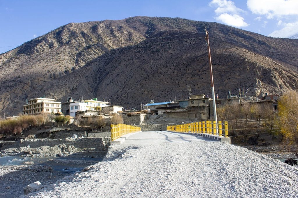
HighlightCross a steel suspension bridge over the Ghami Khola, traverse a dry plateau, and arrive in Tsarang to explore its massive red dzong and ancient monastery.
Tsarang to Lo Manthang (3,840m)
HighlightClimb up the Windy Pass of Lo at 3,850 meters for your first view of the walled capital of Upper Mustang spread across the arid valley floor.
Exploration Day in Lo Manthang (3,840m)
Spend the day visiting the historic multi-story palace, Thubchen Gompa, and Champa Lhakhang, or hike to the nearby cliffside cave dwellings of Chhoser.
Lo Manthang to Yara (3,650m)
Depart the capital eastward across arid plains, descend steeply into a deep canyon floor, and climb back out to reach the isolated cliff-edge village of Yara.
Yara to Luri Gompa and return to Yara (3,900m)
HighlightHike up an eroded trail carved into sandstone hills to visit Luri Gompa, a 14th-century cave monastery nestled into a red rock cliff face.
Yara to Tangge (3,240m)
Tackle the longest and most physically demanding section of the loop, traversing dry plateaus and crossing the Dhechyang Khola riverbed before climbing to Tangge.
Tangge to Chhusang (2,980m)
Climb out of Tangge up a series of stone staircases onto a vast high-altitude plateau, then descend gradually back into the Kali Gandaki valley.
Chhusang to Muktinath (3,760m)
HighlightLeave the main Kali Gandaki trail to climb eastward toward Ghongharke and upward to the sacred pilgrimage site of Muktinath, passing through small farming settlements.
Muktinath to Marpha (2,670m)
Descend past Jharkot and Ekle Bhatti down into the windy Kali Gandaki valley floor, finishing the walk in the charming apple-farming village of Marpha.
Marpha to Tatopani (1,190m)
HighlightFollow the trail as it drops rapidly in altitude, passing through Ghasa and Lete where pine forests replace the arid desert landscape, ending at the natural hot springs.
Tatopani to Pokhara (820m) via Beni
Walk to the road head at Beni via Ghar Khola, then board a local vehicle for the smooth drive back to Pokhara for a celebratory evening.
Pokhara to Kathmandu (1,400m)
Complete the return journey to Kathmandu by road or domestic flight, leaving the afternoon open for souvenir shopping or final paperwork in Thamel.
What's Covered & What's Not
A clear breakdown so you know exactly what to budget for and what's already taken care of.
Annapurna Conservation Area Permit
- Mandatory entry permit (ACAP) required for entering the Mustang region.
Upper Mustang Restricted Area Permit
- Special Department of Immigration restricted area royalty ($500 USD for the first 10 days).
Local Transport
- Shared jeep or local bus transport from Pokhara through Jomsom up to the restricted trailheads.
Teahouse Accommodation
- Standard twin-share lodge room throughout the Lo Manthang and Kali Gandaki valley floor.
International Flights
- Airfare from your home country into Tribhuvan International Airport in Kathmandu.
Nepal Tourist Visa
- On-arrival tourist visa fees payable in cash at Kathmandu airport ($30 for 15 days, $50 for 30 days).
Emergency Evacuation Insurance
- Comprehensive travel insurance explicitly covering high-altitude helicopter rescue above 4,000 meters.
On-Trail Extras
- Hot shower fees, battery charging in teahouses, Wi-Fi tokens, and bottled or purified water supplies.
Trail Meals & Hydration Rules
What to eat for stamina and altitude safety
Dhal Bhat Power
Rice, lentil soup, spiced potato, and spinach. Always comes with free refills to refuel after long hours on trail.
Garlic Soup
Thin clear garlic broth. Often consumed by climbers above 3,500m to help with blood circulation and warmth.
Boiled & Fried Potatoes
Dense carbohydrate source served with local cheese or chili paste in high settlements.
Tibetan Bread & Honey
Deep-fried puffed flatbread. Hearty breakfast before an early morning climb.
Local Noodle Soup
Thick vegetable and noodle soup served steaming hot in rural teahouses.
Boiled Eggs
Reliable protein source available every morning at lodge kitchens.
Boiled Water Bottles
Buy boiled water at night and keep the bottle inside your sleeping bag for warmth.
Ginger Lemon Honey Tea
Warm drink that cuts the dry mountain cough and stays hot in an insulated thermos.
Electrolyte Packs
Add one electrolyte sachet to water daily to replace salts lost on steep ascents.
Water Purification Drops
Use chlorine dioxide tablets for tap water; wait the full 30 minutes before drinking.
Vegetarian Focus
Vegetarian dhal bhat and veg noodles are consistently the freshest food on high trails.
Naturally Gluten-Free
Rice dishes, plain boiled potatoes, and buckwheat porridge offer gluten-free energy.
Black Tea Option
Ask for black tea to avoid powdered milk if you are lactose sensitive.
Lodge Kitchen Flexibility
Cooks can prepare food with less spice upon request if you order before evening rush.
No Meat Above 3,500m
Meat is carried up on foot for days without refrigeration. Stick to vegetarian meals high up.
No Alcohol at High Camp
Alcohol causes rapid dehydration and masks early symptoms of altitude sickness.
Never Drink Untreated Water
Never drink directly from village taps or streams without filtration or purification tablets.
Skip Raw Salads
Stick to thoroughly cooked hot vegetables to prevent stomach upsets.
Trip Preparation & Rules
Paperwork, permit requirements, and cash guidelines for the high desert
Passport & Tourist Visa
Ensure your passport remains valid for at least six months beyond your arrival date. Obtain your tourist visa on arrival at Tribhuvan International Airport in Kathmandu using cash USD.
Rescue Insurance Verification
Confirm your travel insurance policy explicitly covers emergency helicopter evacuation up to 5,500 meters. Carry printed policy documents and emergency contact numbers at all times.
Passport-Sized Photographs
Pack four physical passport-sized photos. These are required for restricted area permit paperwork and local checkpoint registration desks.
Upper Mustang Restricted Area Permit (RAP)
Mandatory Department of Immigration restricted area permit (USD 500 per person for the first 10 days, USD 50/day thereafter), issued via a registered Nepali agency.
Annapurna Conservation Area Permit (ACAP)
Standard conservation entry permit (NPR 3,000) required for all trails within the Annapurna Conservation Area Project boundary.
Agency & Guide Requirement
Restricted area regulations require a certified licensed Nepali guide and processing through a registered trekking company.
Domestic Flight Baggage Limit
Flights between Pokhara and Jomsom strictly enforce a 10kg checked duffel and 5kg carry-on weight limit. Excess weight incurs heavy per-kilogram surcharges or gets left behind.
Morning Wind Contingencies
Jomsom flights operate exclusively in the early morning before high valley winds develop. Build two extra buffer days into your schedule for potential weather delays.
Road Overland Alternative
When flights are grounded due to persistent high winds, the alternative is a rough jeep journey along the Kali Gandaki corridor from Pokhara to Beni and Jomsom.
Sufficient Cash Reserves
ATMs in Jomsom are notoriously unreliable and completely absent further north in walled settlements like Lo Manthang. Carry enough physical Nepalese Rupees for all expenses.
Daily Spending Estimates
Budget between 4,000 and 6,000 NPR daily per person for teahouse lodging, conservative meals, hot showers, and device charging in remote lodges.
Small Denomination Banknotes
Keep a steady supply of 100, 500, and 1,000 NPR notes. Rural teahouse operators cannot easily break large 2,000 or 5000 rupee bills for small purchases.
Trail Customs & Rules
Practical rules for passing animals, stupas, and village paths
Pass Stupas Clockwise
- •Always keep Mani walls, chortens, and prayer wheels on your right side while walking through villages.
- •Never climb on top of sacred stone monuments or sit on inscribed prayer stones.
- •Approach monasteries through main entryways and respect active prayer times.
Pack Animal Right-of-Way
- •Step toward the cliff wall side when mule trains or yak caravans pass on narrow ledges.
- •Never stand on the outer drop-off edge where a sudden nudge from a pack bag could send you down.
- •Wait patiently for the entire caravan to clear before resuming your pace.
Photography Protocols
- •Ask permission before photographing local residents, children, or elderly villagers.
- •Never photograph interior rituals in active gompas unless explicitly permitted by the caretaker.
- •Leave small monetary donations in monastery contribution boxes when touring heritage sites.
Waste & Plastic Management
- •Carry all non-degradable wrappers and batteries back out to urban collection points.
- •Avoid purchasing single-use mineral water bottles in plastic-restricted conservation zones.
- •Use water purification drops or iodine tablets to treat local tap sources.
Teahouse and Lodge Customs
- •Remove muddy trekking boots before stepping onto carpeted dining room platforms.
- •Order breakfast the night before to help kitchen staff manage morning fuel demands.
- •Turn off room lights and charging banks when stepping out to conserve limited solar power.
Cultural Interactions
- •Greet locals with a clear 'Namaste' accompanied by palms pressed together.
- •Dress modestly in villages by covering shoulders and knees out of respect for local traditions.
- •Avoid handing out sweets or money directly to children to prevent encouraging begging habits along trade routes.
Permits & Emergency Directory
Current permit fee structures and official emergency contacts
Required Permits & Mandatory Fees
-
📜Annapurna Conservation Area Permit (ACAP) NPR 3,000
Required for entering the Annapurna Conservation Area region, obtained at NTB Kathmandu or Pokhara.
-
📜Upper Mustang Restricted Area Permit $500 USD
Mandatory 10-day restricted area permit for Upper Mustang, requiring a licensed guide and a minimum of two trekkers.
-
📜Annapurna Rural Municipality Local Fee NPR 2,000
Local development fee collected at trail checkpoints within the rural municipality jurisdiction.
Nepal Tourism Directory
Official contact channels for permits, park regulations, and emergency rescue assistance.
Power, Connectivity & Showers
Realistic day-to-day guide for charging, phones, and hygiene
Device Charging
Electricity in teahouses comes from solar arrays or micro-hydro generators. Charging phones or power banks in dining halls typically costs Rs 300 to 600 per full charge. Carry a high-capacity power bank and a multi-port USB adapter.
Mobile Connectivity
Nepal Telecom (NTC) and Ncell signals reach most lower valley settlements and wide plateau sections. Service becomes intermittent or drops out entirely in deep gorges and high wind-swept passes. Local SIM cards can be purchased in Kathmandu with passport copies.
Wi-Fi Access
Satellite-based and local cellular Wi-Fi hotspots are available in commercial lodges for a fee ranging from Rs 400 to 800 per device card. Connection speeds fluctuate based on weather and network congestion.
Hot Showers & Hygiene
Gas-heated or solar-heated showers cost between Rs 400 and 700 per use. Above 3,800m, freezing temperatures make hot showers risky due to sudden chill; most experienced trekkers rely on biodegradable wet wipes and sponge baths.
Altitude Safety & Health
How to handle altitude symptoms and emergency protocols
Daily Symptom Monitoring
Watch closely for early AMS signs: persistent headache, loss of appetite, nausea, dizziness, and insomnia.
Helicopter Evacuation
In case of severe HAPE or HACE, guides dispatch emergency rescue helicopters to Kathmandu hospitals.
Satellite SOS Communication
Carry a Garmin inReach or ensure your guide carries satellite SOS for dead-zone sections.
Hydration and Electrolytes
Drink 3 to 4 liters daily, factoring in hot lemon, black tea, and garlic soup alongside treated water.
The Golden Altitude Rule
If you have a headache, nausea, or dizziness, do NOT ascend. If symptoms worsen after resting, descend 300 to 500 meters immediately. Descent is the only guaranteed cure.
Highland Villages & Wildlife
Indigenous communities and wildlife along the trail
Thakali Heritage & Architecture
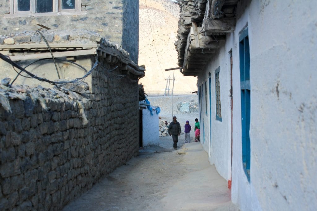
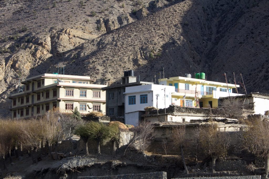
Flat-roofed stone and mud-brick houses featuring traditional inner courtyards and wind-protected alleys across lower and upper Mustang villages.
Traditional Hearth & Hospitality
Central metal and stone stoves burning dried scrub and yak dung, serving as the social hub of remote teahouses where travellers gather for evening warmth.
Weaving & Trade Traditions
Generations of families preserving wool spinning, carpet weaving, and salt-trade lineage rooted in the historic trans-Himalayan caravan routes.
Chhoser & Cave Monasteries
Ancient cliffside cave dwellings, meditation cells, and Buddhist sanctuaries carved directly into eroded canyon walls.
Mani Walls & Chortens
Long stone walls inscribed with Tibetan Buddhist mantras and whitewashed chortens marking village boundaries and trail junctions.
Muktinath Sacred Grounds
Venerated pilgrimage site featuring 108 waterspouts, natural eternal flames, and holy shrines sacred to both Buddhists and Hindus.
Blue Sheep & Himalayan Wildlife
Herds of bharal (blue sheep) grazing on steep, arid scree slopes, occasionally stalked by elusive snow leopards in high remote ridges.
High-Altitude Raptors
Lammergeiers, golden eagles, and Himalayan griffons riding thermal updrafts above deep river gorges and desert plateaus.
Arid Valley Flora
Resilient high-desert scrub, seaberry bushes producing vitamin-rich orange berries, and dwarf junipers surviving harsh winds.
Essential Packing Checklist
Prepare 1 duffel bag (handled by porter team) and 1 daypack for personal warm layers & water.
Frequently Asked Questions
Honest answers about the Great Mustang Loop Trek route