

Kanchenjunga Base Camp Trek (16-23 Days) 23 Days Guide
Trail notes for Kanchenjunga Base Camp Trek (16-23 Days). Daily walking hours, pass elevations, teahouse stops, and permit logistics.
Kanchenjunga Base Camp Trek
Kanchenjunga Base Camp Trek (16-23 Days) runs over 23 days through remote eastern Nepal. Expect steep climbs, rocky mountain paths, and basic teahouses far from urban centers.
Key Trail Realities
What to expect along the route
Remote Eastern Himalayan Wilderness
Traverse the heavily forested mid-hills and rugged alpine terrain of far-eastern Nepal, far removed from the heavy foot traffic of Western trekking circuits.
Dual Base Camp Approach
Explore both the southern base camp at Ramche and the northern base camp at Pang Pema, sitting beneath the massive 8,586-meter wall of the world's third-highest peak.
High Alpine Pass Crossings
Navigate challenging high-altitude ridges including Sele Le Pass, requiring steady pacing across steep, boulder-strewn terrain and loose moraine.
Road and Flight Logistics
Access the remote eastern trailheads through a combination of domestic flights to Bhadrapur or Tumlingtar followed by extended 4WD jeep journeys on unpaved mountain roads.
Traditional Rai and Limbu Settlements
Pass through authentic farming villages in the lower valleys before transitioning into high-altitude yak pastures and seasonal herder shelters.
Glacial Valley Moraine Trails
Trek alongside sprawling ice fields and lateral moraines, where cold winds and rocky footing demand sturdy trekking boots and reliable windproof shell layers.
Staged Acclimatization Strategy
Manage the gradual ascent profile above 4,000 meters carefully, relying on structured rest days to allow red blood cells to adapt to thin mountain air.
Basic Teahouse Infrastructure
Experience rustic mountain hospitality in family-run lodges where menus feature basic dal bhat, noodle soups, and shared wood stoves rather than modern hotel amenities.
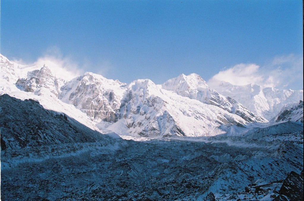
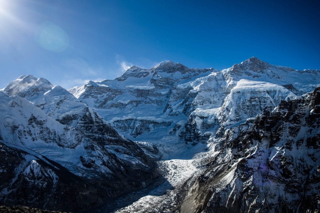
Trail Photos & Videos
High-definition captures and video clips from Himalayan passes, glacial lakes, Sherpa villages, and mountain summits.



Kanchenjunga Base Camp Trek (16-23 Days) Trail Map
Interactive OpenStreetMap topographic trail map tracing the route.
Key High-Altitude Stops
Compatible with Garmin, Apple Watch, Strava & Gaia GPS
Kanchenjunga Base Camp Trek (16-23 Days) Weather Center
Real-time mountain weather and 5-day altitude forecasts across key Kanchenjunga Base Camp Trek (16-23 Days) waypoints.
Loading weather for ...
Choose waypoint
Altitude Chart & Acclimatization Nodes
Strict adherence to "Hike High, Sleep Low" ensures safe high-altitude adaptation.
Complete Itinerary Route
Explore the detailed day-by-day routing, acclimatization schedule, and trek milestones.
Arrival in Kathmandu (1,350m)
Arrive at Tribhuvan International Airport and transfer to your hotel. Use the afternoon to review expedition gear, confirm permit documentation with your agency, and complete the official briefing covering high-altitude safety and remote logistics before heading east.
Kathmandu to Bhadrapur Flight & Drive to Taplejung (1,820m)
Catch an early morning flight from Kathmandu over the eastern plains to Bhadrapur. Meet your transport and settle in for a long, winding mountain drive climbing steadily through Ilam tea estates toward the district headquarters of Taplejung, the gateway to the far eastern range.
Taplejung to Mitlung (921m)
HighlightDescend steeply on a stone-paved track away from the roadside through scattered farm terraces down to the suspension bridge spanning the Tamur River. The route follows the eastern bank through small hillside hamlets before dropping into the warm valley floor at Mitlung.
Mitlung to Chiruwa (1,270m)
HighlightCross small suspension bridges over roaring feeder streams while traversing sub-tropical jungle interspersed with cardamom fields. The path hugs the Tamur River bank, passing small stone settlements like Tawa before reaching Chiruwa, a pleasant village nestled beneath massive rocky cliffs.
Chiruwa to Sekathum (1,575m)
HighlightAscend through forested gorges where the valley narrows considerably, requiring occasional steps carved directly into rock faces. Pass through the scattered settlement of Tapethok before crossing a sturdy suspension bridge to reach Sekathum, located at the confluence of two glacial rivers.
Sekathum to Amjilosa (2,510m)
HighlightTackle the first major sustained climb of the expedition, ascending steeply through dense bamboo and pine forests. Cross the Ghunsa Khola on a high wooden bridge and push up a relentless stone staircase leading onto the high ridge settlement of Amjilosa.
Amjilosa to Gyabla (2,730m)
HighlightTraverse through high-altitude rhododendron and fir forests, keeping an eye out for endangered red pandas in the upper canopy. The trail crosses several wooden footbridges over rushing torrents before easing into Gyabla, a quiet Tibetan-influenced village framed by towering green ridges.
Gyabla to Ghunsa (3,595m)
Descend briefly to the riverbed before climbing gently through sparse pine woodlands into the upper valley. As the tree line recedes, stone Mani walls and prayer wheels signal the approach to Ghunsa, the largest permanent Sherpa settlement in this isolated northeastern drainage.
Acclimatization Day in Ghunsa (3,595m)
AcclimatizationRest the body to allow red blood cell count to increase at this crucial mid-altitude threshold. Take a short morning hike up the western ridge toward Lapsang La trail for panoramic views of the surrounding peaks, then return to Ghunsa to hydrate with hot garlic soup.
Ghunsa to Khambachen (4,050m)
HighlightWalk through boulder-strewn larch forests alongside the glacial Ghunsa Khola, with massive ice faces beginning to dominate the skyline. Cross a wooden bridge below the massive Jannu glacier snout and enter the windswept yak pastures surrounding the stone teahouses of Khambachen.
Acclimatization Day in Khambachen (4,050m)
AcclimatizationAscend the exposed ridge behind the settlement toward the old moraine wall for striking views of Jannu's vertical North Face. Return to the lodge by early afternoon to rest, check cold-weather gear, and monitor your personal hydration levels above the 4,000-meter line.
Khambachen to Lhonak (4,780m)
HighlightTraverse the lateral moraine of the Kanchenjunga Glacier across unstable gravel slopes and sandy ablation valleys. The air thins noticeably as you approach Lhonak, a desolate high-altitude camping flat surrounded by towering snow giants and glacial amphitheaters.
Lhonak to Pang Pema / Kanchenjunga North Base Camp (5,143m) & Return to Lhonak
HighlightSet off early across the high glacial moraine beneath towering rock walls, stepping carefully over loose scree and ice patches. Arrive at Pang Pema, the North Base Camp, standing directly beneath the massive northern wall of Kanchenjunga before retracing your steps back down to Lhonak for the night.
Lhonak to Ghunsa (3,595m)
Begin the long descent down-valley, enjoying the physical relief of breathing thicker air with every step dropped below 4,500 meters. Follow the rocky moraine trail past Khambachen and continue descending along the rushing river back to the familiar comforts of Ghunsa.
Ghunsa to Sele Le (4,290m)
HighlightLeave the main valley behind and climb steeply through pristine rhododendron and pine forests up toward the high ridge of Sele Le. The path gains altitude steadily, emerging above tree line into an isolated high camp used to stage the crossing of the southern passes.
Sele Le to Tseram (3,870m) via Sele Le Pass & Sinion La
HighlightTraverse a series of high ridges, crossing the Sele Le, Sinion La, and Mirgin La passes all exceeding 4,400 meters. Expect cold winds and exposed stone paths before descending along the dramatic upper valley walls down to the lodge settlement at Tseram.
Tseram to Ramche (4,580m) & Ramche Exploration
HighlightAscend past the snout of the Yalung Glacier, walking alongside frozen ablation lakes where blue sheep frequently graze on rocky benches. Arrive at Ramche early in the day, then take a short walk further up the valley toward the Oktang viewpoint for stunning vistas of the Yalung Glacier face.
Ramche to Tseram (3,870m)
Wake up to crisp alpine air before packing bags for the descent down the Yalung Valley floor. The trail drops easily down past glacial streams and stony meadows, bringing you back to Tseram by lunchtime for an afternoon of recovery.
Tseram to Tortong (2,995m)
HighlightDescend steeply through dense pine and rhododendron forests, dropping below the 3,000-meter mark where oxygen levels feel noticeably abundant. Cross slippery wooden footbridges over the Simbua Khola and settle into the quiet forest clearing at Tortong.
Tortong to Yamphudin (2,080m)
Navigate steep, muddy jungle paths and stone steps leading down past scattered waterfalls and remote farming hamlets. Enter the culturally diverse village of Yamphudin, home to a mixed community of Sherpas, Rais, Limbus, and Gurungs.
Yamphudin to Khebang (1,915m)
HighlightCross suspension bridges over the Kabeli Khola and follow rolling hillside trails winding through terraced cornfields and cardamom plantations. Pass through several rural hill villages before reaching Khebang for your final night on the trail.
Khebang to Phidim (1,200m) & Drive to Ilam
Complete the final morning descent to meet your road transport connection at the valley roadhead. Drive past rolling green hills covered in endless tea gardens to spend the evening in the scenic hill town of Ilam.
Ilam to Bhadrapur Drive & Flight to Kathmandu (1,350m)
Board your morning vehicle for the final transfer down to Bhadrapur airport, catching sweeping views of the eastern lowlands. Catch the domestic flight back to Kathmandu to conclude your remote eastern Himalayan expedition.
What's Covered & What's Not
A clear breakdown so you know exactly what to budget for and what's already taken care of.
Required Trail Permits
- Kanchenjunga Conservation Area Project (KCAP) entry permit and the strict Restricted Area Permit (RAP) required for both Taplejung district approaches.
Trailhead Transport
- Local 4WD jeep transport from Bhadrapur or Suketar to the eastern or southern trailheads.
Teahouse Accommodation
- Basic twin-share lodge room throughout the extended lower and upper valleys.
Licensed Guide
- Mandatory licensed local mountain guide registered with the Nepal Tourism Board.
International Flights
- Airfare from your home country into Tribhuvan International Airport in Kathmandu.
Nepal Tourist Visa
- On-arrival tourist visa fee collected by the Department of Immigration.
High-Altitude Medical Insurance
- Comprehensive travel policy covering emergency helicopter evacuation above 5,000 meters.
On-Trail Incidentals
- Hot showers, device charging fees, Wi-Fi tokens, and bottled or treated drinking water.
Trail Meals & Hydration Rules
What to eat for stamina and altitude safety
Dhal Bhat Power
Rice, lentil soup, spiced potato, and seasonal greens. Always comes with free refills to refuel after long hours on trail.
Garlic Soup
Thin clear garlic broth. Local guides consume this regularly above 3,500m to help with blood circulation and warmth.
Boiled & Fried Potatoes
Dense carbohydrate source served with local cheese or chili paste in high settlements.
Tibetan Bread & Honey
Deep-fried puffed flatbread. Hearty breakfast option before an early morning push.
Local Noodle Soup
Thick vegetable and hand-pulled flour noodle soup served steaming hot.
Boiled Eggs
Reliable protein source available every morning at lodge kitchens.
Boiled Water Bottles
Purchase boiled water at lodges and keep the bottle inside your sleeping bag at night for warmth.
Ginger Lemon Honey Tea
Warm drink that helps soothe the dry mountain throat and stays hot in an insulated thermos.
Electrolyte Packs
Add one electrolyte sachet to 1L of water daily to replace salts lost on steep ascents.
Water Purification Drops
Use chlorine dioxide tablets for tap water and wait the full 30 minutes before drinking.
Vegetarian Focus
Vegetarian dhal bhat and veg noodle dishes are consistently the freshest meals available in remote teahouses.
Naturally Gluten-Free
Rice dishes, plain boiled potatoes, and lentil soups are naturally gluten-free options.
Black Tea Option
Order black tea to avoid powdered milk if you are sensitive to dairy.
Kitchen Flexibility
Lodge cooks can prepare food with less spice or salt upon request if asked early in the afternoon.
No Meat Above 3,500m
Meat is carried up on foot for days without refrigeration. Stick to vegetarian meals in higher settlements.
No Alcohol at High Altitude
Alcohol causes rapid dehydration and masks early symptoms of altitude sickness.
Never Drink Untreated Water
Avoid drinking directly from village taps or streams without proper filtration or purification.
Skip Raw Salads
Stick to thoroughly cooked hot vegetables to prevent gastrointestinal illness.
Trip Preparation & Rules
Paperwork, flight baggage limits, and cash guidelines
Passport & Tourist Visa
Passport must remain valid for at least six months past arrival. Obtain a 30-day tourist visa using USD cash at Tribhuvan International Airport.
High-Altitude Rescue Insurance
Insurance policy must explicitly cover emergency helicopter evacuation up to 6,000 meters. Keep a digital and printed copy of your policy details accessible.
Passport-Sized Photographs
Carry four physical passport photos for trail permit verification checkpoints and local cellular data registration.
Copies of Permits
Keep multiple photocopies of your passport, visa stamp, and official trekking permits in separate bags during transit.
Conservation Area Entry Permit
Required park entrance paperwork processed through authorized government tourism offices prior to stepping onto the trail.
Restricted Area Special Permit
Mandatory regional clearance for remote border zones, requiring a licensed guide and a minimum group size of two trekkers.
Local Municipality Fees
Rural municipality development charges collected at designated regional checkpoints along the valley approach.
Strict Baggage Weight Limits
Domestic mountain flights enforce a strict allowance of 10kg checked duffel bags and 5kg carry-on luggage. Excess weight incurs heavy fees.
Weather-Dependent Schedules
Mountain airstrips operate entirely on visual flight rules. Build two to three weather buffer days into your travel schedule.
Carry Essential Gear Onboard
Pack your sleeping bag, hard shell jacket, and primary medications in your carry-on in case checked duffels arrive on a later rotation.
Nepalese Rupee Reserves
Withdraw ample paper currency in Kathmandu. ATMs disappear entirely beyond the lower valley administrative centers.
Small Denominations
Carry plenty of 100 and 500 NPR notes for teahouse purchases, as remote lodge operators rarely have change for large 1,000 NPR bills.
ATM Reliability Warnings
Never rely on mountain card machines or local ATMs. Power outages and network failures make digital payments useless on the trail.
Trail Customs & Mountain Rules
Practical guidelines for respecting local traditions and remote mountain communities
Mani Walls and Stupas
- •Always pass chortens, mani stones, and prayer walls on your right side.
- •Spin prayer wheels exclusively in a clockwise direction.
- •Never climb on top of sacred stone walls or structures for photographs.
Yaks and Pack Animals
- •Step toward the mountain wall side when pack animals pass on narrow ledges.
- •Never stand on the outer cliff edge where startled animals could push past you.
- •Give working yaks and mules wide clearance on steep suspension bridges.
Photography and Monasteries
- •Ask permission before photographing local residents or elders in remote villages.
- •Turn off flash inside monasteries and respect prayer ceremonies in progress.
- •Leave a small donation in the box when touring historic gompas.
Waste and Water Management
- •Pack out all non-biodegradable trash, batteries, and wet wipes to lower elevations.
- •Avoid buying single-use plastic bottles along the trail to reduce rural waste.
- •Use water purification tablets or fill from treated lodge taps.
Village and Cultural Respect
- •Dress modestly in local settlements, keeping shoulders and knees covered.
- •Remove boots before entering teahouse dining rooms or private homes.
- •Ask permission before recording video of communal gatherings or festivals.
Campsite and Trail Conservation
- •Stick to established paths to prevent erosion on fragile alpine slopes.
- •Use designated toilet facilities rather than open ground near water sources.
- •Respect quiet hours in teahouses so fellow travellers can rest and recover.
Permits & Emergency Directory
Current permit fee structures and official emergency contacts for the Kanchenjunga region
Required Permits & Mandatory Fees
-
📜Kanchenjunga Conservation Area Project Permit NPR 3,000 per person
Required for all visitors entering the Kanchenjunga Conservation Area. Obtainable at the Nepal Tourism Board office in Kathmandu or at regional entry checkpoints.
-
📜Restricted Area Entry Permit $20 USD per week (Minimum 5 days)
Mandatory for the restricted border areas of Olangchung Gola and Lelep. Must be processed through a government-registered trekking agency with a licensed guide.
-
☘️Local Rural Municipality Fee NPR 2,000 per person
Local development tax collected by the Phaktanglung Rural Municipality at regional trail checkpoints.
Nepal Tourism Directory
Official contact channels for permits, park regulations, and emergency rescue assistance.
Power, Connectivity & Showers
Realistic day-to-day guide for charging, phones, and hygiene
Device Charging
Electricity in teahouses comes from solar arrays or micro-hydro generators. Charging devices in the dining room generally costs between NPR 300 to 600 per full charge. Carry a high-capacity power bank and a spare camera battery to minimize dependence on wall sockets during peak demand hours.
Mobile SIM & Data
Nepal Telecom (NTC) provides better signal reliability across eastern valleys than Ncell, though coverage drops significantly above Tapethok. Satellite-linked Wi-Fi cards are available at select lodges in higher settlements, but speeds remain throttled and connections fluctuate with weather conditions.
Hot Showers
Gas-heated or solar showers are available in lower elevation teahouses for an extra fee ranging from NPR 400 to 800. Above 4,000 meters, indoor plumbing freezes regularly. Plan for bucket water or wet-wipes rather than heated showers to reduce cold exposure.
Drinking Water Management
Single-use bottled water is discouraged and unavailable in remote conservation zones. Fill reusable bottles from teahouse taps or natural streams and treat every drop using chlorine dioxide tablets, iodine, or a portable UV purifier. Boiling water at lodges costs NPR 150 to 300 per liter.
Altitude Safety & Health
How to handle altitude symptoms and emergency protocols
Daily Symptom Monitoring
Watch closely for early acute mountain sickness signs: a throbbing headache that ibuprofen fails to touch, loss of appetite, persistent nausea, and severe sleep disruption.
Helicopter Evacuation
Verify your travel insurance explicitly covers emergency helicopter rescue up to 6,000 meters before starting this remote expedition.
Satellite Communication
Cellular signal drops entirely past Tapethok and does not return until your return descent, making satellite communication essential for emergency rescue coordination.
Hydration and Nutrition
Drink hot lemon, black tea, and garlic soup throughout the day to meet fluid goals and soothe dry airways in freezing mountain air.
The Golden Altitude Rule
If symptoms worsen overnight or coordination fails like a drunk stumble, do not wait for dawn. Dropping 500 to 1,000 meters reverses symptoms fast and saves lives.
Highland Villages & Wildlife
Indigenous communities and wildlife along the trail
Limbu and Rai Settlements
Lower and middle elevations are inhabited primarily by Rai and Limbu communities, known for traditional stilt houses, cardamom farming, and distinct dialect traditions.
Traditional Stone Architecture
Lower valley homes feature stacked slate roofs and timber frames, transitioning to rugged stone teahouses as elevation increases toward alpine camps.
Traditional Weaving and Craft
Local villagers produce hand-woven Dhaka fabric and sturdy woolen goods designed to withstand harsh Himalayan winters.
Buddhist Monasteries and Mani Stones
Sacred chortens, prayer walls carved with Tibetan mantras, and hillside gompas mark the approaches to upper Kanchenjunga valleys.
Limbu Mundhum Shrines
Indigenous animist shrines and sacred groves dedicated to ancestral spirits and natural deities embedded in the landscape.
Kanchenjunga as a Sacred Abode
The five peaks of Kanchenjunga are revered locally as the sacred treasury of the gods, housing divine protectors and eternal snows.
Snow Leopards and Red Pandas
The remote alpine forests and rocky crags of Kanchenjunga Conservation Area provide critical habitat for rare snow leopards and red pandas.
Rhododendron Forests
Lower river valleys and sub-alpine ridges burst into vibrant pink, red, and white blooms during spring months.
High-Altitude Avian Life
Lesser kestrels, golden eagles, and Himalayan griffons ride thermal updrafts above glacial river gorges and high mountain passes.
Essential Packing Checklist
Prepare 1 duffel bag (handled by porter team) and 1 daypack for personal warm layers & water.
Frequently Asked Questions
Practical details about the Kanchenjunga Base Camp Trek route