

Everest View Trek (7 Days) 7 Days Guide
Trail notes for Everest View Trek. Daily walking hours, pass elevations, teahouse stops, and permit logistics.
Everest View Trek
7-day route along the Everest View Trek. Daily climbs range from 400m to 800m on stone stairs and alpine ridges. Cold nights arrive fast above 3,400m.
Key Trail Realities
What to expect along the route
Namche Bazaar Acclimatization
Spent two nights at 3,440 meters in the main trading hub of the Khumbu, allowing red blood cell production to adapt before pushing higher toward panoramic viewpoints.
Everest View Hotel Panorama
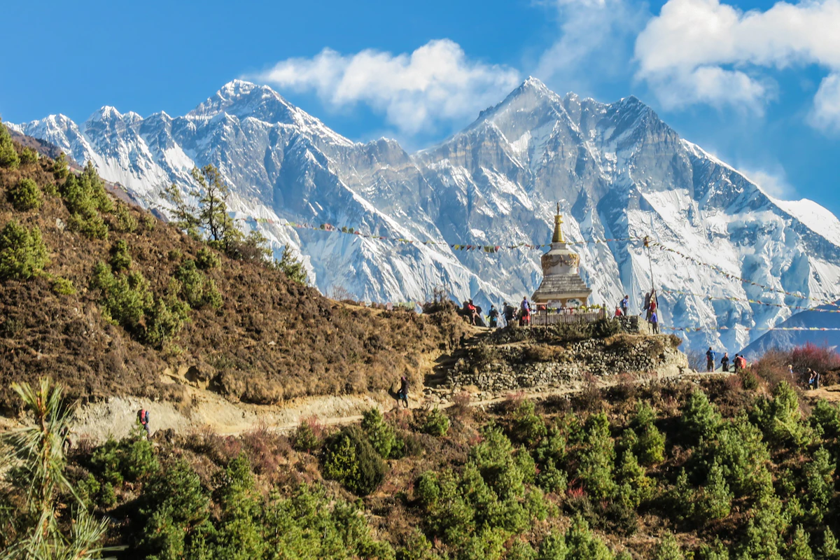
Reaching the 3,880-meter plateau above Namche for direct, unobstructed morning vistas of Everest, Lhotse, Ama Dablam, and Thamserku without committing to higher base camp sleeping altitudes.
Tengboche Monastery Ridge
Walking through pine and rhododendron forests across the Dudh Koshi river gorge to visit the spiritual center of the region at 3,860 meters.
Lukla Mountain Airstrip Transition
Navigating the short, sloping tarmac of Tenzing-Hillary Airport, where flights depend strictly on morning visibility and valley wind speeds.
Sagarmatha National Park Checkpoints
Registering permits at Monjo checkpoint, verifying park entry requirements and local rural municipality fees before entering the protected high mountain area.
Suspension Bridge Crossings
Crossing high-altitude steel suspension bridges strung high above deep river gorges, shared daily with porters carrying heavy loads and pack dzopkyos.
Teahouse Dining and Heating
Gathering around central yak-dung or wood-burning stoves in stone-walled lodges to eat dhal bhat and drink garlic soup as evening temperatures drop below freezing.
Early Morning Ridge Light
Starting morning walks before 7:00 AM while valley air remains cold, calm, and clear before daytime cloud buildup obscures the upper peaks.
Trail Photos & Videos
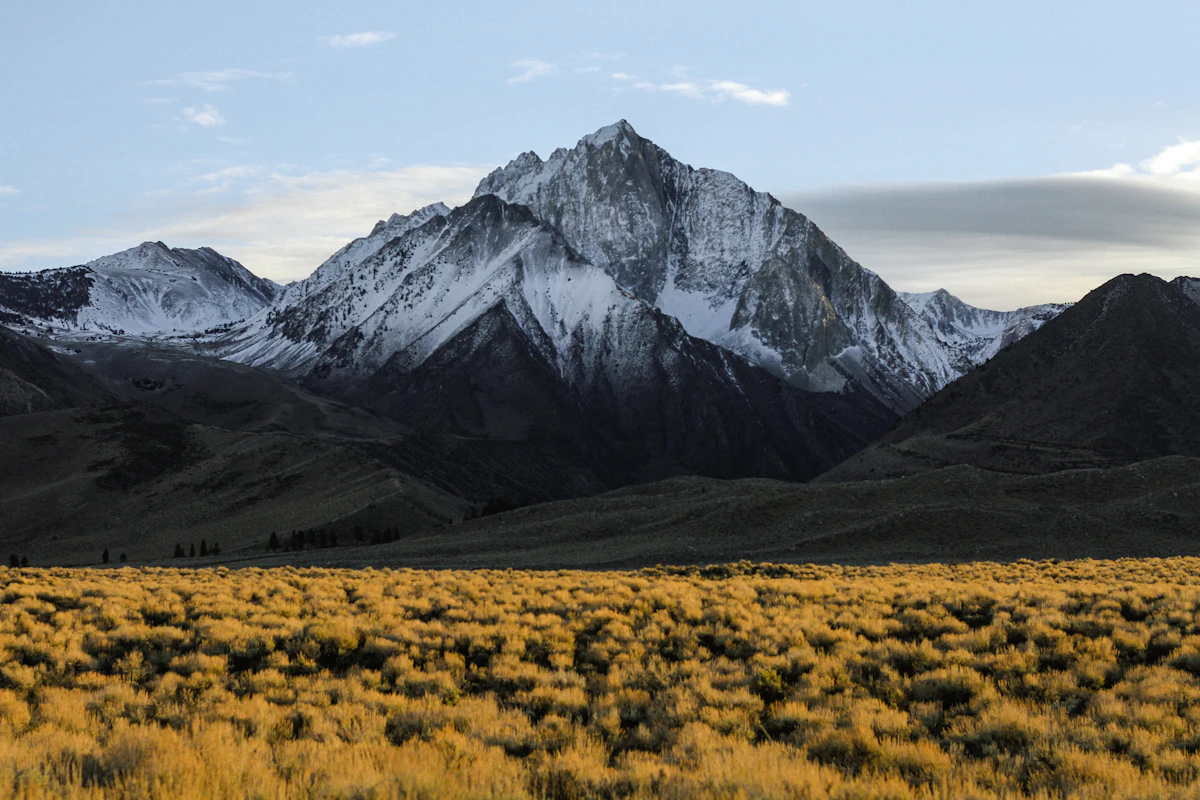
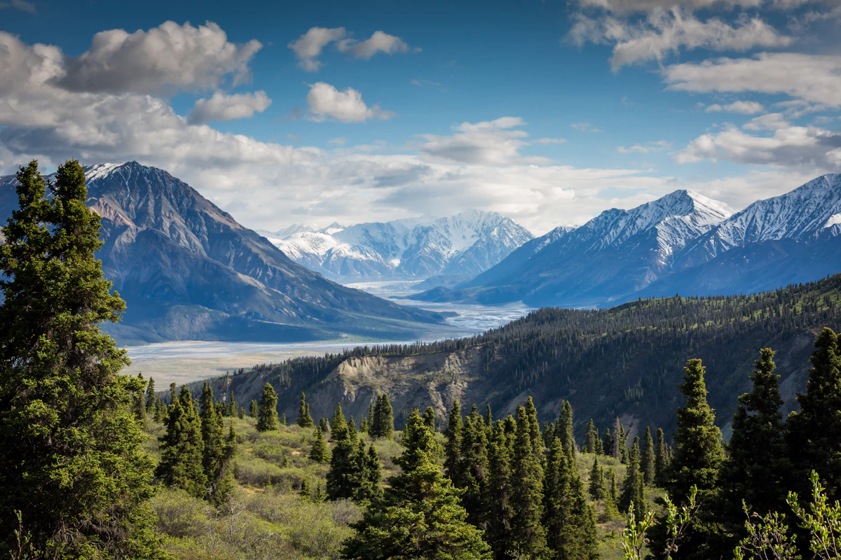
High-definition captures and video clips from Himalayan passes, glacial lakes, Sherpa villages, and mountain summits.


Everest View Trek (7 Days) Trail Map
Interactive OpenStreetMap topographic trail map tracing the route.
Key High-Altitude Stops
Compatible with Garmin, Apple Watch, Strava & Gaia GPS
Everest View Trek (7 Days) Weather Center
Real-time mountain weather and 5-day altitude forecasts across key Everest View Trek (7 Days) waypoints.
Loading weather for ...
Choose waypoint
Altitude Chart & Acclimatization Nodes
Strict adherence to "Hike High, Sleep Low" ensures safe high-altitude adaptation.
Complete Itinerary Route
Explore the detailed day-by-day routing, acclimatization schedule, and trek milestones.
Arrival and Preparation
Settle into the city and check all trekking gear before departure. Walking involves navigating busy, dusty streets with uneven pavement while adjusting to local traffic and exhaust. Keep hydration high and secure any final paperwork or physical cash needed for the trail ahead.
Kathmandu to Initial Trailhead
HighlightBegin with a bumpy vehicle transfer followed by an immediate foot climb on steep, stone-paved stairs. The route passes terraced fields where muddy paths can slow your pace after midday moisture. Rooms in local teahouses are unheated, so prepare your sleeping bag early as temperatures drop sharply after sunset.
Initial Trailhead to Ridge Camp
HighlightClimb steadily through dense rhododendron forests on narrow, root-laced dirt tracks. You may notice mild altitude symptoms such as shortness of breath as the air thins above the tree line. Wind picks up sharply along the open ridge by afternoon, making extra layers essential during rest breaks.
Ridge Camp to Panorama Point
HighlightTrek across exposed alpine scrubland with loose gravel underfoot that requires careful footing on slopes. Cold winds demand a hard shell jacket right from the morning departure. Water sources freeze overnight, so refill your bottles with treated water before evening temperatures plummet below freezing.
Panorama Point to Viewpoint Settlement
HighlightTraverse high altitude ridges on rocky trails with sweeping views of surrounding peaks. The final approach involves a short, steep push into the main settlement. Indoor dining areas rely on yak dung or wood stoves for warmth, creating a smoky atmosphere that fills the communal room by nightfall.
Viewpoint Settlement to Descent Camp
HighlightDescend rapidly down steep, dusty switchbacks that test your knees and toe joints. The lower altitude brings thicker air and noticeably warmer temperatures by midday. Loose gravel and porter traffic require constant attention on the narrow trail sections.
Descent Camp to Return Point
Complete the final walking stretch along rolling hills and terraced farmland paths. Catch a return transport vehicle back to the city along winding, unpaved roads. Finish the trip by sorting gear, tipping local support staff, and resting weary muscles.
What's Covered & What's Not
A clear breakdown so you know exactly what to budget for and what's already taken care of.
Required Trail Permits
- Sagarmatha National Park entry permit and Khumbu Pasang Lhamu Rural Municipality entry fee.
Local Transport
- Shared jeep connection or domestic flight transfer to the designated Khumbu trailhead.
Teahouse Accommodation
- Basic twin-share lodge room throughout the 7-day route.
Licensed Guide / Porter
- Certified trekking guide mandated by Nepal Tourism Board regulations for mountain park entries.
International Flights
- Airfare from your home country into Tribhuvan International Airport in Kathmandu.
Nepal Tourist Visa
- On-arrival tourist visa fees payable in cash at Kathmandu airport ($30 USD for 15 days).
Helicopter Rescue Insurance
- Mandatory international travel policy covering high-altitude medical evacuation up to 4,000 meters.
Trail Incidentals
- Hot shower tokens, battery charging fees, bottled or boiled drinking water, and personal tips.
Trail Meals & Hydration Rules
What to eat for stamina and altitude safety
Dhal Bhat Power
Rice, lentil soup, spiced potato, and spinach. Always comes with free refills to refuel after 6 hours on trail.
Garlic Soup
Thin clear garlic broth. Local guides drink this daily above 3,500m to help with blood circulation and warmth.
Boiled & Fried Potatoes
Dense carbohydrate source served with local yak cheese or chili paste in high settlements.
Tibetan Bread & Honey
Deep-fried puffed flatbread. Hearty breakfast before an early morning climb.
Sherpa Stew (Shyakpa)
Thick vegetable and hand-pulled flour noodle soup served steaming hot.
Boiled Eggs
Safe, reliable protein source available every morning at lodge kitchens.
Boiled Water Bottles
Buy boiled water at night and keep the bottle inside your sleeping bag for warmth.
Ginger Lemon Honey Tea
Warm drink that cuts the dry mountain cough and stays hot in an insulated thermos.
Electrolyte Packs
Add one electrolyte sachet to 1L of water daily to replace salts lost on steep ascents.
Water Purification Drops
Use Aquatabs or chlorine dioxide tablets for tap water; wait full 30 minutes before drinking.
Vegetarian Focus
Vegetarian dhal bhat and veg noodles are always the freshest food on high trails.
Naturally Gluten-Free
Rice dishes, plain boiled potatoes, and buckwheat porridge are naturally gluten-free.
Black Chiya Option
Ask for 'Kalo Chiya' (black tea) to avoid powdered milk if you are lactose sensitive.
Lodge Kitchen Flexibility
Cooks can prepare food with less chili or no salt upon request if you ask before 5:00 PM.
No Meat Above 3,500m
Meat is carried up on foot for days without refrigeration. Stick to vegetarian meals high up.
No Alcohol at High Camp
Alcohol causes rapid dehydration and masks early symptoms of altitude sickness.
Never Drink Untreated Water
Never drink directly from village taps or streams without filtration or purification tablets.
Skip Raw Salads
Stick to thoroughly cooked hot vegetables to prevent stomach upsets.
Trip Preparation & Rules
Paperwork, flight baggage limits, and cash guidelines
Passport & Tourist Visa
Passport valid for at least 6 months. Secure a 30-day tourist visa on arrival at Tribhuvan International Airport.
High-Altitude Medical Insurance
Ensure your policy explicitly covers emergency helicopter evacuation up to 4,000m for this route.
Permit Documentation
Keep multiple physical copies of your passport and permit paperwork accessible in an outer pocket.
Khumbu Pasang Lhamu Permit
Local rural municipality entry permit (NPR 3,000) obtained upon arrival in Lukla or Monjo. Note: TIMS cards are not required or valid in the Khumbu region.
Sagarmatha National Park Permit
Mandatory national park entry permit (NPR 3,000 + 13% VAT = NPR 3,390) obtained in Kathmandu at the Tourism Board or directly at the Monjo park entrance.
Licensed Guide Requirement
Under Nepal Tourism Board regulations, foreign trekkers must trek with a licensed government guide for safety and environmental sustainability.
Baggage Weight Limits
Domestic flights to mountain airstrips enforce a strict limit of 10kg checked duffel and 5kg hand luggage.
Weather-Related Delays
Morning cloud cover or high winds frequently cause flight schedule shifts; build contingency days into your travel timeline.
Manthali Airport Diversion
During peak trekking seasons, flights depart from Ramechhap rather than Kathmandu, requiring a pre-dawn road transfer.
Carry Sufficient Local Currency
Bring enough Nepalese Rupees in cash to cover daily meals, hot showers, and Wi-Fi before heading into the mountains.
ATM Reliability Issues
ATMs in mountain settlements are rare, prone to power outages, and often out of cash.
Accepted Currency Notes
Exchange major foreign currencies for Rupees in Kathmandu; high-altitude teahouses rarely accept large foreign bills.
Trail Customs & Rules
Practical rules for passing animals, stupas, and village paths
Pass Stupas Clockwise
- •Always keep Mani walls, chortens, and prayer wheels on your right.
- •Walk around mani stone piles in a clockwise direction.
- •Never sit or place gear on carved prayer stones.
Pack Animal Right-of-Way
- •Step toward the mountain wall when yaks, dzopkyo, or mules approach.
- •Stay away from the outer cliff edge because swinging packs can knock you off balance.
- •Wait until the entire pack train passes before continuing up the trail.
Photography and Monasteries
- •Ask for verbal permission before photographing local residents or working porters.
- •Turn off camera flashes inside prayer halls and gompas.
- •Leave a small offering in the donation box if you enter a monastery.
Waste and Water Management
- •Pack out all plastic wrappers, wrappers, and non-biodegradable trash.
- •Avoid throwing wet wipes or batteries into lodge pit toilets.
- •Carry a reusable bottle and treatment tablets rather than buying single-use plastic.
Village and Lodge Respect
- •Remove muddy boots before entering teahouse dining rooms or dormitories.
- •Keep voices moderate in shared sleeping areas after 9:00 PM.
- •Support local teahouses by purchasing meals where you sleep.
Local Interactions
- •Greet locals with a polite 'Namaste' accompanied by palms pressed together.
- •Dress modestly in villages by covering shoulders and knees.
- •Avoid giving money or candy directly to children along the trail.
Permits & Emergency Directory
Current permit fee structures and official emergency contacts for the Everest View route
Required Permits & Mandatory Fees
-
📜Sagarmatha National Park Entry Permit NPR 3,000
Mandatory entry permit required for all visitors entering the Sagarmatha National Park. Obtainable at the Nepal Tourism Board office in Kathmandu or at the Monjo checkpoint.
-
📜Khumbu Pasang Lhamu Rural Municipality Fee NPR 3,000
Local government development fee collected at the trail entry gate in Lukla. Replaces the older TIMS card system within this specific municipality.
-
☘️Trekkers' Information Management System Exempt / Replaced
Standard TIMS cards are not required within the Khumbu region due to the local municipal permit system.
Nepal Tourism Directory
Official contact channels for permits, park regulations, and emergency rescue assistance.
Power, Connectivity & Showers
Realistic day-to-day guide for charging, phones, and hygiene
Device Charging
Lodge electricity runs on solar power arrays with hydroelectric backup. Expect to pay Rs 300 to 600 per device or power bank in dining areas, as rooms lack active wall sockets. Carry a high-capacity power bank charged fully before departure.
Mobile Connectivity
Both NTC and Ncell networks maintain signals across most ridge sections and lower valley settlements. Data speeds drop significantly above Namche Bazaar, and deep gorges block reception entirely.
Wi-Fi Access
Everest Link prepaid scratch cards provide community Wi-Fi access at teahouses. Speeds vary with weather conditions, and heavy cloud cover frequently disrupts connections.
Hot Showers
Gas-heated or solar-powered showers cost between Rs 400 and 600 per use. Above 3,500 meters, unheated indoor air makes wet showers risky for cold exposure; biological wet wipes and a towel dry work better.
Altitude Safety & Health
How to handle altitude symptoms and emergency protocols
Daily Symptom Monitoring
Watch closely for early acute mountain sickness signs: a throbbing headache unresponsive to standard ibuprofen, loss of appetite, nausea, dizziness, and insomnia.
Mountain Hydration Strategy
Count hot lemon, black tea, and garlic soup toward your daily 3 to 4 liters of fluid intake. Drink before thirst hits to prevent thick blood and compounding altitude fatigue.
Helicopter Evacuation Insurance
Verify your insurance policy covers emergency helicopter rescue and medical evacuation explicitly up to 6,000 meters before departing Kathmandu.
Immediate Descent Protocol
If severe symptoms like ataxia, stumbling, or a wet gurgling cough develop, drop 500 to 1,000 meters immediately. Descending reverses symptoms fast and saves lives.
The Golden Altitude Rule
If you have a persistent headache, nausea, or dizziness, do NOT ascend. If symptoms worsen after resting, descend 300 to 500 meters immediately. Descent is the only guaranteed cure.
Highland Villages & Wildlife
Indigenous communities and wildlife along the trail
Sherpa Settlement Culture
Stone-built villages influenced by centuries of Tibetan trade and high-altitude Buddhist traditions.
Traditional Hearth & Hospitality
Local teahouses warmed by central iron stoves where travellers gather to dry gear and share stories.
Hand-Woven Wool Craftsmanship
Hand-spun sheep and yak wool woven into thick blankets and winter garments by resident families.
Tengboche Monastery Heritage
The spiritual heart of the Khumbu region, housing ancient Buddhist scriptures and sacred ritual chambers.
Mani Walls & Prayer Wheels
Stone walls carved with sacred mantras and rotating copper prayer wheels lining village approaches.
Sacred Peak Reverence
Mount Everest and surrounding massifs treated as divine entities and protected mountain sanctuaries.
Himalayan Tahr & Musk Deer
Native hoofed wildlife navigating steep cliff faces and sub-alpine forest corridors below tree line.
Rhododendron Forests
Dense evergreen forests bursting with deep red and pink floral blooms during the spring climbing season.
High-Altitude Raptors
Lammergeiers and golden eagles using thermal air currents along deep Himalayan river valleys.
Essential Packing Checklist
Prepare 1 duffel bag (handled by porter team) and 1 daypack for personal warm layers & water.
Frequently Asked Questions
Honest answers about the Everest View Trek route logistics, altitude, and preparation