

Everest Base Camp via Jiri (20 Days) 20 Days Guide
Trail notes for Everest Base Camp via Jiri. Daily walking hours, pass elevations, teahouse stops, and permit logistics.
Everest Base Camp via Jiri
20-day traditional route to Everest Base Camp via Jiri, following the historic early trail through the lower Solu Khumbu hills before joining the main upper valley.
Key Trail Realities
What to expect along the historic route
Extended Foothill Approach
Starting from Jiri adds several days of remote ridge walking through mid-elevation farming terraces before joining the main upper trail.
Early Morning Peak Views
Clear 6:00 AM visibility across high Himalayan ridges before afternoon cloud buildup fills the valleys.
High Pass Crossing
Navigating steep stone staircases and exposed ridgelines above 4,000m with traditional mani walls and prayer flags.
Road and Trail Logistics
Taking a local bus or private jeep from Kathmandu to Jiri replaces the standard Lukla flight for the initial approach.
Highland Sherpa Settlements
Passing through historic mountain villages featuring stone-walled houses and central wood-fired teahouse stoves.
Glacial Valley Trails
Walking along river corridors and crossing high suspension bridges spanning deep gorge waters.
Gradual Altitude Gain
The extended 20-day itinerary allows natural physiological adaptation before reaching the high alpine zone.
High Altitude Base Lodging
Reaching upper teahouses set beneath towering peaks where electricity relies on solar panels and batteries.
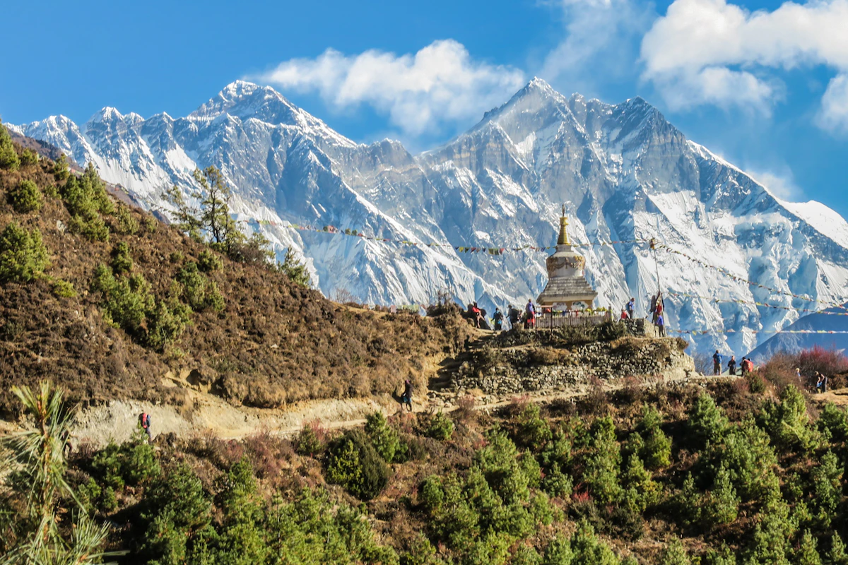
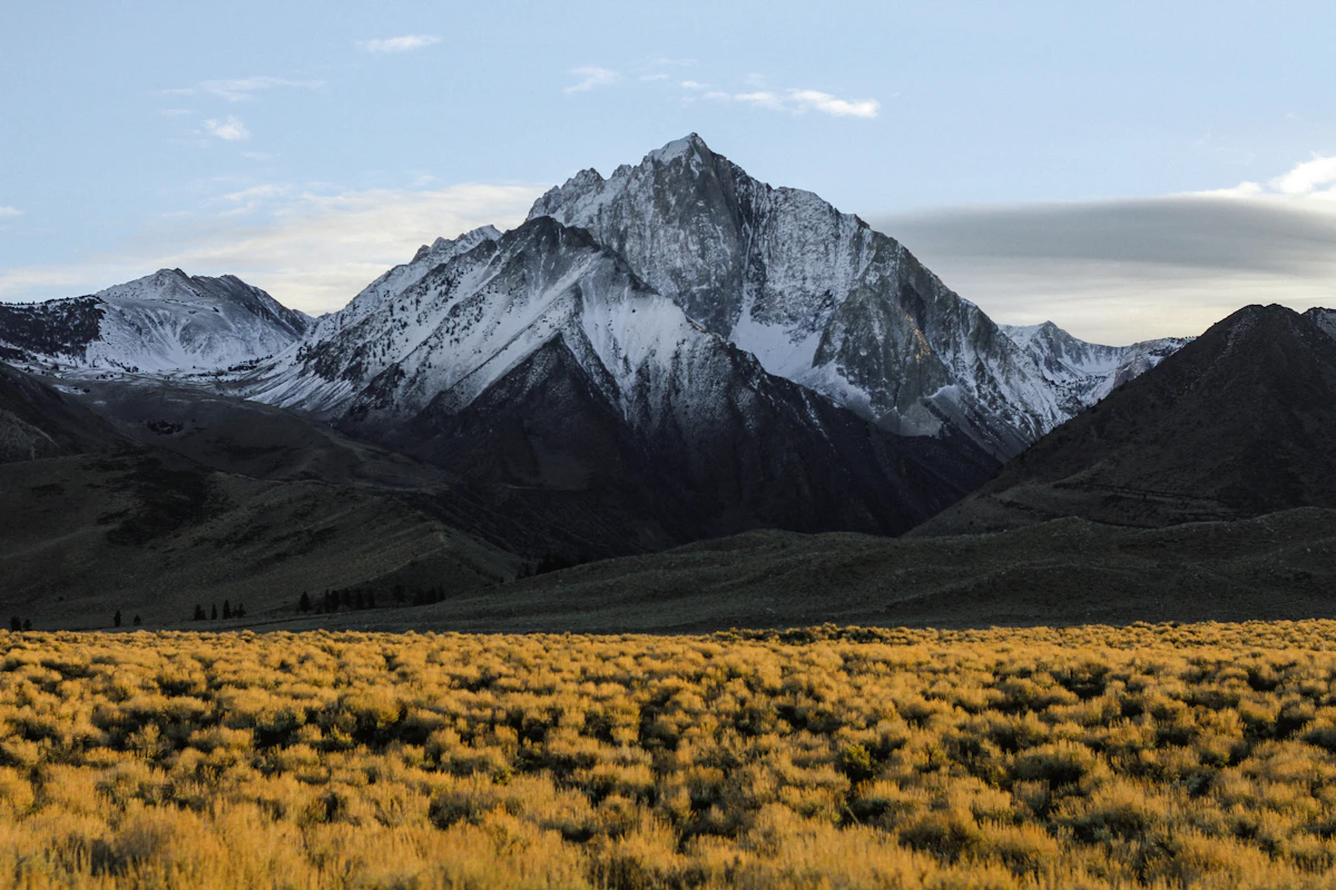
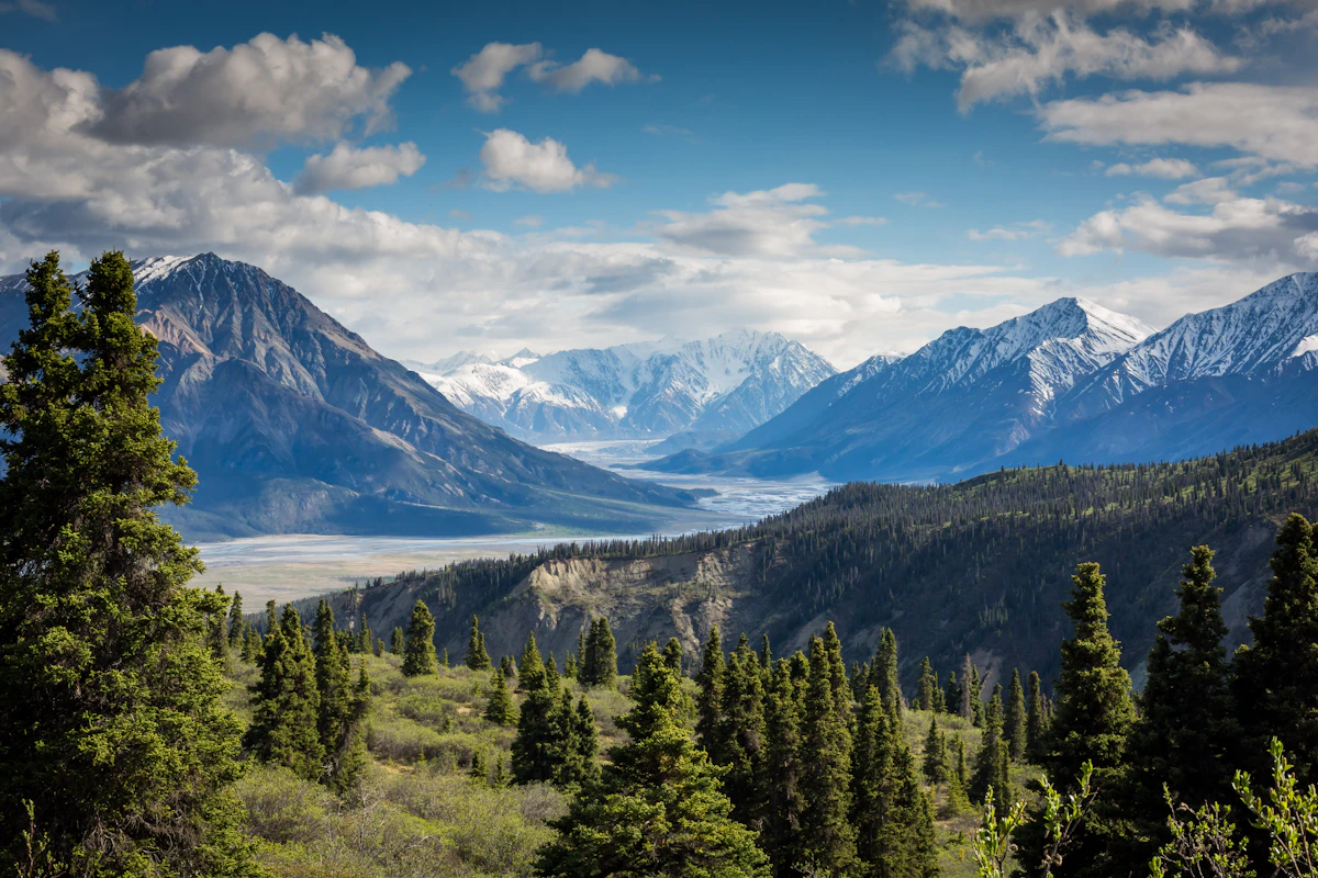
Trail Photos & Videos
High-definition captures and video clips from Himalayan passes, glacial lakes, Sherpa villages, and mountain summits.


Everest Base Camp via Jiri (20 Days) Trail Map
Interactive OpenStreetMap topographic trail map tracing the route.
Key High-Altitude Stops
Compatible with Garmin, Apple Watch, Strava & Gaia GPS
Everest Base Camp via Jiri (20 Days) Weather Center
Real-time mountain weather and 5-day altitude forecasts across key Everest Base Camp via Jiri (20 Days) waypoints.
Loading weather for ...
Choose waypoint
Altitude Chart & Acclimatization Nodes
Strict adherence to "Hike High, Sleep Low" ensures safe high-altitude adaptation.
Complete Itinerary Route
Explore the detailed day-by-day routing, acclimatization schedule, and trek milestones.
Kathmandu to Bhandari
The long jeep drive out of Kathmandu follows winding mountain roads before dropping toward the mid-hills. Dust and vehicle exhaust dominate the early hours until the valley clears. You will arrive at Bhandari by late afternoon, feeling the fatigue of rough transit. Pack warm layers immediately because unheated lodge rooms lose warmth quickly after sunset.
Bhandari to Sete
HighlightThe trail drops steeply to cross a suspension bridge over the Khimti Khola before beginning a relentless stone-stair climb. Humidity makes the lower forests feel heavy, and your legs will burn on the endless uphill steps. Sete sits damply in a narrow valley, trapping evening chill. Keep your water bottles filled and drink heavily to stave off early dehydration.
Sete to Junbesi
HighlightToday requires a long, grinding ascent through dense rhododendron forests toward the Lamjura La pass. The path is often root-strewn and can remain slick with mud or lingering frost in shaded hollows. Crossing the pass brings sweeping views before a welcome descent into Junbesi. Nights here grow noticeably colder, so secure extra thick blankets from the lodge owner.
Junbesi to Nunthala
HighlightLeaving Junbesi, you cross the Junbesi Khola and contour along terraced hillsides farmed by Sherpa communities. The terrain shifts between dirt paths and stone steps as you descend toward the Dudh Koshi basin. Nunthala sits on a sloping ridge surrounded by cornfields. Expect basic washing facilities and wind gusts whistling through valley gaps by evening.
Nunthala to Bupsa
HighlightThe morning starts with a steep drop down to cross the raging Dudh Koshi river via a high suspension bridge. Immediately afterward, your lungs face a relentless uphill grind toward Bupsa through scrub oak and pine. The path is dry and dusty underfoot, kicking up grit with every step. Sleep early as morning starts on this trail are always demanding.
Bupsa to Surke
HighlightYou climb past small scattered settlements and cross several minor ridges before descending into forested gullies. Trail traffic picks up here as the Jiri path merges with common trekking routes coming from the lower airstrips. Surke is a small, quiet hamlet tucked close to the riverbank. Stock up on snacks here since prices begin rising past this point.
Surke to Phakding
HighlightThe trail winds gently northward, following the valley floor alongside rushing glacial water. You will share the wide dirt path with heavily laden pack animals, so always step to the mountain side when they pass. Phakding offers comfortable lodges with bakery items and reliable charging stations. Protect your electronics from the damp valley air by keeping them in dry sacks.
Phakding to Namche Bazaar
AcclimatizationAfter crossing several high suspension bridges festooned with prayer flags, you reach the national park checkpoint at Monjo. The final two hours involve a punishing, steep uphill switchback climb through pine trees. Namche Bazaar clings amphitheatrically to the steep hillside bowl. Acclimatization starts here, so pace your ascent carefully to avoid early headaches.
Namche Bazaar Acclimatization Day
AcclimatizationClimb high to the Everest View Hotel and descend to settle back in Namche for the night to aid red blood cell adaptation. Strong morning winds often sweep the exposed ridge above town, requiring a windproof shell jacket. Use the afternoon to visit the Sherpa culture museum or check gear. Hydration remains critical as the dry mountain air accelerates fluid loss.
Namche Bazaar to Tengboche
HighlightThe trail contours high above the gorge with wide panoramic views before dropping steeply to the river at Phunki Tenga. Lunch here gives your legs a break before tackling the long, pine-shaded climb up to Tengboche. The famous monastery dominates the wide clearing at the ridge top. Indoor dining rooms are heated with yak dung stoves, creating a thick, smoky atmosphere by evening.
Tengboche to Dingboche
HighlightYou descend briefly through birch and rhododendron forests before crossing the Imja Khola on a sturdy bridge. The landscape slowly transitions above tree line into an arid, wind-scoured glacial valley. Dingboche sits surrounded by stone-walled barley fields designed to block biting valley winds. Temperatures drop below freezing immediately after sunset, demanding heavy down jackets indoors.
Dingboche Acclimatization Day
AcclimatizationTake a morning hike up the ridge toward Nagarjun Hill to push your red blood cell count higher. The trail is loose, steep, and exposed to strong, freezing alpine gusts that make steady footing essential. Return to Dingboche by early afternoon to rest and drink plenty of garlic soup or tea. Mild altitude symptoms like restless sleep are common at this elevation.
Dingboche to Lobuche
The route climbs past memorial cairns at Dughla over rough, bouldery moraine terrain. Breathing feels noticeably heavier as the thin air demands slower, deliberate pacing on every step. Lobuche is a small cluster of stone lodges nestled against a freezing hillside. Rooms are entirely unheated, and water inside your bottle may freeze overnight if left uninsulated.
Lobuche to Gorak Shep and Everest Base Camp, return to Gorak Shep
HighlightYou trek over uneven glacial moraine debris to reach the bleak outpost of Gorak Shep before pushing on to Base Camp. The path to Base Camp is rocky, dusty, and requires careful stepping over shifting ice and stones. Stand among the prayer flags and tents before making the exhausting return hike to Gorak Shep. Extreme cold sets in rapidly once the sun drops behind the peaks.
Gorak Shep to Kala Patthar and down to Pheriche
HighlightAn early pre-dawn departure takes you up the steep, sandy switchbacks of Kala Patthar for panoramic dawn views. Frigid summit winds bite through multiple layers, making gloves and a windbreaker mandatory. After descending to Gorak Shep for breakfast, you retrace your steps down valley toward Pheriche. The rapid drop to lower elevation immediately relieves heavy breathing and fatigue.
Pheriche to Namche Bazaar
The long descent follows the river valley down through windswept flats and past scattered herder huts. Your knees absorb continuous impact on the long stone staircases leading back toward Tengboche. Reaching Namche Bazaar feels like returning to civilization with its bustling bakeries and shops. Celebrate completing the high mountain sectors with a hearty meal.
Namche Bazaar to Phakding
Gravity assists your journey today as you drop continuously down the steep hillside steps below Namche. The air grows noticeably thicker and warmer with every hundred meters of descent, boosting your energy levels. Traffic remains steady with porters carrying supplies upward to the mountain settlements. Enjoy a relaxed evening in a familiar lower-altitude teahouse.
Phakding to Lukla
The final trekking leg rolls gently alongside the river before a short uphill push into the town of Lukla. The path is well-paved stone, making for easy walking compared to the rugged upper trails. Lukla bustles with trekkers finishing their journeys and preparing for transport out. Spend the afternoon sorting gear and tipping your hardworking local porters.
Lukla to Ramechhap or Kathmandu Contingency
Mountain flight schedules depend entirely on clear morning weather and can experience sudden delays or cancellations. If flights are grounded, patience is essential while waiting for the next available weather window. Once airborne, enjoy the brief flight back before connecting to road transport. Check into your city hotel and trade mountain dust for a hot shower.
Contingency / Buffer Day
This final day is a crucial buffer for any weather delays encountered during flight transitions or trail extensions. Use the free time to rest tired muscles, explore local markets, or enjoy celebratory meals. Reflect on the massive physical effort required to traverse the historical footpaths from Jiri. Pack your gear carefully for the international journey home.
What's Covered & What's Not
A clear breakdown so you know exactly what to budget for and what's already taken care of.
Required Trail Permits
- Sagarmatha National Park entry permit (NPR 3,000) and Khumbu Pasang Lhamu Rural Municipality entry fee (NPR 3,000).
Road Transport to Trailhead
- Local bus or shared jeep transfer from Kathmandu to Jiri.
Teahouse Accommodation
- Basic twin-share lodge room along the lower hills and main Khumbu valley.
Licensed Guide / Porter
- Mandatory registered guide service and porter support where applicable.
International Flights
- Airfare from your home country into Tribhuvan International Airport in Kathmandu.
Nepal Tourist Visa
- On-arrival visa fees purchased at Kathmandu airport ($50 USD for 30 days).
Helicopter Rescue Insurance
- Mandatory medical evacuation policy covering high-altitude airlift up to 6,000 meters.
On-Trail Extras
- Hot showers, battery charging fees, Wi-Fi access cards, and bottled or treated drinking water.
Trail Meals & Hydration Rules
What to eat for stamina and altitude safety
Dhal Bhat Power
Rice, lentil soup, spiced potato, and spinach. Always comes with free refills to refuel after 6 hours on trail.
Garlic Soup
Thin clear garlic broth. Local guides drink this daily above 3,500m to help with blood circulation and warmth.
Boiled & Fried Potatoes
Dense carbohydrate source served with local yak cheese or chili paste in high settlements.
Tibetan Bread & Honey
Deep-fried puffed flatbread. Hearty breakfast before an early morning climb.
Sherpa Stew (Shyakpa)
Thick vegetable and hand-pulled flour noodle soup served steaming hot.
Boiled Eggs
Safe, reliable protein source available every morning at lodge kitchens.
Boiled Water Bottles
Buy boiled water (Rs 150–300/liter) at night and keep the bottle inside your sleeping bag for warmth.
Ginger Lemon Honey Tea
Warm drink that cuts the dry mountain cough and stays hot in an insulated thermos.
Electrolyte Packs
Add one electrolyte sachet to 1L of water daily to replace salts lost on steep ascents.
Water Purification Drops
Use Aquatabs or chlorine dioxide tablets for tap water; wait full 30 minutes before drinking.
Vegetarian Focus
Vegetarian dhal bhat and veg noodles are always the freshest food on high trails.
Naturally Gluten-Free
Rice dishes, plain boiled potatoes, and buckwheat porridge are naturally gluten-free.
Black Chiya Option
Ask for 'Kalo Chiya' (black tea) to avoid powdered milk if you are lactose sensitive.
Lodge Kitchen Flexibility
Cooks can prepare food with less chili or no salt upon request if you ask before 5:00 PM.
No Meat Above 3,500m
Meat is carried up on foot for days without refrigeration. Stick to vegetarian meals high up.
No Alcohol at High Camp
Alcohol causes rapid dehydration and masks early symptoms of altitude sickness.
Never Drink Untreated Water
Never drink directly from village taps or streams without filtration or purification tablets.
Skip Raw Salads
Stick to thoroughly cooked hot vegetables to prevent stomach upsets.
Trip Preparation & Rules
Paperwork, flight baggage limits, and cash guidelines
Passport Validity
Ensure your passport remains valid for at least six months beyond your arrival date.
Medical Evacuation Policy
Verify your insurer covers emergency helicopter extraction up to 6,000 meters without exclusions.
Passport Photos
Keep four physical passport-sized photos in your daypack for checkpoint registrations.
Khumbu Pasang Lhamu Permit
Local rural municipality entry permit (NPR 3,000) obtained upon arrival in Lukla or Monjo. Note: TIMS cards are not required or valid in the Khumbu region.
Sagarmatha National Park Permit
Mandatory national park entry permit (NPR 3,000 + 13% VAT = NPR 3,390) obtained in Kathmandu at the Tourism Board or directly at the Monjo park entrance.
Licensed Guide Requirement
Under Nepal Tourism Board regulations, foreign trekkers must trek with a licensed government guide for safety and environmental sustainability.
Baggage Weight Allowance
Keep checked duffels under 10kg and carry-on packs under 5kg to meet flight limits.
Weather Contingency Days
Build two buffer days into your travel schedule to absorb domestic flight or road delays.
Printed Tickets
Keep physical or digital copies of all transport bookings accessible offline.
Nepalese Rupee Reserves
Carry sufficient paper currency in smaller denominations for daily teahouse expenses.
ATM Reliability
Withdraw cash in Kathmandu because mountain ATMs are unreliable or unavailable.
Small Denomination Bills
Traders struggle to change large 1,000-rupee notes for minor purchases like tea or water.
Trail Customs & Rules
Practical rules for passing animals, stupas, and village paths
Pass Stupas Clockwise
- •Always keep Mani stones and chortens on your right side.
- •Spin prayer wheels clockwise.
- •Never sit on inscribed prayer stones.
Pack Animal Right-of-Way
- •Stand on the mountain wall side when yaks or mules pass.
- •Never stand near the cliff edge.
- •Give the caravan space and wait for dust to settle.
Photo Etiquette
- •Ask before taking photos of local villagers or monks.
- •Do not use flash inside monastery prayer rooms.
- •Drop Rs 100–200 in the donation box if visiting monasteries.
Trash & Water Ethics
- •Pack all plastic snack wrappers back to Kathmandu.
- •Never throw batteries or wet wipes in pit toilets.
- •Use purification tablets instead of buying single-use plastic bottles.
Village Greetings
- •Greet locals and fellow trekkers with a clear Namaste.
- •Remove footwear before entering homes or monastery sanctuaries.
- •Dress modestly with covered shoulders and knees.
Monastery Rules
- •Check if entry is permitted before stepping into prayer halls.
- •Maintain quiet voices inside religious compounds.
- •Follow local caretaker instructions without argument.
Permits & Emergency Directory
Current permit fee structures and official emergency contacts for the traditional Jiri approach
Required Permits & Mandatory Fees
-
📜Gaurishankar Conservation Area Permit NPR 3,000
Required for the initial sections passing through the Gaurishankar region from Jiri up to Kinja and Kenja.
-
📜Sagarmatha National Park Entry Permit NPR 3,000
Mandatory entry permit inspected at Monjo for all trekking activities inside the park boundaries.
-
📜Khumbu Pasang Lhamu Rural Municipality Fee NPR 3,000
Local government fee collected at Lukla or Namche Bazaar in lieu of the former TIMS card.
Nepal Tourism Directory
Official contact channels for permits, park regulations, and emergency rescue assistance.
Power, Connectivity & Showers
Realistic day-to-day guide for charging, phones, and hygiene along the historical Jiri approach
Device Charging
Electricity in lower teahouses uses standard hydro power, but costs rise to Rs 300–600 per full charge above Namche. Carry a high-capacity power bank and charge it overnight in your sleeping bag to preserve lithium battery life in sub-zero lodge rooms.
Mobile SIM & Data
Nepal Telecom (NTC) maintains stronger signal coverage across the lower Solu ridge paths and Junbesi compared to Ncell. Data signals drop completely in deep river gorges and above 3,800m until reaching Namche Bazaar.
Wi-Fi Access
Everest Link prepaid cards work in select valley lodges, though connection speeds vary significantly based on satellite weather interference and peak evening usage by other trekkers.
Hot Showers & Hygiene
Bucket hot water heated by firewood or gas costs Rs 400–600 in lower villages. Above 4,000 meters, unheated rooms make wet-wipe cleanups much safer than risking cold-water exposure and respiratory chills.
Altitude Safety & Health
How to handle altitude symptoms and emergency protocols
Daily Symptom Monitoring
Watch closely for early acute mountain sickness signs: a throbbing headache that two ibuprofen don't touch, loss of appetite, persistent nausea, and severe insomnia.
Practical Hydration
Count hot lemon, black tea, and garlic soup toward your daily 3-to-4 liter hydration goal. Drink before feeling thirsty, as dehydration at altitude arrives silently.
Emergency Evacuation Insurance
Ensure your insurance policy explicitly covers helicopter rescue and emergency medical evacuation up to 6,000 meters, as rescue flights require upfront financial guarantees.
Critical Warning Signs
Ataxia (stumbling like a drunk person), a wet gurgling cough, and confusion indicate dangerous progression to HAPE or HACE requiring immediate action.
The Golden Altitude Rule
Dropping 500 to 1,000 meters reverses symptoms fast and saves lives. Never wait until morning if severe breathing distress or neurological confusion sets in.
Highland Villages & Wildlife
Indigenous communities and wildlife along the trail
Rai & Sherpa Settlements
Lower villages are primarily inhabited by Rai and Sherpa communities practicing terrace farming on steep hillsides.
Traditional Hearth & Hospitality
Stone teahouses warmed by central stoves where travellers gather in the evening.
Hand-Woven Wool Craftsmanship
Hand-spun sheep and yak wool woven into warm blankets and winter wear by village families.
Ancient Monasteries & Gompas
Centuries-old Buddhist shrines and prayer halls with sacred ritual significance.
Prayer Flags & Mani Walls
Stone walls carved with sacred Buddhist mantras lining paths approaching high settlements.
Sacred Mountain Peaks
Himalayan massifs revered locally as spiritual guardians and abodes of protective deities.
Himalayan Tahr & Musk Deer
Look for cliff-dwelling Himalayan tahr, musk deer, and pheasant species in upper alpine forests.
Rhododendron Blooms
Spring trails bloom with vibrant red and pink rhododendron blossoms in sub-alpine valleys.
Alpine Raptors
Golden eagles and lammergeiers (bearded vultures) soaring above high ridges and glacial moraines.
Essential Packing Checklist
Prepare 1 duffel bag (handled by porter team) and 1 daypack for personal warm layers & water.
Frequently Asked Questions
Honest answers about the Everest Base Camp via Jiri route