

Panchase Trek (4 Days) 9 Days Guide
Trail notes for Panchase Trek. Daily walking hours, pass elevations, teahouse stops, and permit logistics.
Panchase Trek
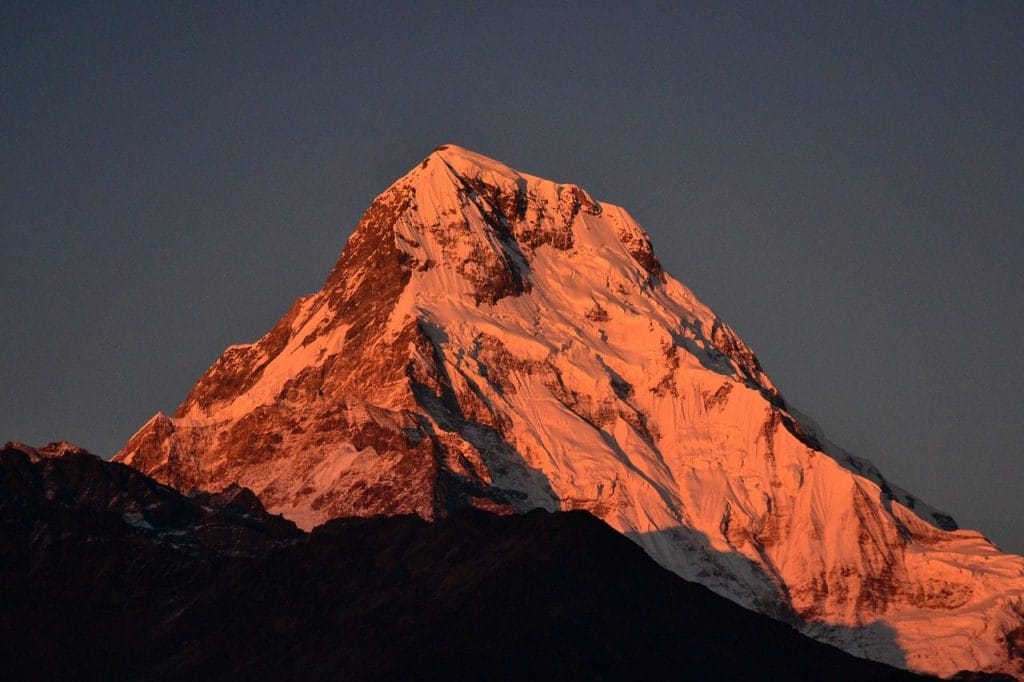
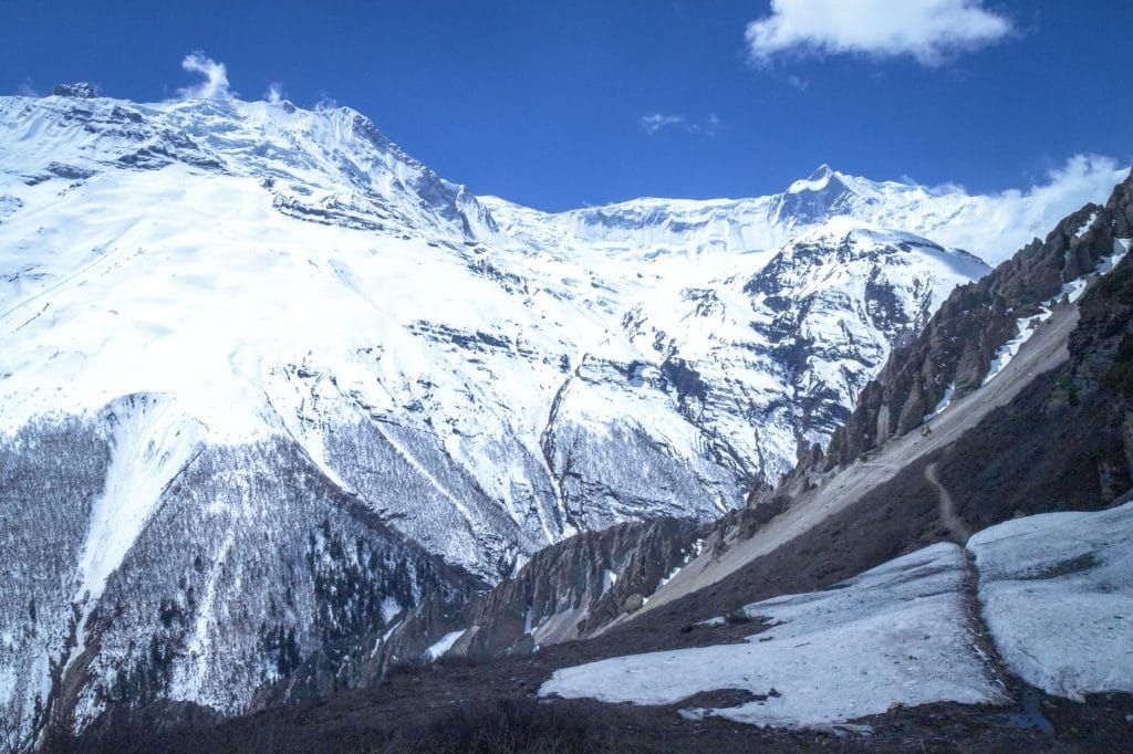
9-day route along the Panchase Trek. Daily walking involves stone stairs, forest paths, and ridge crossings with clear morning views of Annapurna and Dhaulagiri.
Key Trail Realities
What to expect along the route
Annapurna Foothill Ridge Views
Clear morning vantage points across the Annapurna and Dhaulagiri ranges before valley clouds accumulate by noon.
Panchase Hill Summit Climb
Steep stone stair ascents leading to the highest point at 2,500m featuring a stone shrine and unobstructed mountain panoramas.
Traditional Gurung and Brahmin Settlements
Traverse terraced agricultural fields and rural stone-built villages with traditional slate roofs and family-run teahouses.
Pumdi Bhumdi Ridge Traverse
Undulating woodland trails winding through dense rhododendron and oak forests above the Phewa Lake watershed.
Pokhara Valley Trailhead Access
Short local taxi or private jeep transfers from Lakeside Pokhara to the initial trail start points at Kande or Bhadaure.
Low Altitude Accessible Trekking
No high-altitude risks or technical climbing required, making this route suitable for hikers seeking moderate physical effort below 3,000m.
Local Homestay and Teahouse Infrastructure
Simple shared accommodation and basic dal bhat meals prepared over firewood stoves by resident families.
Year-Round Seasonal Access
Traversable during spring and autumn seasons, with clear skies and rhododendron blooms peaking between March and April.
Trail Photos & Videos
High-definition captures and video clips from Himalayan passes, glacial lakes, Sherpa villages, and mountain summits.



Panchase Trek (4 Days) Trail Map
Interactive OpenStreetMap topographic trail map tracing the route.
Key High-Altitude Stops
Compatible with Garmin, Apple Watch, Strava & Gaia GPS
Panchase Trek (4 Days) Weather Center
Real-time mountain weather and 5-day altitude forecasts across key Panchase Trek (4 Days) waypoints.
Loading weather for ...
Choose waypoint
Altitude Chart & Acclimatization Nodes
Strict adherence to "Hike High, Sleep Low" ensures safe high-altitude adaptation.
Complete Itinerary Route
Explore the detailed day-by-day routing, acclimatization schedule, and trek milestones.
Pokhara to Kande and Trek to Australian Camp (2,060m)
Drive from Pokhara to Kande in approximately one hour, starting the uphill climb through stone steps and rhododendron forests. Reach Australian Camp by midday for clear views of the Annapurna range before resting for the evening.
Australian Camp to Pothana and Forest Camp (2,550m)
HighlightLeave Australian Camp through the small settlement of Pothana, entering dense jungle dominated by moss-covered oaks and maple trees. The trail ascends steadily along a ridge without steep drops, bringing you into Forest Camp by mid-afternoon.
Forest Camp to Low Camp (2,990m)
Climb higher through the damp tree line where rhododendrons give way to stunted conifers and alpine shrubs. As elevation increases, gaps in the canopy reveal closer angles of Machhapuchhre (Fishtail) looming directly overhead.
Low Camp to High Camp (3,580m)
HighlightBreak out above the tree line onto an exposed ridge trail subject to strong afternoon winds. Watch the surrounding peaks emerge into full view as the terrain transitions to open alpine tundra leading directly to High Camp.
High Camp to Mardi Himal Viewpoint (4,250m) and Down to Low Camp
HighlightStart before dawn across a narrow ridge path to reach the upper viewpoint beneath Mardi Himal. After taking in the panoramic basin surrounded by Annapurna South and Hiunchuli, retrace your steps downward to Low Camp.
Low Camp to Siding Village (1,750m)
HighlightDescend off the main ridge via a less-traveled trail that drops steeply through farming terraces and rural hamlets. Arrive in Siding, a traditional Gurung village removed from the main tourist routes, offering authentic local accommodation.
Siding Village to Lumre and Drive to Pokhara (827m)
Walk alongside the Mardi Khola river past sub-tropical fields and small water mills until reaching the road head at Lumre. Meet your transport vehicle for the final scenic drive back to Pokhara.
Buffer / Contingency Day in Pokhara (827m)
Use this scheduled buffer day to account for any unexpected weather delays on the trail or relax by Phewa Lake. Review permit records and prepare your gear for the conclusion of the 9-day route.
Departure from Pokhara or Transfer to Kathmandu
Check out from your Pokhara hotel and transfer to the tourist bus station or airport for your return journey to Kathmandu or onward travel destinations.
What's Covered & What's Not
A clear breakdown so you know exactly what to budget for and what's already taken care of.
Required Trail Permits
- Annapurna Conservation Area Project (ACAP) entry permit and local municipality registration cards.
Local Transport
- Shared bus or private taxi connection from Pokhara to the initial trailhead at Kande or Ghatte Khola.
Teahouse Accommodation
- Basic twin-share lodge room along the ridge villages, typically inexpensive if meals are purchased at the same lodge.
Licensed Guide / Porter
- Local certified guide or porter services if booking through a registered local trekking agency.
International Flights
- Airfare from your home country into Tribhuvan International Airport in Kathmandu.
Nepal Tourist Visa
- On-arrival tourist visa fee ($30 USD for 15 days, $50 USD for 30 days, payable in cash or major currencies).
Emergency Evacuation Insurance
- Mandatory travel policy covering emergency rescue and medical expenses for hill walking.
Trail Incidentals
- Hot showers, device charging fees, Wi-Fi access codes, and bottled water or purification supplies.
Trail Meals & Hydration Rules
What to eat for stamina and altitude safety
Dhal Bhat Power
Rice, lentil soup, spiced potato, and spinach. Always comes with free refills to refuel after long trail hours.
Garlic Soup
Thin clear garlic broth. Local guides consume this daily to help with blood circulation and warmth.
Boiled & Fried Potatoes
Dense carbohydrate source served with local cheese or chili paste in ridge settlements.
Tibetan Bread & Honey
Deep-fried puffed flatbread. Hearty breakfast before an early morning climb.
Boiled Water Bottles
Buy boiled water at lodges and keep the bottle inside your sleeping bag for night warmth.
Ginger Lemon Honey Tea
Warm drink that cuts dry mountain air irritation and stays hot in an insulated flask.
Electrolyte Packs
Add one electrolyte sachet to water daily to replace salts lost on steep stair climbs.
Water Purification Drops
Use Aquatabs or chlorine dioxide tablets for tap water; wait the full 30 minutes before drinking.
Vegetarian Focus
Vegetarian dhal bhat and noodle dishes are the freshest and safest food on the route.
Naturally Gluten-Free
Rice dishes, plain boiled potatoes, and corn porridge provide reliable gluten-free energy.
Black Tea Option
Ask for black tea without milk if you are lactose sensitive or avoid powdered milk.
Lodge Kitchen Flexibility
Cooks can adjust spice levels or prepare plain rice upon request if ordered early.
No Meat Above Mid-Elevations
Meat carried up without refrigeration can spoil quickly. Stick to vegetarian meals.
No Alcohol During Ascents
Alcohol causes rapid dehydration and impairs physical coordination on steep stone steps.
Never Drink Untreated Water
Never drink directly from village taps or forest streams without filtration or purification.
Skip Raw Salads
Stick to thoroughly cooked hot vegetables to prevent stomach bugs.
Trip Preparation & Rules
Paperwork, transport logistics, and cash guidelines
Passport & Tourist Visa
Ensure your passport is valid for at least six months beyond arrival. Tourist visas are issued on arrival at Tribhuvan International Airport in Kathmandu, payable in cash.
Rescue Insurance Verification
Confirm your insurance policy explicitly covers emergency helicopter evacuation up to the maximum elevation of the route. Carry a printed copy of your policy and emergency contact numbers.
Passport-Sized Photographs
Keep four physical passport-sized photos in your daypack. They are required for local municipality registration and trail permits.
Conservation Area Entry Permits
All required regional conservation permits and local fees must be secured before starting the trek. Check current counter requirements in Kathmandu or Pokhara.
TIMS Card Alternatives
Standard Trekkers' Information Management System (TIMS) cards are replaced by local municipality permits and conservation entry fees depending on the exact regional jurisdiction.
Mountain Transport Luggage Limits
If your itinerary includes domestic mountain flights or regional transfers, pack efficiently. Check baggage weight limits with your transport operator to avoid overweight fees.
Road Transfer Flexibility
Expect variable road conditions during monsoon and winter seasons. Build extra buffer days into your travel schedule to account for potential highway delays.
Nepalese Rupee Cash Reserve
Exchange sufficient cash in Kathmandu or Pokhara before departure. ATMs are unreliable or completely absent along remote trail sections.
Small Denominations for Teahouses
Carry plenty of smaller banknote denominations (Rs 100, Rs 500). Teahouse operators struggle to provide change for large Rs 1,000 notes for minor purchases.
Trail Customs & Rules
Practical rules for passing animals, stupas, and village paths
Pass Stupas Clockwise
- •Always keep Mani stones, chortens, and prayer walls on your right side.
- •Spin prayer wheels in a clockwise direction only.
- •Never climb on top of stone monuments or sit on inscribed prayer stones.
Pack Animal Right-of-Way
- •Step to the mountain wall side when mule trains or yaks pass.
- •Never stand on the outer cliff edge where animals can bump you.
- •Wait until the entire caravan clears before resuming your pace.
Photography Protocols
- •Ask permission before photographing elders, children, or working villagers.
- •Avoid flash photography inside dark monastery prayer rooms.
- •Drop a small cash contribution into the donation box when visiting local gompas.
Waste Management
- •Carry empty wrappers and plastic trash back out to urban waste bins.
- •Avoid throwing non-biodegradable wet wipes into lodge pit toilets.
- •Treat tap or stream water with purification tablets to reduce single-use plastic reliance.
Lodge & Homestead Boundaries
- •Remove muddy boots before stepping onto indoor wooden dining room floors.
- •Keep voice volume down in shared teahouse sleeping quarters after 9:00 PM.
- •Settle all extra evening snack and drink bills before breakfast departure.
Local Interactions
- •Greet locals with a palms-together 'Namaste' nod.
- •Dress respectfully in modest clothing covering shoulders and knees near villages.
- •Refrain from distributing loose candy or cash to children to prevent begging habits.
Permits & Emergency Directory
Current permit fee structures and official emergency contacts
Required Permits & Mandatory Fees
-
📜Annapurna Conservation Area Permit (ACAP) NPR 3,000
Required for all trekkers entering the Annapurna region. Obtainable at the Nepal Tourism Board in Kathmandu or Pokhara.
-
📜TIMS Card (Trekkers' Information Management System) NPR 2,000
Mandatory registration card required for tracking and safety monitoring across designated trekking routes.
-
☘️Local Municipality Entry Fee NPR 1,000
Collected at regional checkpoints by local rural municipalities to fund trail maintenance and local infrastructure.
Nepal Tourism Directory
Official contact channels for permits, park regulations, and emergency rescue assistance.
Power, Connectivity & Showers
Realistic day-to-day guide for charging, phones, and hygiene
Device Charging
Teahouses charge between 300 and 600 Nepali Rupees per device or power bank in the dining hall. Solar power is standard at higher elevations, so bring a high-capacity power bank and spare camera batteries.
Mobile SIM & Data
Nepal Telecom (NTC) and Ncell signals work intermittently through the lower sections of the route. Once deep into forested ridges and sheltered valleys, mobile data drops entirely until the next vantage point.
Hot Showers
Gas or solar-heated showers cost between 400 and 500 Rupees where available. Teahouses in upper altitudes rely on basic bucket water heated over a fire, while freezing temperatures often freeze pipe systems entirely.
Drinking Water
Single-use plastic bottles are discouraged and restricted across conservation areas. Carry two wide-mouth water bottles and treat natural sources using chlorine dioxide tablets, iodine, or a reliable micro-filter.
Trail Health & Emergency Protocols
Managing minor ailments and mountain emergencies on the route
Early Symptom Awareness
Watch for persistent morning headaches, loss of appetite, mild dizziness, and trouble sleeping. Do not brush these off as simple fatigue.
Practical Hydration
Count hot lemon, black tea, and garlic soup toward daily liquid intake to combat dry mountain air and mild dehydration.
Emergency Evacuation
Verify your insurance policy explicitly covers emergency helicopter rescue up to the maximum elevation of your trek before departure.
Medical Kit Essentials
Pack oral rehydration salts, blister care, ibuprofen for tension headaches, and personal prescriptions in your day pack.
The Decisive Action Rule
If a throbbing headache persists after taking two ibuprofen or if balance becomes unsteady, drop 500 to 1,000 meters immediately. Descending reverses severe altitude symptoms fast and saves lives.
Panchase Villages and Mid-Hill Ecology
Indigenous Gurung communities, sacred ridge sanctuaries, and sub-tropical forest wildlife across the lower Annapurna foothills
Gurung Homesteads & Stone Architecture
Traditional slate-roofed stone houses with well-tended courtyard gardens built by Gurung farming families.
Terraced Hillside Agriculture
Steep paddy fields and millet plots sculpted across steep slopes, reliant entirely on monsoon rains and mountain springs.
Local Tea & Homestay Culture
Community-managed village lodges where travelers share communal dining areas heated by wood-burning iron stoves.
Panchase Hillside Shrine
A sacred stone shrine at the high point of the forested ridge dedicated to local deities, drawing pilgrims during annual festivals.
Sacred Forest Groves
Protected patches of ancient oak and rhododendron forest surrounding local shrines where foraging and logging are traditionally prohibited.
Village Temples
Small roadside shrines and copper-bellied prayer poles marking the approach to rural hill settlements.
Mid-Hill Birdlife
Forested ridges shelter varied bird species, including kalij pheasants, laughing thrushes, and numerous woodpeckers.
Wild Orchid and Rhododendron Forests
Spring trails pass through dense stands of tree rhododendrons, wild orchids, and towering bamboo groves.
Forest Mammals
Rhesus macaques and barking deer inhabit the dense lower forest canopies along the river valleys and trailside ridges.
Essential Packing Checklist
Prepare 1 duffel bag (handled by porter team) and 1 daypack for personal warm layers & water.
Frequently Asked Questions
Honest answers about the Panchase Trek route