
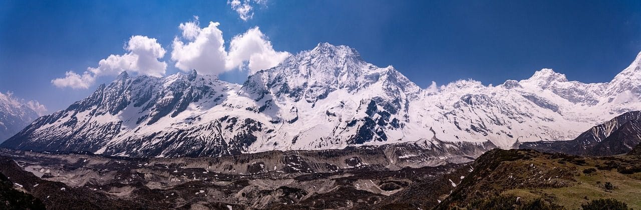
Manaslu Circuit with Tsum Valley Trek (19 Days) 19 Days Guide
Trail notes for Manaslu Circuit with Tsum Valley Trek. Daily walking hours, pass elevations, teahouse stops, and permit logistics.
Manaslu Circuit with Tsum Valley Trek
19-day route along the Manaslu Circuit and Tsum Valley. Daily climbs range from 400m to 900m on rock and stone stairs. Cold nights above 3,500m.
Key Trail Realities on the Manaslu Circuit and Tsum Valley
What to expect along the restricted border route and high mountain passes
Restricted Border Valley Permits
Requires both Manaslu and Tsum Valley restricted area permits, special conservation permits, and a licensed guide enforced by the Nepal Tourism Board.
Budhi Gandaki River Gorge
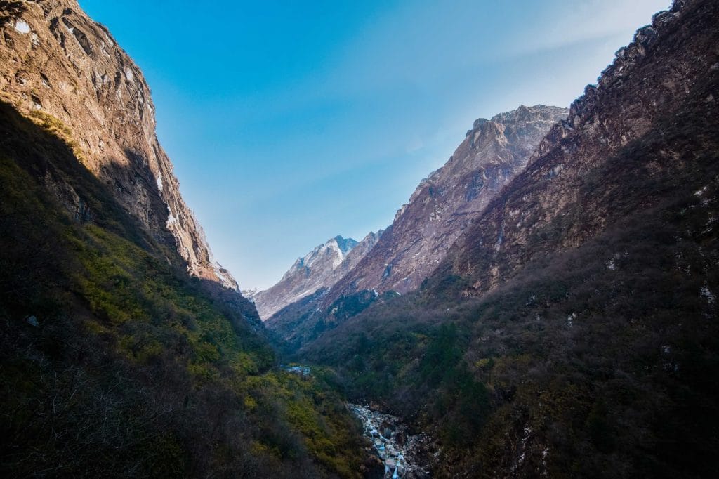
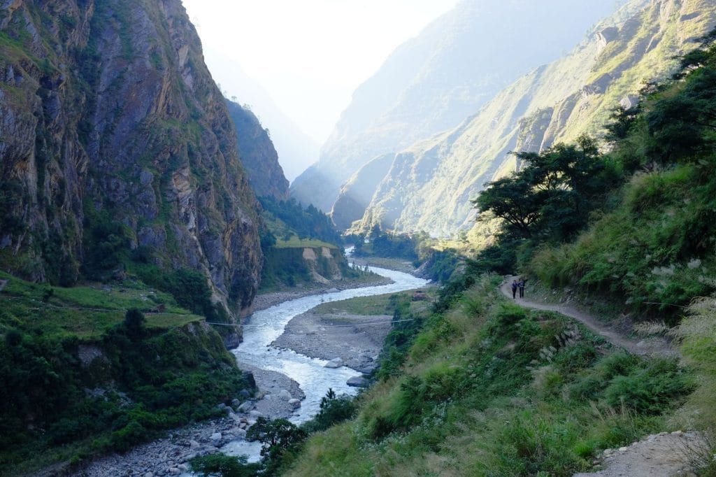
Traverse steep canyon walls via narrow suspended footbridges and carved stone stairs winding high above the rushing turquoise river.
Ancient Tibetan Buddhist Monasteries
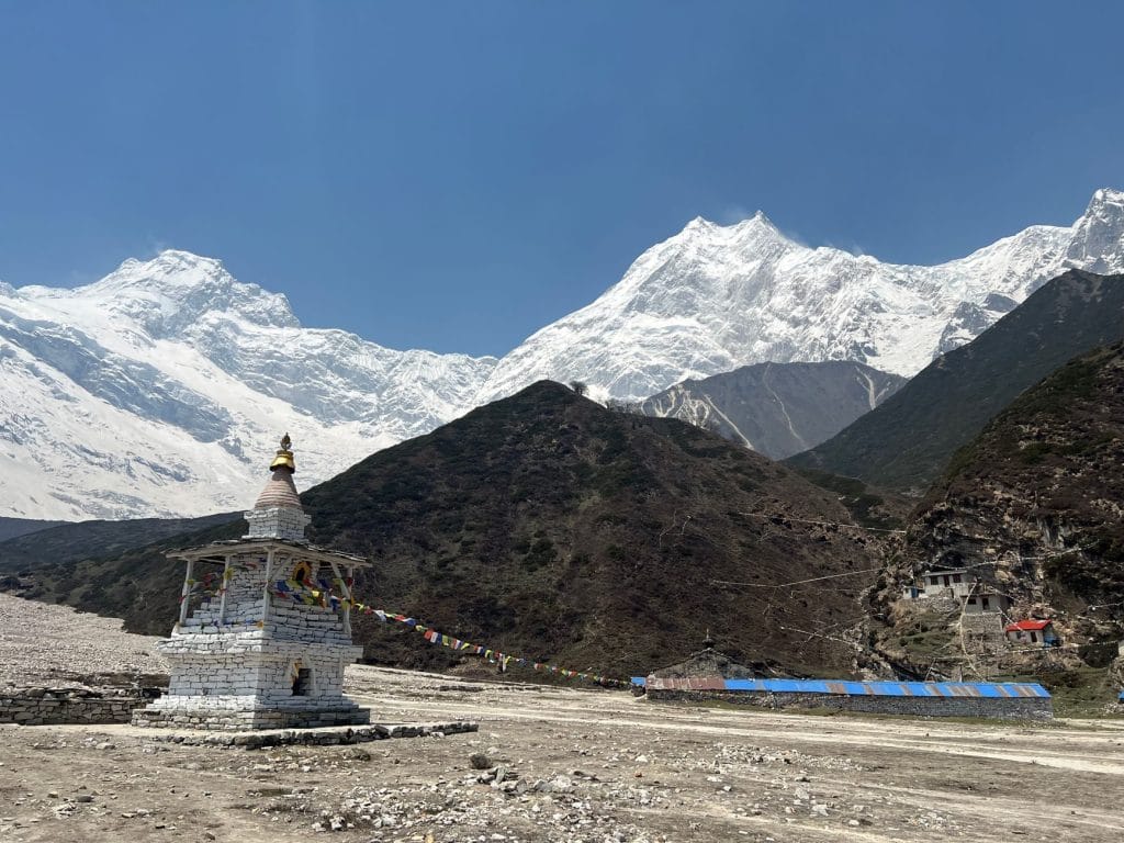
Explore isolated sanctuaries like Rachen Gompa and Mu Gompa, where stone-walled stone halls preserve centuries of Himalayan spiritual heritage.
Larkya La Pass Crossing
Climb steadily to the 5,106-meter summit point before dawn, navigating frozen moraine, slate scree, and deep ice ridges in sub-zero morning temperatures.
Tsum Valley Side Exploration
Venture deep into the sacred hidden valley of smiling people, flanked by the Ganesh Himal range and traditional Tibetan-style stone houses.
Remote Teahouse Infrastructure
Experience basic stone lodges heated by central yak-dung stoves, where charging devices and hot showers require small cash fees.
Gradual Acclimatization Ascent
Gain elevation slowly over two weeks, allowing red blood cells to multiply naturally before descending down the Annapurna foothills toward Dharapani.
Remote Road and Jeep Access
Begin the journey with an unpaved 4WD road transfer from Kathmandu to Machha Khola, navigating rough dirt tracks above hillside cliffs.
Trail Photos & Videos
High-definition captures and video clips from Himalayan passes, glacial lakes, Sherpa villages, and mountain summits.

Manaslu Circuit with Tsum Valley Trek (19 Days) Trail Map
Interactive OpenStreetMap topographic trail map tracing the route.
Key High-Altitude Stops
Compatible with Garmin, Apple Watch, Strava & Gaia GPS
Manaslu Circuit with Tsum Valley Trek (19 Days) Weather Center
Real-time mountain weather and 5-day altitude forecasts across key Manaslu Circuit with Tsum Valley Trek (19 Days) waypoints.
Loading weather for ...
Choose waypoint
Altitude Chart & Acclimatization Nodes
Strict adherence to "Hike High, Sleep Low" ensures safe high-altitude adaptation.
Complete Itinerary Route
Explore the detailed day-by-day routing, acclimatization schedule, and trek milestones.
Kathmandu to Machhedikhola
The journey starts with a long, bumpy jeep drive out of Kathmandu following the Trishuli river before heading north. The road turns unpaved and dusty past Dhading, hugging the cliffside above the Buri Gandaki river. Expect heavy traffic early on and rough terrain as you arrive at Machhedikhola by late afternoon.
Machhedikhola to Jagat
HighlightYou cross several suspension bridges over the raging Buri Gandaki river and navigate rocky steps carved into steep stone faces. The trail passes through Khorlabesi and past natural hot springs at Tatopani before climbing a steep stone staircase to Jagat. Check in your restricted area permits here at the checkpoint.
Jagat to Lokpa
The path ascends past Salleri and lowers down to a wide gravel riverbed before a steep, exposed climb toward the Tsum Valley split. You tackle hundreds of stone steps carved into the sheer cliff walls above the narrowing gorge. Lokpa is the official gateway settlement guarding the hidden valley.
Lokpa to Chumling
HighlightThe trail traverses pine forests and crosses the Lungdang Khola on a sturdy wooden bridge with steady upward gradients. You catch your first clear glimpses of the towering Ganesh Himal range framing the upper valley. Chumling greets you with traditional stone houses, mani walls, and barley fields.
Chumling to Chhekampar
HighlightYou cross a long suspension bridge over the Shyar Khola and walk through open farming valleys dotted with ancient chortens. The wind picks up significantly as you enter the wider plateau of Upper Tsum. Chhekampar offers sweeping valley views and cold night temperatures requiring extra layers.
Chhekampar to Nile
The trail meanders gently past ancient monasteries, extensive mani walls, and traditional stone villages like Lar. Altitude begins to make the morning uphill sections feel heavier, so maintain a slow and steady pace. Nile sits near the Tibetan border, featuring flat-roofed houses and yak dung fuel stacks.
Nile to Mu Gompa and back to Chhule
HighlightA steady morning climb brings you up to Mu Gompa, the largest and highest monastery in the Tsum Valley. The thin air at this elevation demands hydration and deliberate breathing on the steeper inclines. You explore the ancient prayer halls before descending slightly to overnight at Chhule.
Chhule to Rachen Gompa
The route tracks back down the valley along the western bank of the Shyar Khola on easy dirt paths. You visit Rachen Gompa, a historic nunnery housing large clay statues and vivid murals of Buddhist saints. The afternoon wind sweeps down the valley floor, bringing a noticeable chill.
Rachen Gompa to Deng
You retrace your steps down the forested gorge, dropping elevation rapidly through Lokpa back to the main trail junction. The descent tests your knees on steep, uneven stone steps and loose dirt tracks. Deng marks your return to the main Manaslu circuit route amidst dense bamboo.
Deng to Namrung
HighlightThe trail climbs steadily through cascading waterfalls, pine forests, and small settlements displaying distinct Tibetan Buddhist culture. You cross the Buri Gandaki on a high bridge and climb stone switchbacks toward the Bihi Phedi junction. Namrung features well-built lodges and marks the transition into alpine terrain.
Namrung to Sama Gaon
HighlightYou pass through Lho village, offering a massive upfront view of Manaslu rising directly above the valley. The trail levels out as you enter wide glacial valleys dominated by scrub and pine. Sama Gaon is a large traditional village where you will spend an extra day acclimatizing.
Acclimatization Day in Sama Gaon
AcclimatizationAn active rest day designed to help your body adapt to the rising altitude before crossing the pass. Most trekkers hike up toward Pung Gyen Gompa or the Birendra Lake moraine for sweeping views of the glacier. Nights here drop well below freezing, and teahouses lack indoor heating.
Sama Gaon to Samdo
HighlightThe trail climbs gently through juniper and birch woods past stone walls and yak pastures beneath the towering peaks. The air feels noticeably thinner, making even moderate uphills require a slower cadence and frequent water breaks. Samdo is a harsh, windy settlement sitting close to the Tibetan border.
Acclimatization Day in Samdo
AcclimatizationYou take a short acclimatization hike up the ridge behind the village toward the old trade route leading to Tibet. The climb exposes you to cold mountain winds, requiring windproof outer layers and a steady pace. Return to Samdo by early afternoon to rest and hydrate thoroughly.
Samdo to Dharamsala (Larkya Phedi)
HighlightThe trail crosses the Gyacho Khola on a wooden bridge and climbs steadily along a barren, rocky valley slope. Vegetation disappears entirely as you reach Dharamsala, a stark stone outpost serving as base camp for the pass. Accommodations here are basic and crowded, and water freezes overnight.
Dharamsala over Larkya La Pass to Bimtang
HighlightYou start before dawn in freezing darkness, climbing a steep moraine ridge toward the prayer-flagged Larkya La pass. The final ascent is grueling due to ice, scree, and thin air at high altitude. The long descent down loose gravel requires careful footing before leveling out at Bimtang.
Bimtang to Tilije
HighlightThe trail descends rapidly through pine forests, rhododendron bushes, and open pasture land along the Dudh Khola. You pass temporary herder huts at Sangure Kharka before dropping into the warmer, greener Marshyangdi river valley. Tilije is a large village with stone-paved paths and lower-altitude air.
Tilije to Dharapani to Besisahar
A short morning walk brings you down to Dharapani where you join the classic Annapurna Circuit trekking route. You board a local four-wheel-drive jeep for the rough, unpaved road journey down to Besisahar. Expect a bumpy ride along cliffside tracks overlooking the Marsyangdi river.
Besisahar to Kathmandu
The final travel day involves a standard tourist bus or private jeep ride from Besisahar back to Kathmandu. The highway follows the Marshyangdi and Trishuli rivers through terraced hills and roadside towns. Traffic delays entering the Kathmandu valley are common by late afternoon.
What's Covered & What's Not
A clear breakdown so you know exactly what to budget for and what's already taken care of.
Manaslu Conservation Area Permit (MCAP)
- Mandatory entry permit for the conservation zone.
Annapurna Conservation Area Permit (ACAP)
- Required for the western descent trail connection down through Dharapani.
Tsum Valley Restricted Area Permit
- Special entry authorization required for the upper Tsum Valley branch.
Licensed Guide / Porter Services
- Certified trekking guide and porter required by current Nepal Tourism Board regulations.
International Flights
- Airfare from your home country into Kathmandu.
Nepal Tourist Visa
- On-arrival tourist visa fee purchased at Tribhuvan International Airport.
High-Altitude Medical Insurance
- Mandatory travel insurance policy covering emergency evacuation above 5,000 meters.
On-Trail Incidentals
- Hot showers, electronic device charging fees, Wi-Fi tokens, and bottled or boiled drinking water.
Trail Meals & Hydration Rules
What to eat for stamina and altitude safety
Dhal Bhat Power
Rice, lentil soup, spiced potato, and spinach. Always comes with free refills to refuel after 6 hours on trail.
Garlic Soup
Thin clear garlic broth. Local guides drink this daily above 3,500m to help with blood circulation and warmth.
Boiled & Fried Potatoes
Dense carbohydrate source served with local cheese or chili paste in high settlements.
Tibetan Bread & Honey
Deep-fried puffed flatbread. Hearty breakfast before an early morning climb.
Local Noodle Soup
Thick vegetable and hand-pulled flour noodle soup served steaming hot.
Boiled Eggs
Safe, reliable protein source available every morning at lodge kitchens.
Boiled Water Bottles
Buy boiled water at night and keep the bottle inside your sleeping bag for warmth.
Ginger Lemon Honey Tea
Warm drink that cuts the dry mountain cough and stays hot in an insulated thermos.
Electrolyte Packs
Add one electrolyte sachet to 1L of water daily to replace salts lost on steep ascents.
Water Purification Drops
Use Aquatabs or chlorine dioxide tablets for tap water; wait full 30 minutes before drinking.
Vegetarian Focus
Vegetarian dhal bhat and veg noodles are always the freshest food on high trails.
Naturally Gluten-Free
Rice dishes, plain boiled potatoes, and buckwheat porridge are naturally gluten-free.
Black Tea Option
Ask for black tea to avoid powdered milk if you are lactose sensitive.
Lodge Kitchen Flexibility
Cooks can prepare food with less chili or no salt upon request if you ask before 5:00 PM.
No Meat Above 3,500m
Meat is carried up on foot for days without refrigeration. Stick to vegetarian meals high up.
No Alcohol at High Camp
Alcohol causes rapid dehydration and masks early symptoms of altitude sickness.
Never Drink Untreated Water
Never drink directly from village taps or streams without filtration or purification tablets.
Skip Raw Salads
Stick to thoroughly cooked hot vegetables to prevent stomach upsets.
Essential Route Preparation & Rules
Paperwork, physical conditioning, and financial logistics for the trail
Valid Passport & Tourist Visa
Passport must have at least 6 months remaining validity. Obtain your 30-day tourist visa on arrival at Tribhuvan International Airport using cash USD.
Mandatory Rescue Insurance
Ensure your policy explicitly covers high-altitude emergency helicopter evacuation up to 5,500m+ without exception.
Passport-Sized Photographs
Carry four physical passport photos for restricted area paperwork and local SIM registration desks.
Manaslu Conservation Area Permit (MCAP)
Required conservation entry fee for entering the protected northern drainage.
Tsum Valley Restricted Area Permit
Mandatory special entry permit for the Tsum Valley branch, requiring a registered agency and licensed guide.
Annapurna Conservation Area Permit (ACAP)
Required upon crossing the Larkya La pass downward into the Annapurna sector.
Soti Khola Road Transfer
The journey begins via a rugged dirt jeep track from Kathmandu to Soti Khola, taking 7 to 9 hours depending on monsoon road damage.
Bag Weight Discipline
Keep your main duffel bag packed efficiently for porter transport or jeep roof storage.
Nepali Rupee Cash Reserve
ATMs cease to exist beyond Arughat. Carry sufficient cash in Nepalese Rupees for tea houses, hot showers, and battery charging.
Small Denomination Notes
Carry plenty of Rs 100 and Rs 500 notes. Teahouse operators cannot break Rs 1,000 notes for small trail purchases.
Trail Customs & Rules
Practical rules for passing animals, stupas, and village paths
Pass Stupas Clockwise
- •Always keep Mani stones, chortens, and prayer walls on your right side.
- •Spin prayer wheels in a clockwise direction only.
- •Never sit or place gear on carved prayer stones.
Pack Animal Right-of-Way
- •Step toward the mountain wall when yaks, mules, or dzopkyos pass on narrow trails.
- •Never stand on the outer cliff edge as loose pack animals can nudge past you.
- •Wait until the entire caravan clears before resuming your pace.
Photography and Monasteries
- •Ask permission before photographing village residents or elders.
- •Keep cameras off inside active monastery prayer halls unless explicitly permitted by monks.
- •Contribute a small cash donation in the monastery box when entering sacred spaces.
Waste and Water Discipline
- •Carry all non-biodegradable trash, including wrappers and batteries, out of the valley.
- •Avoid throwing wet wipes or plastic trash into pit toilets.
- •Purify tap water with chlorine dioxide or a filter rather than purchasing disposable plastic bottles.
Village and Cultural Respect
- •Dress modestly in Tibetan-influenced villages by covering shoulders and knees.
- •Remove footwear before entering teahouse dining rooms or local homes.
- •Ask before stepping into private courtyards or agricultural storage sheds.
Camp and Lodge Courtesy
- •Keep noise levels low in teahouse common areas after 9:00 PM as locals and guides sleep early.
- •Pay for phone charging and hot showers directly to lodge owners without haggling.
- •Support your lodge by purchasing breakfast, dinner, and hot drinks where you sleep.
Permits & Emergency Directory
Current permit fee structures and official emergency contacts for the Manaslu region
Required Permits & Mandatory Fees
-
📜Manaslu Conservation Area Permit (MCAP) NPR 3,000
Mandatory entry permit for the Manaslu Conservation Area, obtainable through registered trekking agencies at NTB Kathmandu or Pokhara.
-
📜Manaslu Restricted Area Permit (RAP) $100 USD (first 7 days)
Required special permit for restricted sections from Jagat up to Dharamshala, with an additional $15 USD per day charge beyond the first week during autumn and spring.
-
📜Tsum Valley Restricted Area Permit $40 USD (first 7 days)
Special entry permit required specifically for the Tsum Valley branch, with an additional $7 USD per day charge after the initial week.
-
📜Annapurna Conservation Area Permit (ACAP) NPR 3,000
Required because the Manaslu Circuit exit route descends past Dharapani and connects into the Annapurna conservation checkpoint.
Nepal Tourism Directory
Official contact channels for permits, park regulations, and emergency rescue assistance.
Power, Connectivity & Showers
Realistic day-to-day guide for charging, phones, and hygiene
Device Charging
Charging costs Rs 300 to 600 per device in dining rooms, with prices rising past Samagaun. Carry a high-capacity power bank and a USB-C PD cable.
Mobile SIM & Wi-Fi
NTC cellular coverage works in the lower Budi Gandaki valley and parts of Tsum, but drops out near Lho, Sama, and Dharamsala. Airlink satellite Wi-Fi cards are available at lodges for a separate fee.
Hot Showers
Gas or solar-heated showers cost between Rs 400 and 700. Above 3,500m, indoor bathrooms are unheated and uninsulated, making hot showers a significant risk for rapid chilling.
Battery Preservation
Cold mountain temperatures drain lithium-ion batteries rapidly. Keep phones, cameras, and power banks inside your sleeping bag at night to retain charge.
Altitude Safety & Health
How to handle altitude symptoms and emergency protocols
Daily Symptom Monitoring
Watch closely for early AMS signs: persistent headache, loss of appetite, nausea, dizziness, and insomnia.
Helicopter Evacuation
In case of severe HAPE or HACE, guides dispatch emergency rescue helicopters to Kathmandu hospitals.
Satellite SOS Communication
Carry a Garmin inReach or ensure your guide carries satellite SOS for dead-zone sections.
Hydration and Electrolytes
Drink 3 to 4 liters daily, factoring in hot lemon, black tea, and garlic soup alongside treated water.
The Golden Altitude Rule
If you have a headache, nausea, or dizziness, do NOT ascend. If symptoms worsen after resting, descend 300 to 500 meters immediately. Descent is the only guaranteed cure.
Highland Villages & Wildlife
Indigenous communities and wildlife along the trail
Nubri and Tsum Tibetan Culture
Distinct Tibetan-origin communities with ancient dialects, flat-roofed stone settlements, and traditional polyandry practices.
Traditional Hearth & Hospitality
Stone teahouses warmed by central wood stoves where travellers gather in the evening.
Hand-Woven Wool Craftsmanship
Hand-spun sheep and yak wool woven into warm blankets and winter wear by village families.
Mu Gompa and Rachen Gompa
Centuries-old Buddhist monasteries perched on high cliff edges serving as spiritual centers for the Tsum Valley.
Prayer Flags & Mani Walls
Extensive stone walls carved with sacred Buddhist mantras lining paths approaching high settlements.
Sacred Mountain Peaks
Mount Manaslu and Ganesh Himal massifs revered locally as spiritual guardians and abodes of protective deities.
Himalayan Tahr & Snow Leopards
Rugged alpine terrain supporting elusive snow leopards, Himalayan tahr, and blue sheep in upper valleys.
Rhododendron and Pine Forests
Lower gorge trails passing through dense subtropical pine, oak, and vibrant spring rhododendron forests.
Alpine Raptors
Golden eagles and lammergeiers soaring above high river gorges and glacial valley walls.
Essential Packing Checklist
Prepare 1 duffel bag (handled by porter team) and 1 daypack for personal warm layers & water.
Frequently Asked Questions
Honest answers about the Manaslu Circuit with Tsum Valley Trek route