

Tsum Valley & Ganesh Himal Base Camp Trek (11 Days) 11 Days Guide
Trail notes for Tsum Valley & Ganesh Himal Base Camp Trek. Daily walking hours, pass elevations, teahouse stops, and permit logistics.
Tsum Valley & Ganesh Himal Base Camp Trek
11-day route along Tsum Valley & Ganesh Himal Base Camp Trek. Daily climbs range from 400m to 900m on rock and stone stairs. Cold nights above 3,500m.
Essential Route Features
What defines this trail
Restricted Valley Isolation
Traverse the restricted cultural enclave of the upper valley where traditional stone-walled villages and ancient monasteries remain largely preserved from mass tourism.
Ganesh Himal Base Camp Approach
Climb through remote sub-alpine forests and rocky alpine meadows directly toward the dramatic amphitheater beneath the Ganesh Himal massif.
Budhi Gandaki River Gorges
Follow steep mountain trails carved into vertical rock faces, crossing suspension bridges high above roaring glacial river waters.
Tibetan-Influenced Heritage
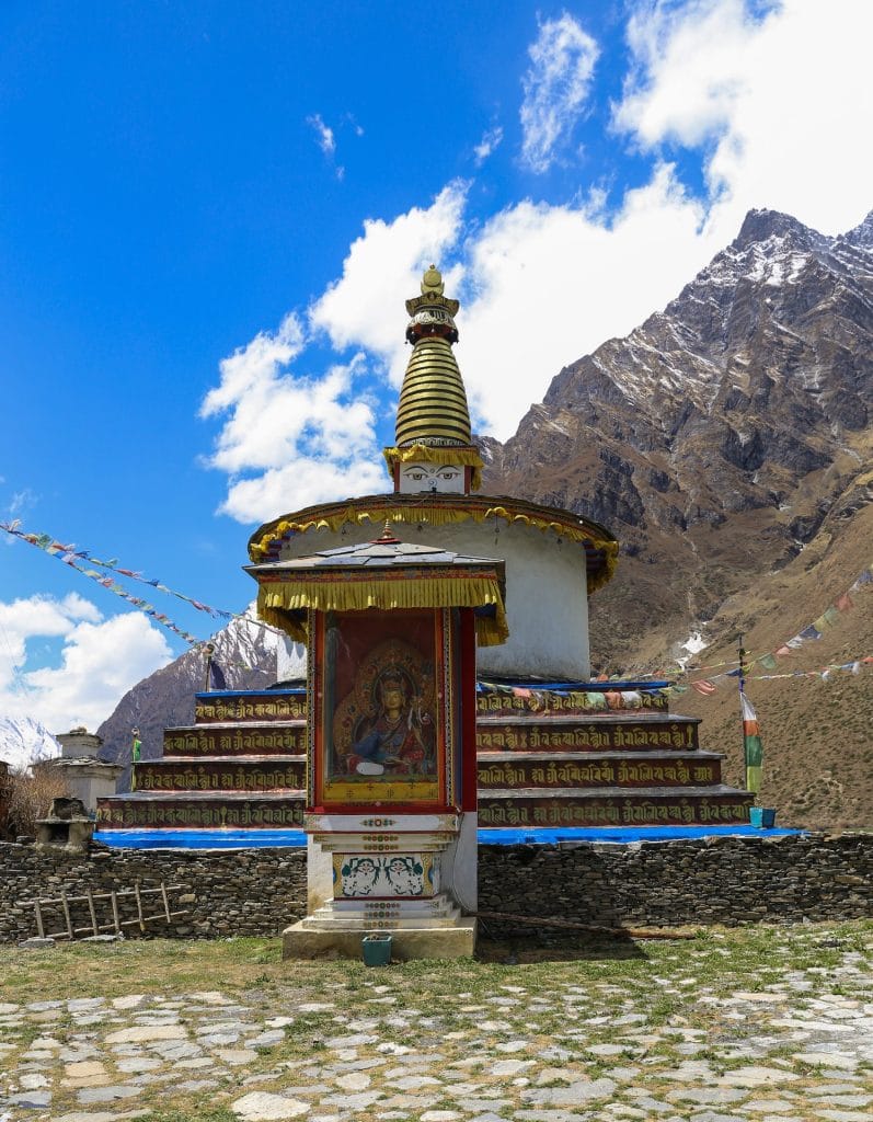
Observe traditional flat-roofed stone houses, mani walls, and active chortens reflecting historical and cultural ties to neighboring Tibet.
Gradual Valley Elevation Gain
Ascend progressively through river valleys from subtropical forest zones up to high alpine grazing pastures near base camp.
Remote Teahouse Infrastructure
Stay in basic family-run lodges featuring communal wood-stoved dining rooms and simple twin-share rooms without modern amenities.
Restricted Area Permit Requirement
Access the trail under mandatory government regulations requiring a licensed guide, a minimum of two trekkers, and special restricted area entry permits.
High Alpine Ridge Viewpoints
Reach high elevation ledges offering clear morning panoramas of glaciated peaks, deep river canyons, and surrounding Himalayan ridges.
Trail Photos & Videos
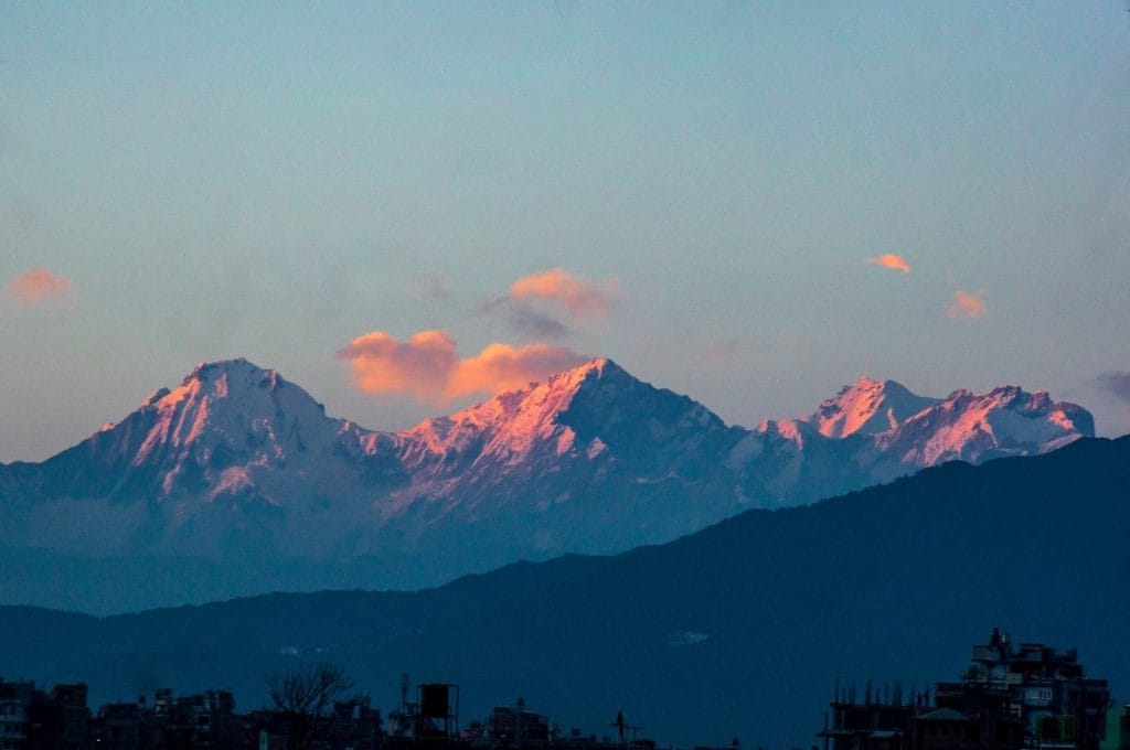
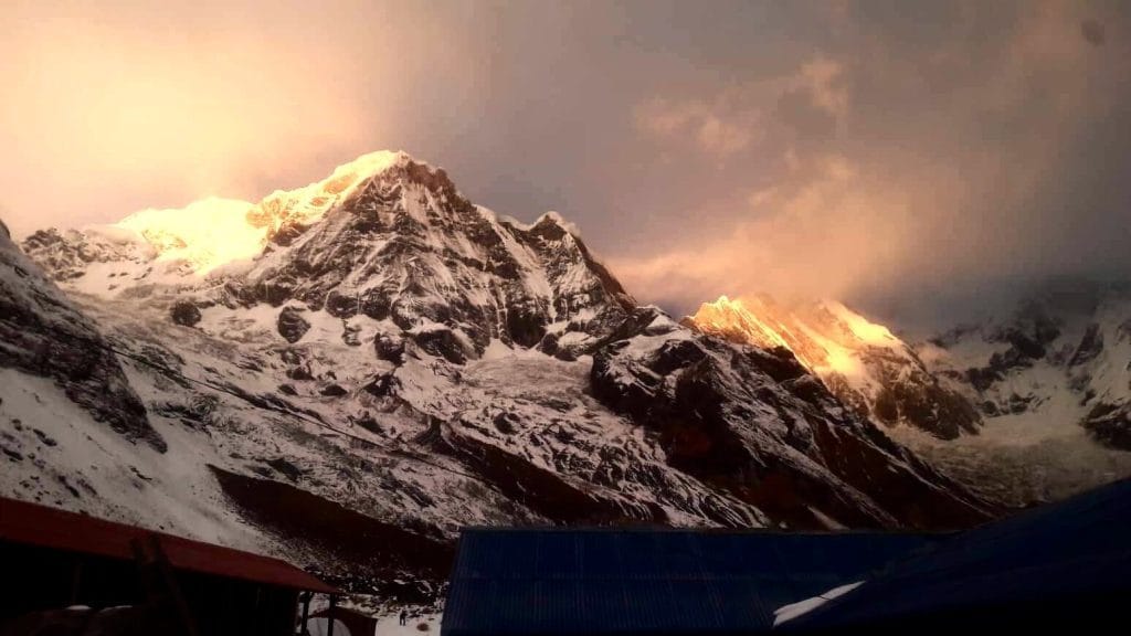
High-definition captures and video clips from Himalayan passes, glacial lakes, Sherpa villages, and mountain summits.


Tsum Valley & Ganesh Himal Base Camp Trek (11 Days) Trail Map
Interactive OpenStreetMap topographic trail map tracing the route.
Key High-Altitude Stops
Compatible with Garmin, Apple Watch, Strava & Gaia GPS
Tsum Valley & Ganesh Himal Base Camp Trek (11 Days) Weather Center
Real-time mountain weather and 5-day altitude forecasts across key Tsum Valley & Ganesh Himal Base Camp Trek (11 Days) waypoints.
Loading weather for ...
Choose waypoint
Altitude Chart & Acclimatization Nodes
Strict adherence to "Hike High, Sleep Low" ensures safe high-altitude adaptation.
Complete Itinerary Route
Explore the detailed day-by-day routing, acclimatization schedule, and trek milestones.
Arrival in Kathmandu (1,350m)
Land at Tribhuvan International Airport and transfer to hotel. Afternoon gear check covers layered clothing, broken-in boots, and purification tablets. Evening briefing reviews restricted-area permits, daily altitude gains, and emergency evacuation protocol for the Tsum Valley section.
Kathmandu to Soti Khola (710m)
HighlightEarly departure on the Prithvi Highway to Dhading Besi, then rough mountain road along the Budhi Gandaki. Landslide delays are common after monsoon. Arrive mid-afternoon at the trailhead village; short walk to the river suspension bridge helps stretch legs before dinner.
Soti Khola to Machha Khola (900m)
HighlightTrail follows the Budhi Gandaki upstream through sal forest and Gurung settlements. Cross multiple suspension bridges; the section near Khorla Besi has exposed rockfall zones — move steadily. Machha Khola sits beside a sandy beach used by porters for washing; cold nights set in quickly here.
Machha Khola to Jagat (1,340m)
Steady climb past Tatopani hot springs (worth a quick soak if time allows). Trail narrows through a gorge before opening to Dobhan. Final ascent to Jagat is steep stone stairs; ACAP and Tsum Valley restricted-area permits are checked at the police post. Lodges here have solar charging — bring a power bank.
Jagat to Lokpa (2,240m)
Leave the main Manaslu circuit at Philim, turning north into the Tsum Valley. Trail climbs through pine and rhododendron forest with occasional views of Shringi Himal. Lokpa is the first Tsum village — stone houses, mani walls, and a small gompa. Temperature drops noticeably after sunset.
Lokpa to Chumling (2,386m)
HighlightGentle day crossing the Siyar Khola on a long suspension bridge, then traversing barley fields. Chumling (Lower Tsum) has a monastery with ancient murals and a clinic run by Himalayan Rescue Association volunteers. Good spot to test altitude tolerance — sleep at 2,386m after only 146m net gain.
Chumling to Chhekampar (3,010m)
HighlightSteady climb through pine forest to the upper valley. Pass Gho village with its distinctive chorten gateway. Chhekampar sits on a sunny plateau; Ganesh Himal I (7,422m) dominates the skyline. Lodges are basic — shared squat toilets, bucket showers only. Order garlic soup early; kitchen runs on limited gas.
Chhekampar to Mu Gompa (3,700m) via Nile (3,361m)
HighlightTrail contours above the Shiar Khola, passing Nile village and its nunnery. Final hour climbs steeply to Mu Gompa, the valley's highest monastery (founded 1895). Rooms are unheated; nights hit -10°C in October. Monks offer butter tea — accept politely. No meat served above Chhekampar per local Buddhist custom.
Mu Gompa to Ganesh Himal Base Camp (~4,300m) and return
HighlightPre-dawn start on moraine terrain toward the Ganesh Himal glacier lobe. Route follows a faint herder's track — cairns mark the way. Base Camp is a seasonal yak pasture with no facilities; turn back by noon before wind picks up. Descent tests knees; trekking poles essential. Dark urine or persistent headache means immediate return.
Mu Gompa to Chumling (2,386m)
HighlightLong descent retracing the valley floor. Pass Chhekampar by mid-morning; option to stop for dal bhat refill. Trail drops through rhododendron forest — slippery when wet. Chumling feels warm after nights at 3,700m. Check feet for blisters; wet socks from stream crossings are common.
Chumling to Jagat (1,340m), drive to Kathmandu
Final trekking day descends through Lokpa and Philim to Jagat. Jeep meets you at the roadhead for the bone-rattling return to Kathmandu. Traffic jams at Naubise add unpredictable delay. Arrive late evening; hot shower and proper bed feel like luxury. Permit copies returned to agency for restricted-area compliance.
What's Covered & What's Not
A clear breakdown so you know exactly what to budget for and what's already taken care of.
Manaslu Conservation Area Permit (MCAP)
- Mandatory entry permit required for entering the Manaslu region.
Tsum Valley Restricted Area Permit
- Special entry permit issued by the Department of Immigration for restricted upper Tsum settlements.
Local Transport
- Shared jeep connection from Kathmandu up to Soti Khola or Machha Khola trailhead.
Teahouse Accommodation
- Basic twin-share lodge room along the Tsum Valley trail.
International Flights
- Airfare from your home country into Tribhuvan International Airport.
Nepal Tourist Visa
- On-arrival tourist visa fee ($30 USD for 15 days, $50 USD for 30 days).
Helicopter Rescue Insurance
- Mandatory travel policy covering emergency helicopter evacuation up to 5,000 meters.
Trail Incidentals
- Hot showers, phone device charging, Wi-Fi tokens, and personal snacks.
Trail Meals & Hydration Rules
What to eat for stamina and altitude safety
Dhal Bhat Power
Rice, lentil soup, spiced potato, and seasonal greens. Always comes with free refills to refuel after long walking hours on the trail.
Garlic Soup
Thin clear garlic broth served in teahouses. High garlic intake helps with throat comfort and circulation in dry mountain air.
Boiled & Fried Potatoes
Dense carbohydrate source providing steady energy through steep village ascents.
Tibetan Bread
Deep-fried puffed flatbread that provides a heavy, calorie-dense breakfast before early morning departures.
Noodle Soup
Broth-based noodle dishes with local vegetables and egg, served steaming hot.
Boiled Eggs
Reliable protein source available at every lodge kitchen along the valley.
Boiled Water Refills
Purchase boiled water at lodges and fill insulated bottles. Keep a hot bottle inside your sleeping bag at night to prevent freezing.
Ginger Lemon Honey Tea
Hot tea that keeps the throat moist in cold air and counts toward daily fluid intake.
Electrolyte Sachets
Mix into water daily to replace minerals lost through heavy perspiration on steep climbs.
Purification Tablets
Carry chlorine dioxide or iodine tablets as a backup for tap or stream sources, allowing thirty minutes before drinking.
Vegetarian Focus
Vegetarian meals are the safest option on the mountain, prepared fresh daily from local produce.
Rice-Based Staples
Rice and potato dishes offer reliable carbohydrate energy without hidden gluten.
Black Tea Alternative
Order black tea without powdered milk if dairy causes digestive issues at altitude.
Early Kitchen Orders
Place dinner orders by 5:00 PM to give lodge operators time to prepare meals for the evening.
Meat Above 3,500 Meters
Meat carried up by porters lacks refrigeration and causes food poisoning risks in high settlements.
Alcohol at High Camp
Alcohol accelerates dehydration and masks dangerous symptoms of altitude sickness.
Untreated Tap Water
Never drink directly from village standpipes or streams without proper boiling or chemical treatment.
Raw Vegetables
Avoid uncooked salads and unpeeled fruit washed in local water sources.
Trip Preparation & Rules
Paperwork, permit requirements, and cash guidelines for the Tsum Valley approach
Passport & Tourist Visa
Ensure your passport is valid for at least 6 months past arrival. Secure a 30-day tourist visa on arrival at Kathmandu airport using cash USD or major credit cards.
Rescue Insurance Verification
Mandatory high-altitude insurance must explicitly cover emergency helicopter evacuation above 4,000 meters. Verify policy wording before departure.
Passport Photos
Carry 4 printed passport photos. They are required for restricted area permit paperwork and checkpoint registration logs.
Manaslu Conservation Area Permit
MCAP entry fee is required for all travelers entering the Budi Gandaki river valley and lower approach trails.
Tsum Valley Restricted Permit
Special restricted area permit is mandatory for entry beyond Philim into the Tsum Valley. Minimum two trekkers required alongside a licensed guide.
TIMS Card Alternative
Registered conservation permits and local municipality entry fees replace the standard TIMS card across restricted conservation zones.
Road Transfer Logistics
The route begins via a private jeep or local bus from Kathmandu up the Prithvi Highway to Soti Khola or Machha Khola.
Duffel Bag Allocation
If using porter support, keep individual duffel weight within practical limits for steep stone staircases and suspension bridges.
Road Delay Buffer
Build at least two buffer days into travel schedules to account for monsoon road blockages, landslides, or transport delays along dirt corridors.
Daily Cash Requirement
Carry sufficient Nepali Rupees to cover meals, tea, hot showers, and Wi-Fi tokens. Budget roughly 4,000 to 5,000 NPR daily.
Absence of ATMs
ATMs do not exist past Arughat or early trailheads. Withdraw all necessary cash in Kathmandu before starting the trek.
Small Denomination Banknotes
Carry small denomination notes (100, 500, and 1,000 NPR). Teahouses struggle to provide change for large 2,000 or 5,000 rupee notes.
Trail Customs & Rules
Practical rules for passing animals, stupas, and village paths
Pass Stupas Clockwise
- •Always keep Mani walls, chortens, and prayer wheels on your right side while walking.
- •Never step over prayer items or sit directly on carved mani stones.
- •Respect sacred village gates and entrances by walking past them without obstructing traffic.
Pack Animal Right-of-Way
- •Step toward the mountain wall side whenever mule trains or yaks approach on narrow ledges.
- •Never stand on the outer cliff edge when loaded caravans pass by.
- •Wait until the entire pack animal string clears before resuming your pace.
Photography Protocols
- •Ask permission before photographing elders, monks, or local residents in remote valley hamlets.
- •Turn off camera flash entirely inside monastery prayer halls where ancient murals exist.
- •Leave a small cash donation in the monastery collection box when entering sacred spaces.
Waste & Water Management
- •Pack out all non-degradable wrappers, batteries, and wet wipes down to lower villages or Kathmandu.
- •Avoid purchasing bottled mineral water to reduce single-use plastic waste along the drainage.
- •Use water purification tablets or fill up from trusted boiling stations provided by teahouses.
Local Interaction & Dress
- •Dress modestly in mountain villages by covering shoulders and knees out of respect for local customs.
- •Greet locals with a traditional 'Namaste' accompanied by palms pressed together.
- •Remove hats and sunglasses before entering monastery rooms or local homes.
Firewood & Forest Preservation
- •Understand that firewood is scarce and costly in high-altitude conservation areas.
- •Refuse wood-heated showers where eco-standards mandate solar or gas heating systems.
- •Support local teahouse energy conservation rules to protect fragile alpine timberlines.
Permits & Emergency Directory
Current permit fee structures and official emergency contacts for the Tsum Valley & Ganesh Himal Base Camp trail
Required Permits & Mandatory Fees
-
📜Manaslu Conservation Area Permit (MCAP) NPR 3,000
Mandatory entry permit required for all visitors entering the Manaslu Conservation Area, payable at the Nepal Tourism Board office in Kathmandu or Pokhara.
-
🛡️Tsum Valley Restricted Area Permit $40 USD per week
Special restricted area permit required specifically for the Tsum Valley section. Autumn months (September to November) cost $40 USD for the first week and $7 USD per extra day; winter/spring months (December to August) cost $30 USD for the first week.
-
🛂Local Rural Municipality Fee NPR 1,000
Local development fee collected by the rural municipality checkpoints along the trail to support local path maintenance and community facilities.
Nepal Tourism Directory
Official contact channels for permits, park regulations, and emergency rescue assistance.
Power, Connectivity & Showers
Realistic day-to-day guide for charging, phones, and hygiene
Device Charging
Electricity in teahouses comes from small hydro or solar installations. Charging batteries or phones in dining halls costs Rs 200–500 per device. Pack a high-capacity power bank and a multi-port wall charger.
Mobile SIM & Data
Nepal Telecom (NTC) and Ncell coverage extends into lower valleys, though signals drop out entirely in steep gorges and upper Tsum. Local SIM cards with data packages work better than lodge Wi-Fi.
Wi-Fi Access
AirLink and Everest Link cards provide paid satellite Wi-Fi at select teahouses up the valley. Speeds fluctuate heavily based on weather and user volume, making offline navigation apps essential.
Hot Showers
Gas-heated or solar showers are available in lower villages for Rs 300–600. Above 3,500m, temperatures drop fast, and hot water is rare. Pack wet wipes and hand sanitizer for cold nights.
Altitude Safety & Health
How to handle altitude symptoms and emergency protocols
Daily Symptom Monitoring
Watch closely for early acute mountain sickness signs: a throbbing headache that two ibuprofen don't touch, loss of appetite, persistent nausea, and insomnia.
Hydration Management
Count hot lemon, black tea, garlic soup, and boiled water toward your daily intake. Drink before you feel thirsty to prevent silent dehydration.
Helicopter Evacuation Insurance
Verify your insurance policy explicitly covers emergency helicopter rescue and medical evacuation up to 6,000 meters before starting the route.
Critical Warning Signs
Ataxia (stumbling like you're drunk), a wet bubbling cough, or extreme breathlessness at rest indicate HAPE or HACE requiring immediate descent.
The Golden Altitude Rule
If you have a headache, nausea, or dizziness, do NOT ascend. If symptoms worsen after resting, dropping 500 to 1,000 meters reverses symptoms fast and saves lives.
Highland Villages & Wildlife
Indigenous communities and wildlife along the trail
Highland Farming Life
Stone-walled terraces growing barley, buckwheat, and mountain potatoes.
Traditional Hearth & Hospitality
Stone teahouses warmed by central stoves where travellers gather in the evening.
Hand-Woven Wool Craftsmanship
Hand-spun sheep and yak wool woven into warm blankets and winter wear by village families.
Ancient Monasteries & Gompas
Centuries-old Buddhist shrines and prayer halls with sacred ritual significance.
Prayer Flags & Mani Walls
Stone walls carved with sacred Buddhist mantras lining paths approaching high settlements.
Sacred Mountain Peaks
Himalayan massifs revered locally as spiritual guardians and abodes of protective deities.
Himalayan Tahr & Musk Deer
Look for cliff-dwelling Himalayan tahr, musk deer, and pheasant species in upper alpine forests.
Rhododendron Blooms
Spring trails bloom with vibrant red and pink rhododendron blossoms in sub-alpine valleys.
Alpine Raptors
Golden eagles and lammergeiers (bearded vultures) soaring above high ridges and glacial moraines.
Essential Packing Checklist
Prepare 1 duffel bag (handled by porter team) and 1 daypack for personal warm layers & water.
Frequently Asked Questions
Honest answers about the Tsum Valley & Ganesh Himal Base Camp Trek route