

Ruby Valley Trek (7 Days) 7 Days Guide
Trail notes for Ruby Valley Trek. Daily walking hours, pass elevations, teahouse stops, and permit logistics.
Ruby Valley Trek
7-day route along Ruby Valley Trek. Daily climbs range from 400m to 900m on rock and stone stairs. Cold nights above 3,500m.
Key Trail Realities
What to expect along the route
Remote Ridge Crossings
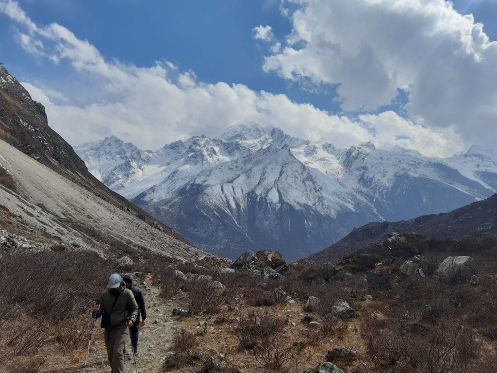
Traverse isolated ridgelines connecting rural settlements between the Ganesh Himal and Langtang mountain ranges.
Traditional Tamang & Gurung Villages
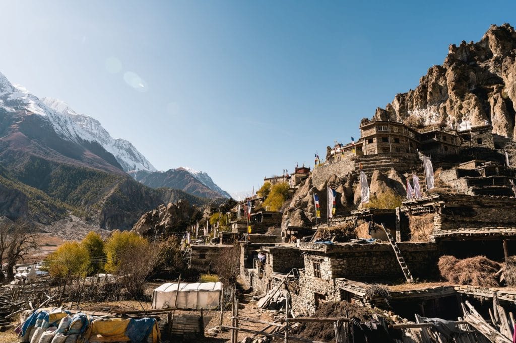
Pass through terraced farming settlements like Gatlang and Borang, experiencing traditional stone-built mountain architecture.
Hot Springs at Tatopani
Rest tired legs in natural sulfur-rich hot spring pools located alongside the valley riverbanks.
High Viewpoints at Sing La
Reach panoramic viewpoints exceeding 4,000 meters, offering clear morning sightlines toward Ganesh Himal and Manaslu.
Rugged Terrain & Stone Staircases
Navigate steep descents and ascents across uneven stone steps, suspension bridges, and forested hillside trails.
Teahouse Accommodation Realities
Stay in locally run, basic mountain lodges featuring communal dining stoves and simple twin-share rooms.
Local Overland Transport
Begin the journey via local 4WD jeep transport over unpaved mountain roads connecting Dhading Besi to the trailhead.
Alpine Flora & Waterfall Crossings
Trek through dense pine and rhododendron forests past seasonal high-altitude water streams.
Trail Photos & Videos
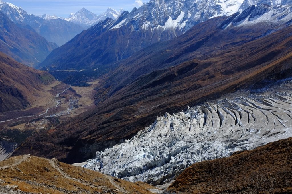
High-definition captures and video clips from Himalayan passes, glacial lakes, Sherpa villages, and mountain summits.



Ruby Valley Trek (7 Days) Trail Map
Interactive OpenStreetMap topographic trail map tracing the route.
Key High-Altitude Stops
Compatible with Garmin, Apple Watch, Strava & Gaia GPS
Ruby Valley Trek (7 Days) Weather Center
Real-time mountain weather and 5-day altitude forecasts across key Ruby Valley Trek (7 Days) waypoints.
Loading weather for ...
Choose waypoint
Altitude Chart & Acclimatization Nodes
Strict adherence to "Hike High, Sleep Low" ensures safe high-altitude adaptation.
Complete Itinerary Route
Explore the detailed day-by-day routing, acclimatization schedule, and trek milestones.
Kathmandu to Dhading Besi and Drive to Soti Khola
Depart early from Kathmandu along the Prithvi Highway before branching north toward Dhading Besi. The road transitions to a rough dirt track following the Trishuli and Ankhu river valleys, ending at the hillside settlement of Soti Khola.
Soti Khola to Borang
HighlightCross the suspension bridge over the torrential Ankhu Khola and climb past terraced cornfields and scattered stone homesteads. The trail contours along wooded ridge slopes before dropping into Borang, a traditional Tamang village with stone-paved alleys.
Navigate steep stone staircases climbing out of Borang toward the dramatic ridge of Tipling. Two prominent Buddhist monasteries dominate the village skyline, flanked by chortens and traditional wooden houses overlooking the deep river gorge below.
Tipling to Shoting Kharka via Pangsang Pass
HighlightAscend steadily through rhododendron forests toward the wide grassy plateau of Pangsang Pass at 3,845 meters. The summit viewpoint delivers expansive panoramas of Ganesh Himal, Langtang Lirung, and the Manaslu massif before descending to Shoting Kharka.
Shoting Kharka to Somdang
Descend along alpine pastures following old mining trails into the remote valley floor of Somdang. The settlement features historical zinc mining infrastructure and a local micro-hydro plant nestled beside the cold glacial stream.
Somdang to Gatlang
HighlightTraverse the forested ridge line dividing the Ankhu Khola and Trisuli river basins, passing traditional Tamang settlements. Arrive in Gatlang in the afternoon, noted for its clustered stone architecture and the sacred Parvati Kund lake nearby.
Gatlang to Syabrubesi and Drive to Kathmandu
Descend steeply on stone switchbacks through pine woods down to Syabrubesi along the Bhote Koshi river. Board a private jeep or local bus for the long overland return drive back to Kathmandu via Dhunche.
What's Covered & What's Not
A clear breakdown so you know exactly what to budget for and what's already taken care of.
Required Trail Permits
- National Park entry permit and local rural municipality registration cards.
Local Transport
- Shared local jeep transport from Kathmandu to the Ruby Valley trailhead.
Teahouse Accommodation
- Basic twin-share lodge room throughout the 7-day route.
Licensed Guide / Porter
- Government-licensed local guide and support porter wages and insurance.
International Flights
- Airfare from your home country into Tribhuvan International Airport.
Nepal Tourist Visa
- On-arrival tourist visa fee ($30 USD for 15 days, $50 USD for 30 days).
Helicopter Rescue Insurance
- Required travel policy covering emergency helicopter airlift above 4,000m.
Trail Incidentals
- Hot showers, device charging fees, and personal snack purchases.
Trail Meals & Hydration Rules
What to eat for stamina and altitude safety
Dhal Bhat Power
Rice, lentil soup, spiced potato, and spinach. Always comes with free refills to refuel after 6 hours on trail.
Garlic Soup
Thin clear garlic broth. Local guides drink this daily above 3,500m to help with blood circulation and warmth.
Boiled & Fried Potatoes
Dense carbohydrate source served with local cheese or chili paste in high settlements.
Tibetan Bread & Honey
Deep-fried puffed flatbread. Hearty breakfast before an early morning climb.
Local Noodle Soup
Thick vegetable and hand-pulled flour noodle soup served steaming hot.
Boiled Eggs
Safe, reliable protein source available every morning at lodge kitchens.
Boiled Water Bottles
Buy boiled water at night and keep the bottle inside your sleeping bag for warmth.
Ginger Lemon Honey Tea
Warm drink that cuts the dry mountain cough and stays hot in an insulated thermos.
Electrolyte Packs
Add one electrolyte sachet to 1L of water daily to replace salts lost on steep ascents.
Water Purification Drops
Use purification tablets for tap water and wait a full 30 minutes before drinking.
Vegetarian Focus
Vegetarian dhal bhat and veg noodles are always the freshest food on high trails.
Naturally Gluten-Free
Rice dishes, plain boiled potatoes, and grain porridge are naturally gluten-free.
Black Tea Option
Ask for black tea to avoid powdered milk if you are lactose sensitive.
Lodge Kitchen Flexibility
Cooks can prepare food with less spice or no salt upon request if you ask before evening meal times.
No Meat Above 3,500m
Meat is carried up on foot for days without refrigeration. Stick to vegetarian meals high up.
No Alcohol at High Camp
Alcohol causes rapid dehydration and masks early symptoms of altitude sickness.
Never Drink Untreated Water
Never drink directly from village taps or streams without filtration or purification tablets.
Skip Raw Salads
Stick to thoroughly cooked hot vegetables to prevent stomach upsets.
Trip Preparation & Rules
Paperwork, baggage limits, and cash logistics for the Ruby Valley trail
Passport Validity & Tourist Visa
Ensure your passport is valid for at least 6 months beyond arrival. Secure a 30-day tourist visa on arrival at Tribhuvan International Airport using cash or card.
High-Altitude Rescue Insurance
Mandatory travel policy must explicitly cover emergency helicopter evacuation and medical treatment up to 4,000 meters.
Passport-Sized Photographs
Carry four physical passport photos for permit registration desks, TIMS card checks, and local SIM card activation in Kathmandu.
Conservation Area Entry Permits
Required permits for the Ruby Valley region include the Langtang National Park entry permit and local rural municipality fees, typically processed in Kathmandu.
TIMS Card Registration
Trekkers' Information Management System card is required for tracking and safety registry before departing the trailhead.
Local Municipality Fees
District development fees apply upon entering rural municipality checkpoints along the Dhading-Ganesh Himal trail corridor.
Baggage Weight Restrictions
Most domestic mountain flights and shared transport transfer services enforce strict baggage limits of 10kg for checked duffels and 5kg for daypacks.
Weigh-In Procedures
Carry excess gear carefully or arrange luggage storage at your Kathmandu hotel if you plan to return after the trek.
Weather Contingency Buffer
Build two extra buffer days into your travel schedule to absorb potential transport delays caused by seasonal road washouts or mountain weather shifts.
Cash Reserves in Nepalese Rupees
Exchange currency in Kathmandu before departure. Carry sufficient Nepali rupees to cover teahouse meals, hot showers, and battery charging.
ATM Availability Warning
Electronic payment networks and working ATMs do not exist past district hubs. Rely entirely on physical banknotes on the trail.
Small Denomination Banknotes
Carry lower denominations like Rs 100 and Rs 500 notes. Teahouse operators cannot easily break high-value Rs 1,000 notes for small trail purchases.
Local Trail Customs & Homestay Etiquette
Practical behavioral guidelines for remote Tamang and Gurung communities
Sacred Monuments & Chortens
- •Walk on the left side to keep chortens and Mani walls on your right.
- •Spin all village prayer wheels in a clockwise direction.
- •Never step over, sit on, or lean trekking poles against carved slate stones.
Homestay & Kitchen Protocols
- •Remove muddy trail boots outside before stepping onto wooden living quarters.
- •Avoid placing feet near the central hearth or pointing soles at family members.
- •Never touch cooking pots, open water vessels, or stove tops uninvited.
Pack Animal Right-of-Way
- •Step onto the mountain wall side when mule or livestock trains approach.
- •Never position yourself along the valley edge or steep drop-offs.
- •Give cattle handlers space along narrow cliff sections around Pangsang.
Photography & Community Respect
- •Ask permission before photographing villagers, weaving looms, or family shrines.
- •Avoid flash photography inside village gompas and prayer rooms.
- •Leave a small cash donation in the monastery box when viewing historical artifacts.
Waste & Firewood Conservation
- •Carry non-biodegradable wrappers, foil packets, and batteries back to roadheads.
- •Never drop wet wipes or menstrual products into traditional pit latrines.
- •Keep showers brief to avoid burning scarce timber in high-elevation settlements.
Local Interaction & Modesty
- •Greet villagers with a polite 'Namaste' or local Tamang 'Tashi Delek'.
- •Dress modestly with covered shoulders and knees when moving through settlements.
- •Decline to hand out candy or small cash directly to children on the trail.
Permits & Emergency Directory
Permit fee requirements and emergency contacts for the Ruby Valley trail network
Required Permits & Mandatory Fees
-
📜Langtang National Park Entry Permit NPR 3,000
Required when entering or crossing through the Rasuwa sector via Syabrubesi, Gatlang, or Somdang. Payable at the Nepal Tourism Board office in Kathmandu or at the Dhunche checkpoint.
-
🛂TIMS Card (Trekkers' Information Management System) NPR 2,000
Mandatory trekking registration card for foreign nationals. Under current Nepal Tourism Board regulations, this must be issued through a government-licensed trekking agency alongside a certified guide.
-
🛂Ruby Valley / Local Rural Municipality Fee NPR 1,000 – 2,000
Local development and trail maintenance fee collected at rural municipality checkpoints in Dhading or Rasuwa border entry posts depending on seasonal transit rules.
Nepal Tourism Directory
Official contact channels for permits, park regulations, and emergency rescue assistance.
Power, Connectivity & Showers
Realistic day-to-day guide for charging, phones, and hygiene
Device Charging
Electricity in teahouses comes from small local hydro or solar setups. Charging phones or battery banks costs between Rs 200 to 500 per device in dining areas. Carry a high-capacity power bank and a multi-port USB charger.
Mobile Connectivity
Nepal Telecom (NTC) and Ncell signals reach parts of the lower Ganesh Himal valleys, but coverage drops entirely in remote forested ravines and high mountain passes. Local SIM cards provide sporadic data until crossing into upper ridges.
Hot Showers
Bucket showers heated by firewood or basic gas cylinders are available in most lower villages for Rs 300 to 500. Above 3,500 meters, hot water is rare and freezing temperatures make cold exposure risky; pack biodegradable wet wipes instead.
Drinking Water & Refills
Single-use plastic bottles are restricted in conservation areas. Fill your Nalgene bottles directly from tap sources and treat the water using chlorine dioxide tablets, iodine, or a reliable micro-filter to prevent stomach illness.
Altitude Safety & Health
How to handle altitude symptoms and emergency protocols
Daily Symptom Monitoring
Watch closely for early AMS signs: persistent headache that two ibuprofen don't relieve, loss of appetite, nausea, dizziness, and insomnia.
Hydration and Electrolytes
Count hot lemon, black tea, and garlic soup toward your daily 3-to-4 liter hydration goal to prevent rapid altitude dehydration.
Helicopter Evacuation
Verify your travel insurance policy explicitly covers emergency helicopter rescue up to 6,000 meters before leaving Kathmandu.
Immediate Descent Protocol
Dropping 500 to 1,000 meters reverses worsening symptoms fast and saves lives when severe headache or ataxia sets in.
The Golden Altitude Rule
If you have a throbbing headache, persistent nausea, or stumbling coordination, do not ascend further. If symptoms do not improve with rest, descend 300 to 500 meters immediately. Descent remains the only guaranteed treatment for acute mountain sickness.
Highland Villages & Wildlife
Indigenous communities and wildlife along the trail
Tamang Hill Communities
Stone-walled hillside villages inhabited primarily by Tamang and Gurung communities preserving traditional stone-masonry architecture.
Traditional Hearth & Hospitality
Family-run teahouses centered around wood-burning stoves where travellers dry gear and share meals in the evening.
Agropastoral Terraces
Steep hillside agricultural terraces growing maize, millet, and potatoes across varying valley microclimates.
Buddhist Chortens & Mani Walls
Stone mani walls and whitewashed chortens inscribed with Tibetan Buddhist mantras marking community boundaries.
Highland Monasteries
Village gompas and prayer halls housing ancient Buddhist artifacts and serving as spiritual centers for local families.
Sacred Ridge Shrines
Small stone shrines perched on high pass crossings where travellers offer juniper incense for safe passage.
High-Altitude Fauna
Sub-alpine forests inhabited by barking deer, langur monkeys, and occasional sightings of mountain goats along steep ridges.
Rhododendron Forests
thick groves of wild rhododendron trees turning pink and red along mid-altitude slopes during spring.
Raptor Migration
Eagles, hawks, and bearded vultures riding thermal updrafts above deep river gorges and rocky valley rims.
Essential Packing Checklist
Prepare 1 duffel bag (handled by porter team) and 1 daypack for personal warm layers & water.
Frequently Asked Questions
Practical answers for independent travellers planning the Ruby Valley Trek